Frederick in Frederick County, Maryland — The American Northeast (Mid-Atlantic)
1862 Antietam Campaign
Lee Invades Maryland
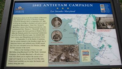
Fresh from victory at the Second Battle of Manassas, Gen. Robert E. Lee’s Army of Northern Virginia crossed the Potomac River on September 4–6, 1862, to bring the Civil War to Northern soil and to recruit sympathetic Marylanders. Union Gen. George B. McClellan’s Army of the Potomac pursued Lee, who had detached Gen. Thomas J. “Stonewall” Jackson’s force to capture the Union garrison at Harpers Ferry. After the Federals pushed the remaining Confederates out of the South Mountain gaps, Lee awaited Jackson’s return near Sharpsburg and Antietam Creek.
On September 17, at the Battle of Antietam, the two armies clashed in the bloodiest single day in American History and suffered some 23,000 casualties. Lee soon retreated across the Potomac, ending his first invasion of the North.
Follow in the footsteps of Gens. Lee and McClellan along Maryland Civil War Trails’ Antietam Campaign: Lee Invades Maryland, a 90 mile tour route that allows you to explore the stories of triumph and tragedy at more than 60 Civil War sites. Please drive carefully as you enjoy the beauty and history along the trail.
Erected by Maryland Civil War Trails.
Topics and series. This historical marker is listed in this topic list: War, US Civil. In addition, it is included in the Maryland Civil War Trails series list. A significant historical month for this entry is September 1862.
Location. 39° 22.625′ N, 77° 23.737′ W. Marker is in Frederick, Maryland, in Frederick County. Marker can be reached from Urbana Pike (State Highway 355), on the right when traveling north. Located at the Monocacy National Battlefield visitor center. Touch for map. Marker is in this post office area: Frederick MD 21704, United States of America. Touch for directions.
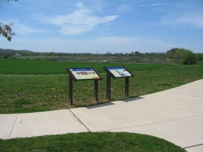
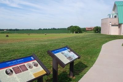
Other nearby markers. At least 8 other markers are within walking distance of this marker. The Lost Order (here, next to this marker); Monocacy Battlefield (here, next to this marker); Battle Begins (a few steps from this marker); A Bold Plan (within shouting distance of this marker); This Boulder Overlooks the Monocacy Battlefield (about 500 feet away, measured in a direct line); Battle of Monocacy (about 500 feet away); Headquarters of Generals Robert E. Lee, "Stonewall" Jackson and Longstreet Sept. 6-9, 1862. (about 500 feet away); Nick of Time (approx. 0.4 miles away). Touch for a list and map of all markers in Frederick.
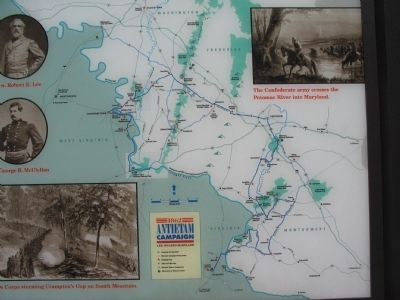
More about this marker. The marker displays pictures of Gens. Lee and McClellan, newspaper drawing of Confederates crossing the Potomac, a drawing of Franklin’s Corps at Compton’s Gap, and a strategic map showing the trail stops.
Regarding 1862 Antietam Campaign. This marker is one of the standard set used to orient travelers to the Antietam Campaign.
Also see . . . 1862 Antietam Campaign. Maryland Civil War Trails map PDF (Submitted on June 27, 2022, by Larry Gertner of New York, New York.)
Credits. This page was last revised on June 27, 2022. It was originally submitted on April 27, 2009, by Craig Swain of Leesburg, Virginia. This page has been viewed 1,315 times since then and 33 times this year. Photos: 1, 2, 3. submitted on April 27, 2009, by Craig Swain of Leesburg, Virginia. 4. submitted on August 9, 2015, by Brandon Fletcher of Chattanooga, Tennessee.


