Near Rapidan in Culpeper County, Virginia — The American South (Mid-Atlantic)
Battle of Cedar Mountain
A Narrow Victory
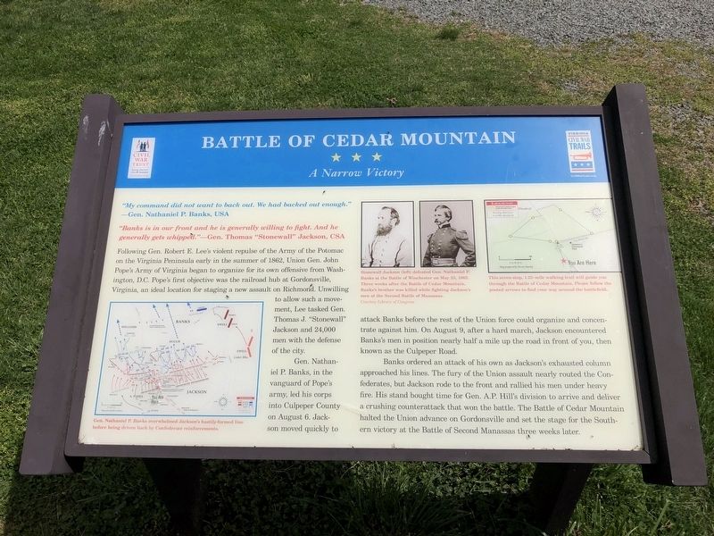
"My command did not want to back out. We had backed out enough." —Gen. Nathaniel P. Banks, USA
"Banks is in our front and he is generally willing to fight. And he generally gets whipped." —Gen. Thomas "Stonewall" Jackson, CSA
Following Gen. Robert E. Lee's violent repulse of the Army of the Potomac on the Virginia Peninsula early in the summer of 1862, Union Gen. John Pope's Army of Virginia began to organize for its own offensive from Washington, D.C. Pope's first objective was the railroad hub at Gordonsville, Virginia, an ideal location for staging a new assault on Richmond. Unwilling to allow such a movement, Lee tasked Gen. Thomas J. "Stonewall" Jackson and 24,000 men with the defensive of the city.
Gen. Nathaniel P. Banks, in the vanguard of Pope's army, led his corps into Culpeper County on August 6. Jackson moved quickly to attack Banks before the rest of the Union force could organize and concentrate against him. On August 9, after a hard march, Jackson encountered Banks's men in position nearly half a mile up the road in front of you, then known as the Culpeper Road.
Banks ordered an attack of his
this page online
(captions)
Gen. Nathaniel P. Banks overwhelmed Jackson's hastily-formed line before being driven back by Confederate reinforcements.
Stonewall Jackson (left) defeated Gen. Nathaniel P. Banks at the Battle of Winchester on May 25, 1862. Three weeks after the Battle of Cedar Mountain, Banks's brother was killed while fighting Jackson's men at the Second Battle of Manassas. Courtesy Library of Congress
This seven-stop, 1.25-mile walking trail will guide you through the Battle of Cedar Mountain. Please follow the posted arrows to find your way around the battlefield.
Erected by Civil War Trust; Virginia Civil War Trails.
Topics and series. This historical
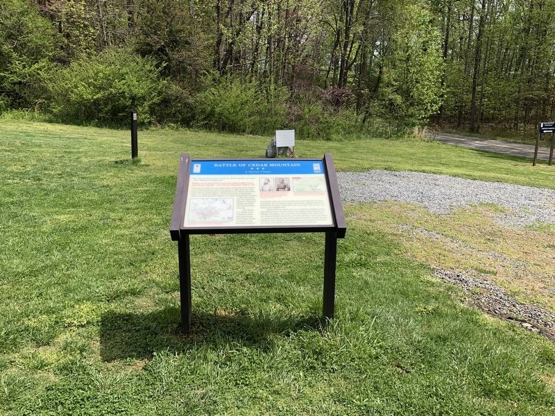
Location. This marker has been replaced by another marker nearby. It was located near 38° 24.278′ N, 78° 4.213′ W. Marker was near Rapidan, Virginia, in Culpeper County. It was on General Winder Road (Virginia Route 657) 0.3 miles west of North James Madison Highway (U.S. 15), on the right when traveling west. Marker is located at the parking area and main trailhead for the Cedar Mountain Battlefield Interpretive Trail (Stop 1). Touch for map. Marker was at or near this postal address: 9465 General Winder Road, Rapidan VA 22733, United States of America. Touch for directions.

Regionally, this marker was in the Washington Metropolitan Area and in Northern Virginia. It was also in the American South, specifically in the Upper South, and in the Mid-Atlantic. Globally, it was in North America, the Western Hemisphere, the Western World, and the Anglosphere. Historically, it found itself in what was once the territory of the Mississippian
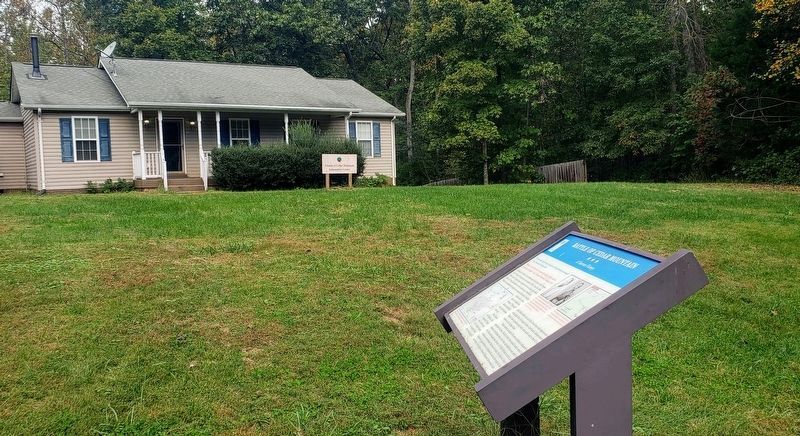
Photographed by Bradley Owen, October 16, 2021
3. Battle of Cedar Mountain Marker
The Friends of Cedar Mountain Information Center building is in the background.
Other nearby markers. At least 8 other markers are within walking distance of this location: A different marker also named Battle of Cedar Mountain (here, next to this marker); a different marker also named Battle of Cedar Mountain (about 400 feet away, measured in a direct line); a different marker also named Battle of Cedar Mountain (about 400 feet away); Hand-to-Hand Fighting (about 400 feet away); a different marker also named The Battle of Cedar Mountain (about 500 feet away); a different marker also named Battle of Cedar Mountain (about 500 feet away); a different marker also named Battle of Cedar Mountain (approx. ¼ mile away); a different marker also named Battle of Cedar Mountain (approx. ¼ mile away). Touch for a list and map of all markers in Rapidan.
Other markers no longer nearby. Battle of Cedar Mountain (was about 500 feet away but has been reported to have been replaced with another marker now near it); a different marker also named The Battle of Cedar Mountain (was about 500 feet away but has
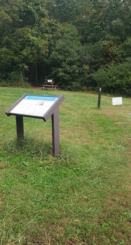
Photographed by Bradley Owen, October 16, 2021
4. Battle of Cedar Mountain Marker
The start of the Cedar Mountain Battlefield Interpretive Trail can be seen above the marker at the opening of the woods.
Related marker. Click here for another marker that is related to this marker. New Marker At This Location also titled "Battle of Cedar Mountain".
Also see . . . Friends of Cedar Mountain Battlefield. (Submitted on August 11, 2022.)
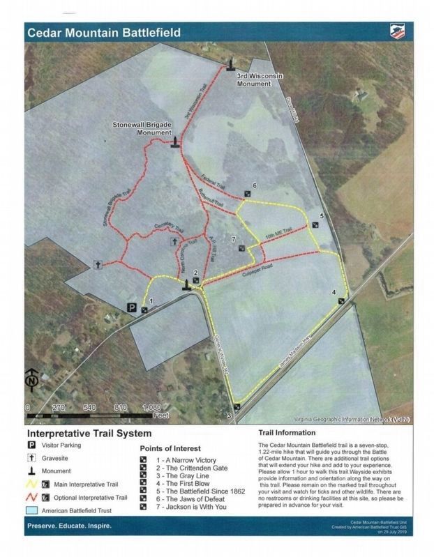
Courtesy American Battlefield Trust., October 17, 2021
5. Cedar Mountain Battlefield Trail Map
Credits. This page was last revised on August 11, 2022. It was originally submitted on April 19, 2021, by Devry Becker Jones of Washington, District of Columbia. This page has been viewed 543 times since then and 36 times this year. Last updated on October 16, 2021, by Bradley Owen of Morgantown, West Virginia. Photos: 1, 2. submitted on April 19, 2021, by Devry Becker Jones of Washington, District of Columbia. 3, 4. submitted on October 16, 2021, by Bradley Owen of Morgantown, West Virginia. 5. submitted on October 17, 2021, by Bradley Owen of Morgantown, West Virginia.
