Saticoy in Ventura County, California — The American West (Pacific Coastal)
Saticoy Springs
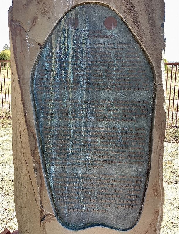
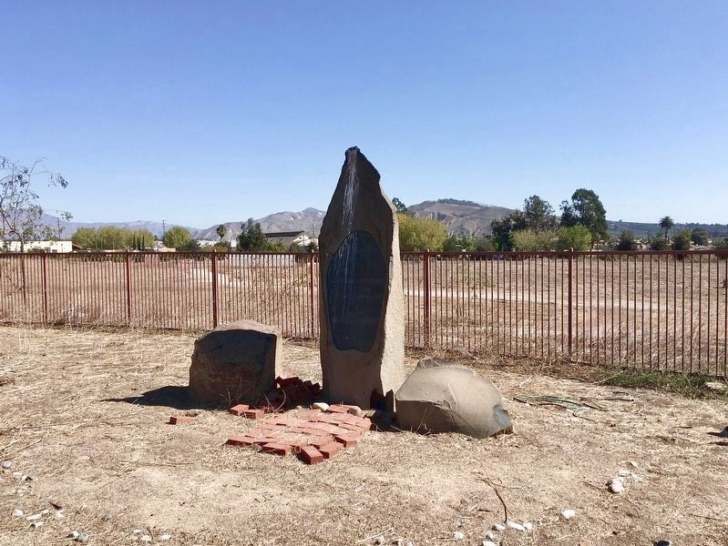
Historic Point of Interest
— Chumash Indian Village —
Ventura County is within the historic territory of the Ventureño Chumash. The Chumash village of Sa’aqtik’oy, from which the Saticoy area takes its name, was located near this site and was first recorded in the diaries of Juan Rodriguez Cabrillo in 1542. Sa’aqtik’oy, meaning “place sheltered from the wind”, was also identified by its springs, which were considered an unfailing source of water supply. The springs were of significant religious and sacred importance to the Ventureño Chumash people, and were the focal point of the village.
In 1860, Moses Wells bought a 150 acre parcel from the Chumash people, which included the Saticoy Springs. Subsequently, a small town grew around the Chumash village of Sa’aqtik’oy, near the current location of Telephone Road and Saticoy Avenue.
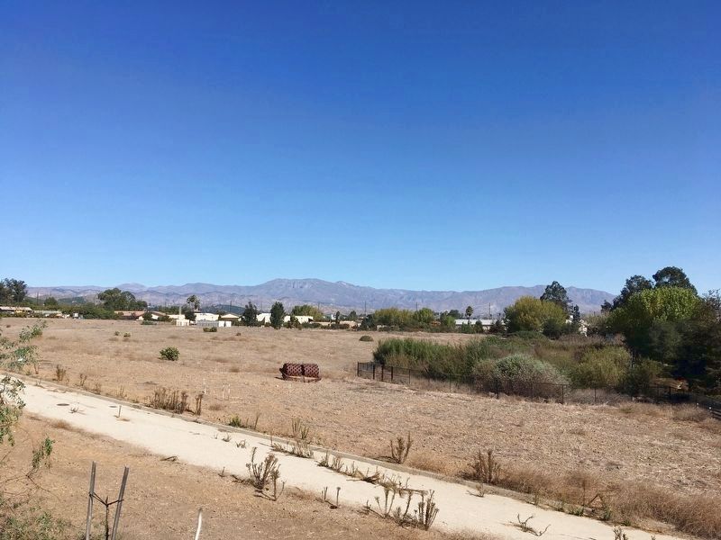
Rancho Attilio was established on this site in 1916, when 117 acres of the property were purchased by Attilio Vanoni. To increase the land’s agricultural productivity, the Vanonis capped many of the springs and installed a system of French drains. As the location of the Saticoy Springs and the Chumash village of Sa’aqtik’oy, the Rancho Attilio site is formally designated as a County of Ventura Point of Interest.
In order to properly respect and honor these historical and cultural resources, the development of this site was conducted under agreement with, and active monitoring by, designated representatives of the Saticoy Chumash Village people, and qualified archaeological experts.
Erected 1988 by Ventura County. (Marker Number 6.)
Topics and series. This historical marker is listed in these topic lists: Agriculture • Native Americans • Natural Resources • Settlements & Settlers. In addition, it is included in the Ventura County Historical Landmarks series list.
Location. 34° 16.822′ N, 119° 9.209′ W. Marker is in Saticoy, California, in Ventura County. Marker can be reached from Cosmos Avenue, 0.1 miles south of Telephone Road. Located on private property, not open to the public. Touch for map. Marker is at or near this postal address: 1079 Cosmos Ave, Ventura CA 93004, United States of America. Touch for directions.
Other nearby markers. At least 8 other markers are within 6 miles of this marker, measured as the crow flies. Saticoy Railroad Depot (approx. half a mile away); Faulkner House (approx. 4.2 miles away); The Maulhardt Winery (approx. 4.6 miles away); Dudley House (approx. 5 miles away); Cesar E. Chavez (approx. 5.2 miles away); Olivas Adobe (approx. 5.7 miles away); a different marker also named Olivas Adobe (approx. 5.7 miles away); Henry Levy House (approx. 5.7 miles away).
Regarding Saticoy Springs. Sa’aqtik’oy means “Place where people sun themselves” not as the plaque says “place sheltered from the wind.”
Ventura County Historical Point of Interest statement of significance:
Saticoy Springs and Chumash Indian Village Sa'aqtik'oy Site.
Ventura County Historical Point of Interest No. 6. Designated May 1988.
Location: Bounded by Saticoy Ave., Telephone Rd., Wells Rd, and R.R. tracks; Saticoy.
Chumash settlement of this site dates back to 5,500 BC. By 1782, the village of Sa’aqtik’oy had been reduced to a minor or seasonal native settlement. It was not actively operated as a rancheria (agricultural outpost) by the Mission, nor did any Chumash converts in Mission records report Sa’aqtik’oy as their village of origin. Chumash resettlement of Sa’aqtik’oy was undertaken after the secularization of the Missions in 1834. Luis Francisco became chief of the Saticoy rancheria. In the fall of 1863, he presided over a fiesta that drew some 300 Indians from Ventura, Santa Barbara, Tejon, and other places. (Nunis, 1977: 107)
This site was home to the last major Chumash ceremonial gathering in 1869. The celebration lasted five days, drawing Chumash leaders from Santa Inez, Santa Barbara and San Fernando for singing and dancing. The site was eventually purchased by an Italian farmer in 1916, and has been farmed ever since.
Also see . . .
1. Rancho Santa Paula y Saticoy. Wikipedia page with a more complete history of this area. (Submitted on August 31, 2023.)
2. Barbareño/Ventureño Band of Mission Indians. The current owners of this five acres of land are planning to create a Food Forest with native and introduced plants. Their website will soon include a Saticoy page. (Submitted on August 31, 2023.)
Credits. This page was last revised on October 26, 2023. It was originally submitted on October 20, 2021, by Craig Baker of Sylmar, California. This page has been viewed 1,028 times since then and 163 times this year. Photos: 1, 2, 3. submitted on October 20, 2021, by Craig Baker of Sylmar, California.


