Near Winchester in Frederick County, Virginia — The American South (Mid-Atlantic)
The Defense of the Stone Wall
Photographed by Bradley Owen, October 15, 2021
1. The Defense of the Stone Wall Marker
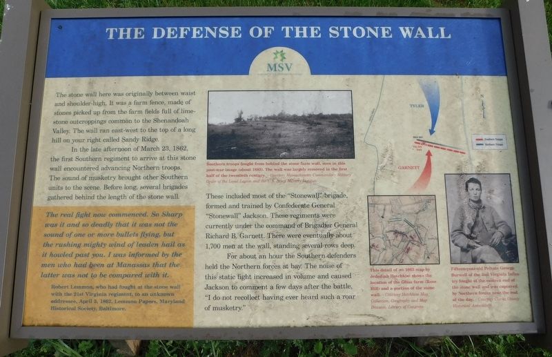
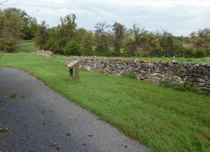
The stone wall here was originally between waist and shoulder-high. It was a farm fence, made of stones picked up from the farm fields full of lime stone outcroppings common to the Shenandoah Valley. The wall ran east-west to the top of a long hill on your right called Sandy Ridge.
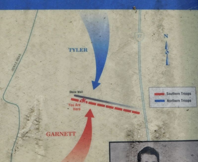
In the late afternoon of March 23, 1862, the first Southern regiment to arrive at this stone wall encountered advancing Northern troops. The sound of musketry brought other Southern units to the scene. Before long, several brigades gathered behind the length of the stone wall.
These included most of the "Stonewall" brigade, formed and trained by Confederate General "Stonewall" Jackson. These regiments were currently under the command of Brigadier General Richard B. Garnett. There were eventually about 1,700 men at the wall, standing several rows deep.
For about an hour the Southern defenders held the Northern forces at bay. The noise of this static fight increased in volume and caused Jackson to comment a few days after the battle, "I do not recollect having ever heard such a roar of musketry."
(Sidebar)
The real fight now commenced. So Sharp was it and so deadly that it was not the sound of one or more bullets flying, but the rushing mighty wind of leaden hail as it howled past you. I was informed by the men who had been at Manassas that the latter was not to be compared with it.
Robert
this page online
(Photo Captions)
Southern troops fought from behind the stone farm wall, seen in this post-war image (about 1885). The wall was largely removed in the first half of the twentieth century. - Courtesy Massachusetts Commandery Military Order of the Loyal Legion and the U.S. Army Military Institute.
This detail of an 1863 map by Jedediah Hotchkiss shows the location of the Glass farm (Rose Hill) and a portion of the stone wall. - Courtesy Hotchkiss Map Collection, Geography and Map Division, Library of Congress
Fifteen-year-old Private George Burwell of the 2nd Virginia Infantry fought at the eastern end of the stone wall and was captured by Northern forces near the end of the day. - Courtesy Clarke County Historical Association
Erected by Museum of the Shenandoah Valley (MSV).
Topics. This historical marker is listed in this topic list: War, US Civil. A significant historical date for this entry is March 23, 1862.
Location. 39° 9.106′ N, 78° 12.953′ W. Marker is near
Photographed by Bradley Owen, October 15, 2021
2. The Defense of the Stone Wall Marker
Reconstructed stone wall is in front of the marker.

Regionally, this marker is in Virginia’s Shenandoah Valley. It is also in the American South, specifically in the Upper South, and in the Mid-Atlantic. Globally, it is in North America, the Western Hemisphere, the Western World, and the Anglosphere. Historically, it finds itself in what was once the territory of the Mississippian Culture, one of the original Thirteen Colonies, one of the Confederate States of America, and the Antebellum South.
Other nearby markers. At least 8 other markers are within walking distance of this marker: Fight for the High Ground (about 400 feet away); The Order For Retreat (about 400 feet away); The Advance of Tyler's Brigade (about 600 feet away); a different marker also named Northern Victory, Southern Defeat
Photographed by Bradley Owen, October 15, 2021
3. The Defense of the Stone Wall Marker
Closeup of the battle map on the marker.
Other markers no longer nearby. Northern Victory, Southern Defeat (was about 300 feet away, measured in a direct line but has been replaced with another marker now near it); a different marker also named Fight for the High Ground (was about 600 feet away but has been replaced with another marker now near it); a different marker also named The Defense of the Stone Wall (was about 700 feet away but has been replaced with another marker now near it); The Order for Retreat (was about 700 feet away but has been replaced with another marker now near it); How To See the Battlefield (was approx. 0.2 miles away but has been permanently removed); a different marker also named The Advance of Tyler’s Brigade (was approx. 0.2 miles away but has been replaced with another marker now near it); War in the Backyard (was approx. 0.2 miles away but has been permanently removed); a different marker also named Rose Hill (was approx. ¼ mile away but has been replaced with another marker now near it).
Related marker. Click here for another marker that is related to this marker. Old Marker At This Location also titled "The Defense of the Stone Wall".
Credits. This page was last revised on November 4, 2021. It was originally submitted on November 3, 2021, by Bradley Owen of Morgantown, West Virginia. This page has been viewed 664 times since then and 68 times this year. Photos: 1, 2, 3. submitted on November 3, 2021, by Bradley Owen of Morgantown, West Virginia. • Bernard Fisher was the editor who published this page.
