
Near Winchester in Frederick County, Virginia — The American South (Mid-Atlantic)
The Defense of the Stone Wall
Photographed by Craig Swain, October 20, 2007
1. The Defense of the Stone Wall Marker
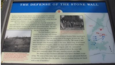
The stone wall here at 1st Kernstown was originally waist-high. It was a farm fence, made of stones picked up from the farm fields full of limestone outcroppings common to the northern Shenandoah Valley. The wall began about 200 yards east of the Rose Hill farmhouse and ran east-west to the top of Sandy Ridge.
The first Southern regiment to arrive at this stone wall encountered the advancing Northern column of Colonel Erastus Tyler, marching in a long thin column from the nearby town of Winchester (to your left). The time was 3:55 p.m. The battle had started at 9:00 a.m. The sound of musketry brought other Southern units to the scene. Before long, all of Colonel Samuel Fulkerson's brigade, a little less than half of Colonel Jesse Burk's brigade, and most of the "Stonewall" brigade under the command of Brigadier General Richard B. Garnett gathered behind
this page online
For about an hour Southern defenders held Tyler's Northern troops at bay. The noise of this static fight increased in volume and caused Jackson to comment a few days after the battle, "I do not recollect having ever heard such a roar of musketry." (Marker Number 5.)
Topics. This historical marker is listed in this topic list: War, US Civil.
Location. This marker has been replaced by another marker nearby. It was located near 39° 9.221′ N, 78° 12.967′ W. Marker was near Winchester, Virginia, in Frederick County. It could be reached from Jones Road (County Route 621), on the right when traveling north. Located at stop five of the walking tour of Rose Hill. See the link to the Museum of the Shenandoah for details about visiting Rose Hill. Touch for map. Marker was at or near this postal address: 1985 Jones Road, Winchester VA 22602, United States of America. Touch for directions.

Regionally, this marker was in Virginia’s Shenandoah Valley. It was also in the American South, specifically in the
Photographed by Craig Swain, October 20, 2007
2. Map of the Battle Area
Other nearby markers. At least 8 other markers are within walking distance of this location: A different marker also named The Advance of Tyler's Brigade (about 600 feet away); a different marker also named The Defense of the Stone Wall (about 700 feet away); a different marker also named Fight for the High Ground (approx. 0.2 miles away); The First Battle Of Kernstown (approx. 0.2 miles away); Rose Hill (approx. 0.2 miles away); The Order For Retreat (approx. 0.2 miles away); War In The Backyard (approx. 0.2 miles away); a different marker also named Northern Victory, Southern Defeat (approx. ¼ mile away). Touch for a list and map of all markers in Winchester.
Other markers no longer nearby. The Order for Retreat (was about 300 feet away, measured in a direct line but has been replaced
Photographed by Craig Swain, October 20, 2007
3. Walking Tour Stop Five for Rose Hill
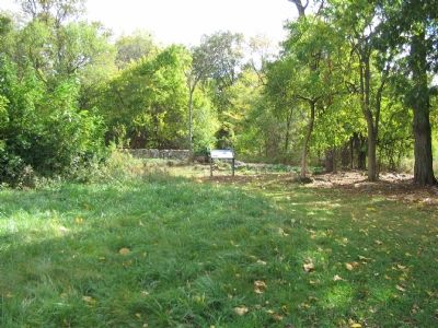
The stone wall stands beyond the marker. Portions of the wall have been reconstructed.
More about this marker. On the lower left of the marker is a photograph of "The stone wall shown in this post-war image (c. 1885)" which "gave Southern troops a natural defense work from behind which to fight. The wall was largely removed in the first half of the 20th century."
In the upper center is a photograph of "Tourists or veterans leaning against the stone wall, 1885."
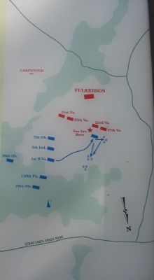
On the far right is a map of the tactical situation described on the marker.
Regarding The Defense of the Stone Wall. This is one of seven battlefield interpretive markers at Rose Hill. See the related markers section below for a listing of the walking tour, or the Kernstown Battles Virtual Tour by Markers in the links section for a driving tour.
Related marker. Click here for
Photographed by Craig Swain, October 20, 2007
4. The Federal approach to the Stone Wall
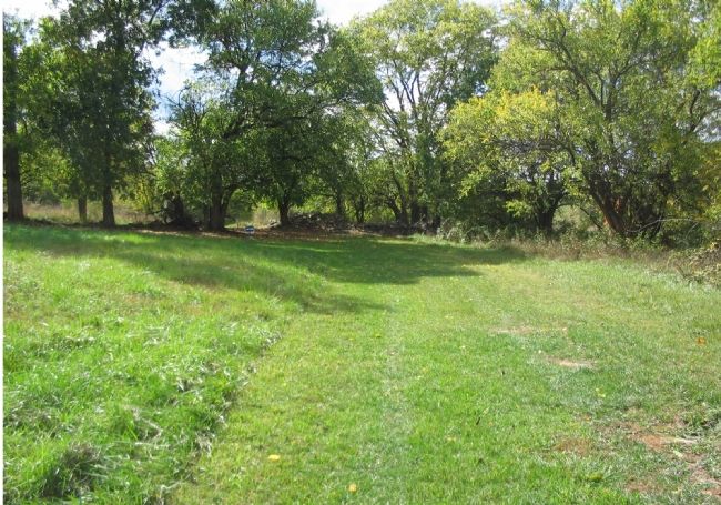
The Federals' 1st West Virginia Infantry Regiment advanced in this general area against the Confederates' 23rd and 37th Virginia Infantry Regiments behind the stone wall. Remains of the original section of the stone wall are piled up along the trees in the center of this photo.
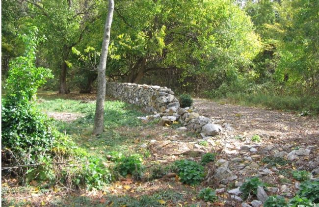
Photographed by Craig Swain, October 20, 2007
5. Portions of the Reconstructed Stone Wall
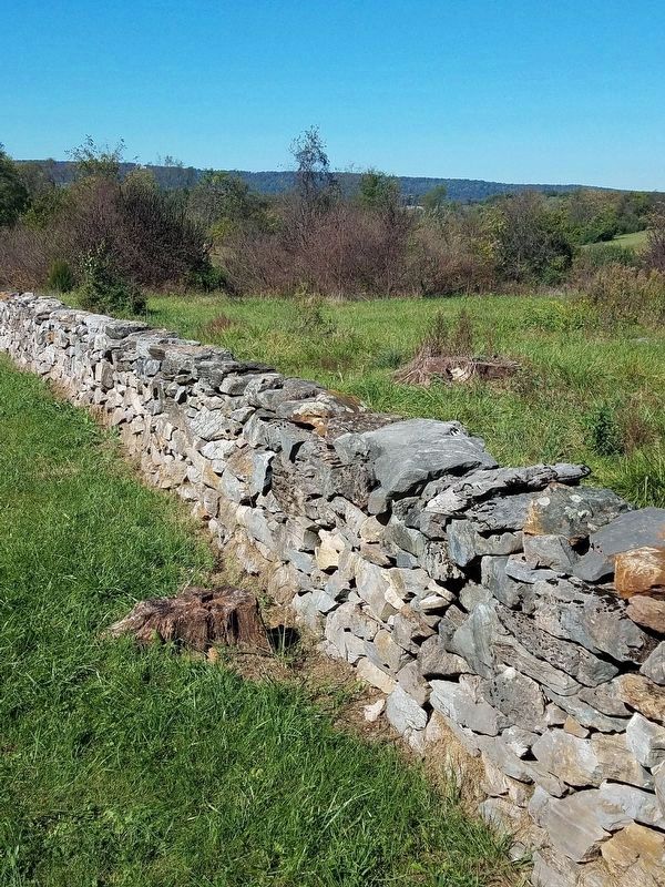
Photographed by Bradley Owen, October 18, 2017
6. The Reconstructed Stone Wall
Credits. This page was last revised on September 6, 2026. It was originally submitted on November 12, 2007. This page has been viewed 2,292 times since then and 41 times this year. Last updated on November 3, 2021. Photos: 1, 2, 3, 4, 5. submitted on November 12, 2007, by Craig Swain of Leesburg, Virginia. 6. submitted on August 14, 2020, by Bradley Owen of Morgantown, West Virginia. • Bernard Fisher was the editor who published this page.
