Biddeford in York County, Maine — The American Northeast (New England)
Samuel Peirson's House
⎯⎯⎯
La Maison Samuel Peirson
Biddeford, Maine
| — | The Museum in the Streets® | — |
Photographed by Devry Becker Jones (CC0), November 12, 2021
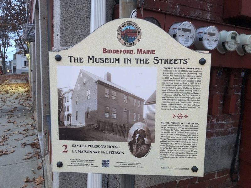
1. Samuel Peirson's House / La Maison Samuel Peirson Marker

"Squire" Samuel Peirson's House was located on the site of Phillip's garrison house destroyed by the Indians in 1675 during King Phillip's War. The house shown here was erected in 1767 by Jeremiah Hill who died in 1820. Samuel Peirson's son-in-law bought it in 1820 and occupied it until his death in 1852. He was 93. Samuel Peirson was a Revolutionary War soldier and a clerk to George Washington during the siege of Boston. He shared February 22nd as a birthday with George Washington and began a local custom called "Tar Tub Day." Bonfires of used Christmas trees, roasted apples, and much noise making were traditional. He was the last person known to wear "small clothes" (colonial dress) complete with knee breeches and silver buckles. The spelling of Peirson is unusual. The house was demolished around 1970.
this page online
Erected 2006 by The Museum in the Streets®. (Marker Number 2.)
Topics and series. This historical marker is listed in these topic lists: Colonial Era • Notable Events • Settlements & Settlers • War, US Revolutionary. In addition, it is included in the The Museum in the Streets: Biddeford, Maine series list. A significant historical date for this entry is February 22, 1675.
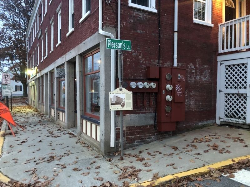
Location. 43° 29.533′ N, 70° 26.992′ W. Marker is in Biddeford, Maine, in York County. It is at the intersection of Water Street and Pierson's Lane, on the right when traveling east on Water Street. Touch for map. Marker is at or near this postal address: 20 Water St, Biddeford ME 04005, United States of America.
Photographed by Devry Becker Jones (CC0), November 12, 2021
2. Samuel Peirson's House / La Maison Samuel Peirson Marker
Note that the roadway is named Pierson's Lane.

Regionally, this marker is on Southern Maine Coast. It is also in the American Northeast, in New England, and on the Eastern Seaboard. Globally, it is in the North Atlantic Region, North America, the Western Hemisphere, the Western World, and the Anglosphere.
Other nearby markers. At least 8 other markers are within walking distance of this marker: Biddeford, Maine (within shouting distance of this marker); The James Sullivan Home / Le Résidence de James Sullivan (within shouting distance of this marker); The Biddeford Shipyards / Les Chantiers Navals (within shouting distance of this marker); A Stone Fort (about 600 feet away, measured in a direct line); Fort Saco in 1693 / Le Fort Saco en 1693 (about 600 feet away); St. André's Church / L'Église Sainte André (about 700 feet away); Honor Roll (about 700 feet away); Alfred Street / La Rue Alfred (approx. 0.2 miles away). Touch for a list and map of all markers in Biddeford.
Credits. This page was last revised on November 18, 2021. It was originally submitted on November 18, 2021, by Devry Becker Jones of Washington, District of Columbia. This page has been viewed 451 times since then and 47 times this year. Photos: 1, 2. submitted on November 18, 2021, by Devry Becker Jones of Washington, District of Columbia.
