Defiance in Defiance County, Ohio — The American Midwest (Great Lakes)
Fort Defiance / The Indian Wars 1790 - 1795
Anthony Wayne Parkway
Fort Defiance
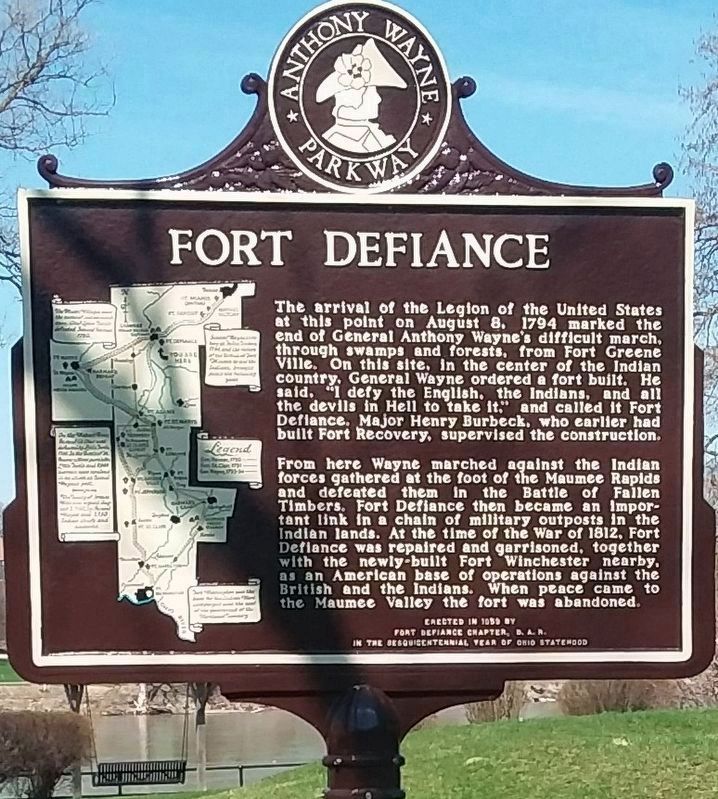
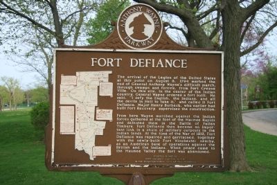
The arrival of the Legion of the United States at this point on August 8, 1794 marked the end of General Anthony Wayne's difficult march, through swamps and forests, from Fort GreeneVille. On this site, in the center of the Indian country, General Wayne ordered a fort built. He said, "I defy the English, the Indians, and all the devils in Hell to take it," and called it Fort Defiance. Major Henry Burbeck, who earlier had built Fort Recovery, supervised the construction.
From here Wayne marched against the Indian forces gathered at the foot of the Maumee Rapids and defeated them in the Battle of Fallen Timbers. Fort Defiance then became an important link in a chain of military outposts in the Indian lands. At the time of the War of 1812, Fort Defiance was repaired and garrisoned, together with the newly-built Fort Winchester nearby, as an American base of operations against the British and the Indians. When peace came to the Maumee Valley the fort was abandoned.
The Indian Wars 1790 - 1795
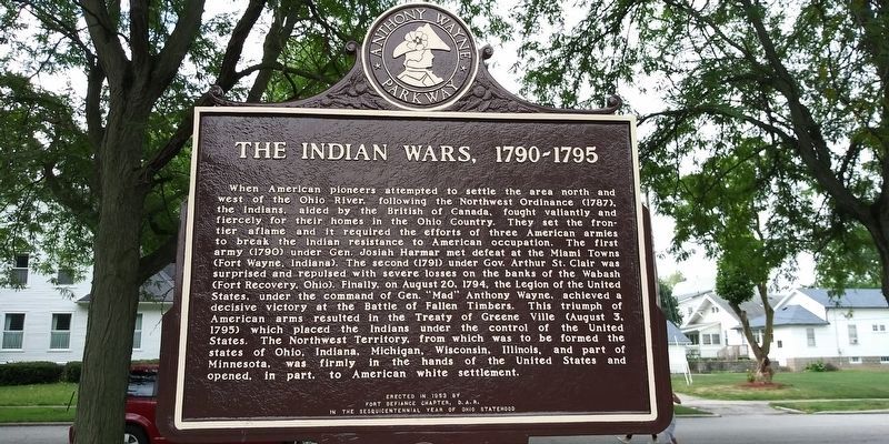
When American pioneers attempted to settle the area north and west of the Ohio River, following the Northwest Ordinance (1787), the Indians, aided by the British in Canada, fought valiantly and fiercely for their homes in the Ohio Country. They set the frontier aflame and it required the efforts of three American armies to break the Indian resistance to American occupation. The first army (1790) under Gen. Josiah Harmar met defeat at the Miami Towns (Fort Wayne, Indiana). The second (1791) under Gov. Arthur St. Clair was surprised and repulsed with severe losses on the banks of the Wabash (Fort Recovery, Ohio). Finally, on August 20, 1794, the Legion of the United States, under the command of Gen. "Mad" Anthony Wayne, achieved a decisive victory at the Battle of Fallen Timbers. This triumph of American arms resulted in the Treaty of Greene Ville (August 3, 1795) which placed the Indians under the control of the United States. The Northwest Territory, from which was to be formed the states of Ohio, Indiana, Michigan, Wisconsin, and Illinois, and part of Minnesota, was firmly in the hands of the United States and opened, in part, to American white settlement.
Erected 1958 by Fort Defiance Chapter, D.A.R. in the Sesquicentennial Year of Ohio Statehood.
Topics and series. This historical marker is listed in these topic lists: Forts and Castles • Native Americans • War of 1812 • Wars, US Indian. In addition, it is included in the Daughters of the American Revolution series list. A significant historical year for this entry is 1794.
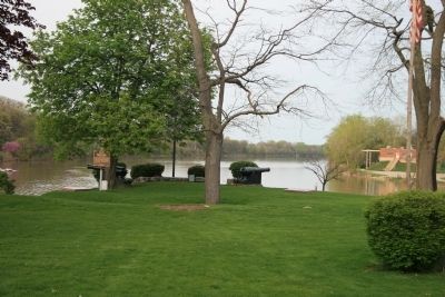
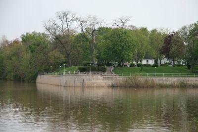
Location. 41° 17.245′ N, 84° 21.458′ W. Marker is in Defiance, Ohio, in Defiance County. Marker is at the intersection of Fort Street and Washington Avenue, on the right when traveling west on Fort Street. This historical marker is situated on the southwest point of land, at the juncture of the Auglaize River with the Maumee River. Touch for map. Marker is at or near this postal address: 320 Fort Street, Defiance OH 43512, United States of America. Touch for directions.
Other nearby markers. At least 8 other markers are within walking distance of this marker. Service Star Legion Veterans Memorial (here, next to this marker); Fort Defiance (a few steps from this marker); Defiance Public Library (within shouting distance of this marker); West Blockhouse (within shouting distance of this marker); Construction Of Fort Defiance (within shouting distance of this marker); Legion of Anthony Wayne (within shouting distance of this marker); Fort Defiance Flagstaff (within shouting distance of this marker); Reinforcement Work (within shouting distance of this marker). Touch for a list and map of all markers in Defiance.
More about this marker. The marker is one of several markers located at the actual site of Fort Defiance. The marker can be found on the edge of the actual fortification, just outside the low lying earthworks that mark the outline of the fort.
Regarding Fort Defiance / The Indian Wars 1790 - 1795. From the time of the French and Indian War until the end of the War of 1812, as white-Europeans struggled with one another and with the Native American population for control of the Great Lakes basin, the area around the juncture of the Auglaize River with the Maumee River was of extreme strategic importance.
Throughout the time of Indian Wars of 1790-1795, the Indians had made this area an important cultural center and it was the scene of several of the largest council gatherings ever held by Native Americans. From here the Native Americans plotted their strategy against American encroachments into their territory. From here they had planned their victorious campaigns against the American armies led by General Josiah Harmar (1790) and then again against General Arthur St. Clair (1791), but it was General Anthony Wayne's campaign in 1794 that proved to be their undoing.
The Native Americans had anticipated General Wayne to march his army in the direction of the Native American population centers at the headwaters of the Maumee River (the modern day Fort Wayne, Indiana area) as his predecessors, Harmar and St.Clair had done. However, General Wayne had surprised the Native American chieftains by marching up the Auglaize River instead and showing up virtually on their front doorstep before they detected him. Because General Wayne had caught them completely by surprised, the Native
Americans abandoned the Auglaize-Maumee area without a fight, and once he secured the area by building a strong fortification, General Wayne exploited his advantage. He did so by marching from his newly constructed Fort Defiance first down the Maumee river and defeating the Native American military forces at the Maumee rapids (between present day Waterville and Maumee, Ohio), and then marching down the Maumee River, beyond Fort Defiance, to the head waters of the Maumee River (present day Fort Wayne, Indiana) and destroying their population center.
After the Indian Wars of 1790-1795 the Fort Defiance area again became an area of strategic military importance during the War of 1812. The area became heavily militarized by the Americans with both forts and fortified encampments and served an important role in the American military campaigns of both General Winchester and General Harrison.
Credits. This page was last revised on April 5, 2024. It was originally submitted on May 5, 2009, by Dale K. Benington of Toledo, Ohio. This page has been viewed 2,223 times since then and 139 times this year. Last updated on January 9, 2024, by J.T. Lambrou of New Boston, Michigan. Photos: 1. submitted on November 21, 2020, by Craig Doda of Napoleon, Ohio. 2. submitted on May 5, 2009, by Dale K. Benington of Toledo, Ohio. 3. submitted on January 29, 2021, by Craig Doda of Napoleon, Ohio. 4, 5. submitted on May 5, 2009, by Dale K. Benington of Toledo, Ohio. • Devry Becker Jones was the editor who published this page.
