Defiance in Defiance County, Ohio — The American Midwest (Great Lakes)
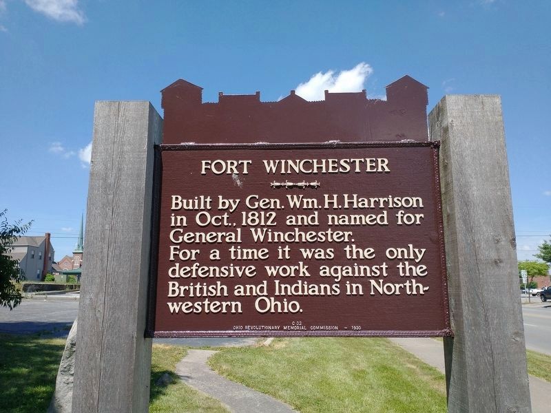
Fort Winchester
Ohio Revolutionary Memorial Trail
Built by General Wm. H. Harrison in Oct. 1812 and named for General Winchester.
For a time it was the only defensive work against the British and Indians in Northwestern Ohio.
Erected 1930 by Ohio Revolutionary Memorial Commission. (Marker Number C32.)
Topics and series. This historical marker is listed in these topic lists: Forts and Castles • Military • Native Americans • War of 1812. In addition, it is included in the Former U.S. Presidents: #09 William Henry Harrison, and the Ohio Revolutionary Memorial Commission series lists. A significant historical year for this entry is 1812.
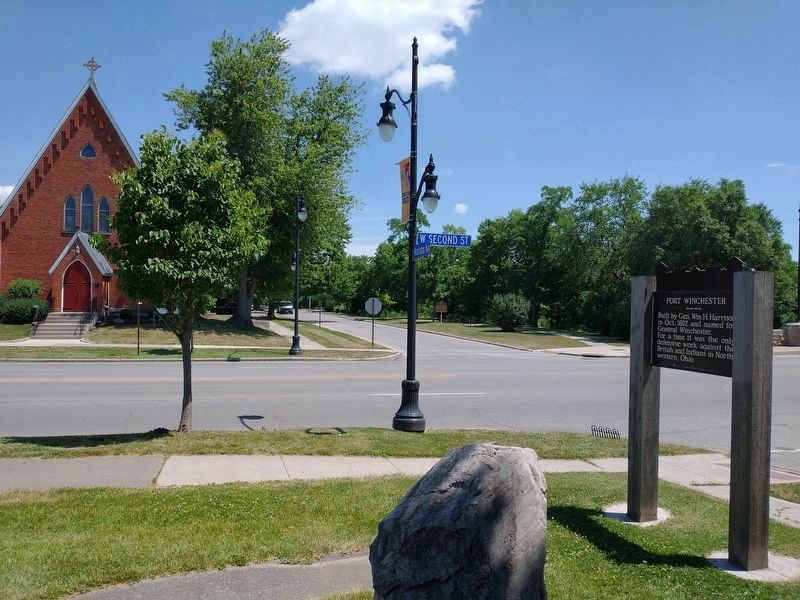
Location. 41° 17.119′ N, 84° 21.518′ W. Marker is in Defiance, Ohio, in Defiance County. Marker is at the intersection of West 2nd Street and Washington Avenue, on the right when traveling east on West 2nd Street. This historical marker is located on the southwest corner of the intersection of Washington Avenue. and West 2nd Street. As of May of 2009 it was on the front edge of the parking lot of the "Family Video" store. Touch for map. Marker is at or near this postal address: 315 West 2nd Street, Defiance OH 43512, United States of America. Touch for directions.
Other nearby markers. At least 8 other markers are within walking distance of this marker. A different marker also named Fort Winchester (within shouting distance of this marker); Fort Winchester - Former Site Of South East Blockhouse (about 300 feet away, measured in a direct line); Fort Winchester - Former Site Of North East Blockhouse (about 400 feet away); Fort Winchester - Former Site Of South West Blockhouse (about 400 feet away); Fort Winchester - Former Site Of North West Blockhouse (about 500 feet away); Defiance Historic Sites (about 600 feet away); 1913 Flood (about 700 feet away); a different marker also named Fort Winchester (about 800 feet away). Touch for a list and map of all markers in Defiance.
More about this marker. When it was originally built Fort Winchester was situated on the west bank of the Auglaize River, just upstream from the location of Fort Defiance at the juncture of the Auglaize River with the Maumee River. When visiting Defiance, Ohio today, the Ohio Revolutionary Memorial Commission (ORMC) historical marker for Fort Winchester can be viewed when traveling east from downtown Defiance on W. 2nd St. and looking on your right, just prior to crossing the bridge over the Auglaize River.
The more recent Ohio Historical Marker for Fort Winchester can be seen when looking to your left,
just prior to crossing the bridge over the Auglaize River.
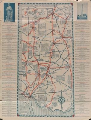
The featured historical marker is part of the Ohio Revolutionary Memorial Trail series (type C) which was put in place in 1930 to celebrate the 150th anniversary of the Ohio's Revolutionary War era Battle of Piqua, by the Ohio Revolutionary Memorial Commission.
In order to accomplish this, in 1929 the state of Ohio created the Ohio Revolutionary Memorial Commission, and then in 1930 this commission created 22 military trails, throughout western Ohio, between Cincinnati, Ohio on the state's southern border and Toledo, Ohio on the state's northern border. Each of these military trails represented the routes, or trails, used by military leaders during either the Revolutionary War, the Indian Wars of 1790 to 1795, or the War of 1812. Each of these military routes connected various related historical sites, that were marked with Ohio Revolutionary Memorial Commission (type C) markers, along each of the military trails.
The routes of these military trails were in turn marked by type A and type B Ohio Revolutionary Memorial Commission markers that served as directional (type B) and distance (type A) markers.
Originally, back in 1930, there were erected 70 some of these Ohio Revolutionary Memorial
Commission, type C, markers. To date, there are only 20 some of them that have been located and posted on the Historical Marker database. A number of them are presently missing, and presumed to be permanently lost.
Of the 20 some original markers that have been included in the historical marker database only a small number of them have the original art work, sometimes referred to as silhouettes, across the top of the historical marker. This is a feature that makes these markers quite unique from most other historical markers. This "Fort Winchester" marker is one of those very few markers.
Regarding Fort Winchester. The War of 1812 was still in its infancy and already the American theater of military operations in the Northwest had suffered a serious setback. General Hull had marched an American army northward, through northwestern Ohio, to one of America's border's with Canada, at Fort Detroit. Once there however, instead of the anticipated successful invasion of Canada, Hull's army experienced a stunning defeat. And with the loss of General Hull's army the door was opened for the British to launch an invasion of conquest into Ohio.
To make matters worse, there was soon infighting between the Americans over who would assume command of the Northwestern military theater of operations. Initially it appeared that General William Henry Harrison would be the man in charge and he began the task of scrambling to secure
as much as he could of what was now the contested territory between the British up in Detroit and the Americans down in southern and central Ohio. But then another general appeared on the scene, James Winchester, and he successfully argued that technically his commission outranked that of General Harrison, and then he assumed control of the American operations in the Northwest. But his command was short lived because General Harrison's supporters quickly secured a higher ranking commission for him and General Winchester was forced to accept a secondary role and placed in command of the Left Wing of the Northwestern Army.
So while it had been under General Winchester's command that the American army had advanced into the Fort Defiance area (the area at the juncture of the Auglaize River with the Maumee River), it would now be under the command of General Harrison that a major fort would be built there.
It is in his book (copyright 1905) entitled, "History of the Maumee River Basin" that Defiance native Charles E. Slocum writes about Fort Winchester and states: "General Harrison selected the site and drew the plan for a new fort to embrace over twelve times the ground space of Fort Defiance....As further evidence of the desire to respect and honor the commander of the Left Wing, the new fort at Defiance was duly christened Fort Winchester. This fort was completed by soldiers working with short and often unwholesome rations, thinly clad, and with much suffering from inclement weather; but it was happily completed and fulfilled its mission during the war as an important stronghold for the defense of the territory of the upper rivers, as a rendezvous for troops and, later, for the storing of supplies to be boated down the Maumee River as wanted by the advancing troops. For some length of time it was the only obstruction against the incursions of the British and Aborigines into Northwestern Ohio."
Also see . . . Ohio Revolutionary Memorial Trail System. A description of the Revolutionary Memorial Trail System developed by the state of Ohio in 1929 - 1930. (Submitted on November 17, 2010, by Dale K. Benington of Toledo, Ohio.)
Additional keywords. William Henry Harrison
Credits. This page was last revised on September 25, 2022. It was originally submitted on May 7, 2009, by Dale K. Benington of Toledo, Ohio. This page has been viewed 2,592 times since then and 72 times this year. Photos: 1. submitted on September 5, 2022, by Tom Bosse of Jefferson City, Tennessee. 2. submitted on May 7, 2009, by Dale K. Benington of Toledo, Ohio. 3. submitted on September 5, 2022, by Tom Bosse of Jefferson City, Tennessee. 4. submitted on September 8, 2014, by Dale K. Benington of Toledo, Ohio. • Syd Whittle was the editor who published this page.


