Cumberland in Allegany County, Maryland — The American Northeast (Mid-Atlantic)
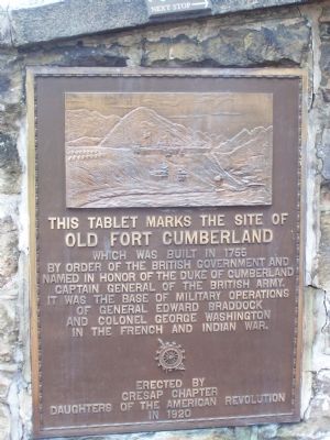
This Tablet Marks the Site of Old Fort Cumberland
Inscription.
Which was built in 1755 by order of the British Government and named in honor of the Duke of Cumberland, Captain General of the British Army. It was the base of military operations of General Edward Braddock and Colonel George Washington in the French and Indian War.
Erected 1920 by Cresap Chapter Daughters of the American Revolution.
Topics and series. This historical marker is listed in these topic lists: Colonial Era • Forts and Castles • War, French and Indian. In addition, it is included in the Daughters of the American Revolution series list. A significant historical year for this entry is 1755.
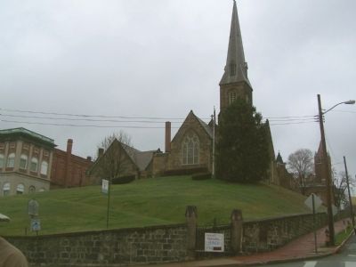
Location. 39° 39.049′ N, 78° 45.878′ W. Marker is in Cumberland, Maryland, in Allegany County. Marker is at the intersection of Greene St. and Washington Street on Greene St.. Touch for map. Marker is in this post office area: Cumberland MD 21502, United States of America. Touch for directions.
Other nearby markers. At least 8 other markers are within walking distance of this marker. Site of Fort Cumberland (here, next to this marker); Ohio Co. and Fort Cumberland (a few steps from this marker); Baltimore Street Bridge (a few steps from this marker); Algonquian Hotel (a few steps from this marker); Alteration of the Site (within shouting distance of this marker); Light The Steeples (within shouting distance of this marker); Abandonment of Ft. Cumberland (within shouting distance of this marker); Trenches and Tunnels / Army Discipline (within shouting distance of this marker). Touch for a list and map of all markers in Cumberland.
Credits. This page was last revised on August 29, 2022. It was originally submitted on May 7, 2009, by Bill Pfingsten of Bel Air, Maryland. This page has been viewed 1,610 times since then and 25 times this year. Photos: 1, 2. submitted on May 7, 2009, by Bill Pfingsten of Bel Air, Maryland. 3. submitted on August 7, 2022, by Craig Doda of Napoleon, Ohio.


