
Mount Vernon in Knox County, Ohio — The American Midwest (Great Lakes)
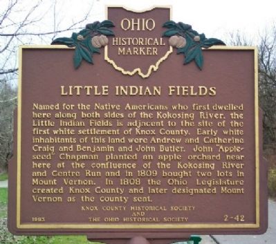
Little Indian Fields
Photographed by William Fischer, Jr., November 16, 2008
1. Little Indian Fields Marker
Erected 1993 by Knox County Historical Society and The Ohio Historical Society. (Marker Number 2-42.)
Topics and series. This historical marker is listed in these topic lists: Indigenous Peoples and Communities • Settlements & Settlers • Waterways & Vessels. In addition, it is included in the Ohio Historical Society / The Ohio History Connection series list. A significant historical year for this entry is 1809.
Location. 40° 22.959′ N, 82° 28.104′ W. Marker is in Mount Vernon, Ohio, in Knox County. It is at the intersection of Lower Gambier Road (County Route
this page online

Regionally, this marker is in Amish Country. It is also in the American Midwest and in the Corn Belt. Globally, it is in North America, the Western Hemisphere, the Western World, and the Anglosphere. Historically, it finds itself in what was once the Haudenosaunee (Iroquois) Confederacy, the territory of the Mississippian Culture, and the Northwest Territory.
Other nearby markers. At least 8 other markers are within walking distance of this marker: Lakeholm Administration Building (approx. 0.8 miles away); M.C. Kirk House (approx. 0.8 miles away); L.B. Ward House (approx. 0.8 miles away); C.G. Cooper House (approx. 0.9 miles away); C.P. Buckingham House (approx. 0.9 miles away); Durbin House (approx. 0.9 miles away); C.A. Bope House (approx. 0.9 miles away); Sturgess House (approx. 0.9 miles away). Touch for a list and map of all markers in Mount Vernon.
Photographed by William Fischer, Jr., November 16, 2008
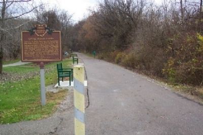
2. Little Indian Fields Marker
Looking south along the Kokosing Gap Trail (former railroad right of way).
Photographed by William Fischer, Jr., November 16, 2008
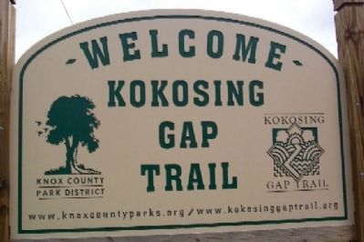
3. Kokosing Gap Trail Sign
Credits. This page was last revised on December 2, 2019. It was originally submitted on May 8, 2009, by William Fischer, Jr. of Reynoldsburg, Ohio. This page has been viewed 1,862 times since then and 53 times this year. Photos: 1, 2, 3. submitted on May 8, 2009, by William Fischer, Jr. of Reynoldsburg, Ohio. • Syd Whittle was the editor who published this page.
