Collinsville in St. Clair County, Illinois — The American Midwest (Great Lakes)
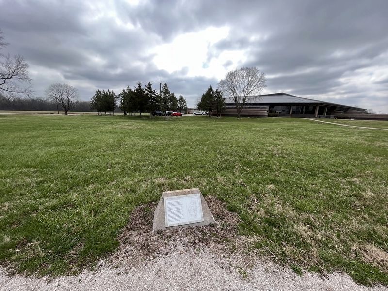
Interpretive Center Tract

Photographed by Thomas Smith, December 5, 2021
1. Interpretive Center Track Marker
Prior to the construction of the Interpretive Center, excavations revealed the location of over 80 structures and hundreds of pits and postholes.
Careful analysis of the materials showed how this neighborhood changed from AD 1000-1200. House basins got shallower, the house got larger, and the arrangement of the changed from a linear pattern to clustering of houses around family courtyards. Storage changed from shared "granaries" to storage pits inside the houses, perhaps as resources became scarcer and there was less sharing.
Topics. This historical marker is listed in these topic lists: Anthropology & Archaeology • Indigenous Peoples and Communities • Settlements & Settlers. A significant historical year for this entry is 1000 CE.
Location. 38° 39.337′ N, 90° 3.596′ W. Marker is in Collinsville, Illinois, in St. Clair County. It is on Ramey St half a mile south of Collinsville Rd (U.S. 40), on the right when traveling south. Touch for map. Marker is in this post office area: Collinsville IL 62234, United States of America. Touch for directions.

Regionally, this marker is in Greater St. Louis. It is also in
this page online
Other nearby markers. At least 8 other markers are within walking distance of this marker: Grand Plaza (within shouting distance of this marker); Mound 55 (within shouting distance of this marker); You Are Walking Where a Cahokia Neighborhood Once Stood (about 500 feet away, measured in a direct line); Cahokia Mounds (about 600 feet away); Cahokia (about 600 feet away); Mound 50 (approx. 0.2 miles away); Mound 51 (approx. 0.2 miles away); The South Stockade (approx. 0.2 miles away). Touch for a list and map of all markers in Collinsville.
Credits. This page was last revised on April 2, 2023. It was originally submitted on December 7, 2021, by Thomas Smith of Waterloo, Ill. This page has been viewed 208 times since then and 15 times this year. Photos: 1. submitted on December 7, 2021, by Thomas Smith of Waterloo, Ill. 2. submitted on April 2, 2023, by Devry Becker Jones of Washington, District of Columbia. • Bill Pfingsten was the editor who published this page.
