Near Osoyoos in Okanagan-Similkameen, British Columbia — Canada’s West Coast (North America)
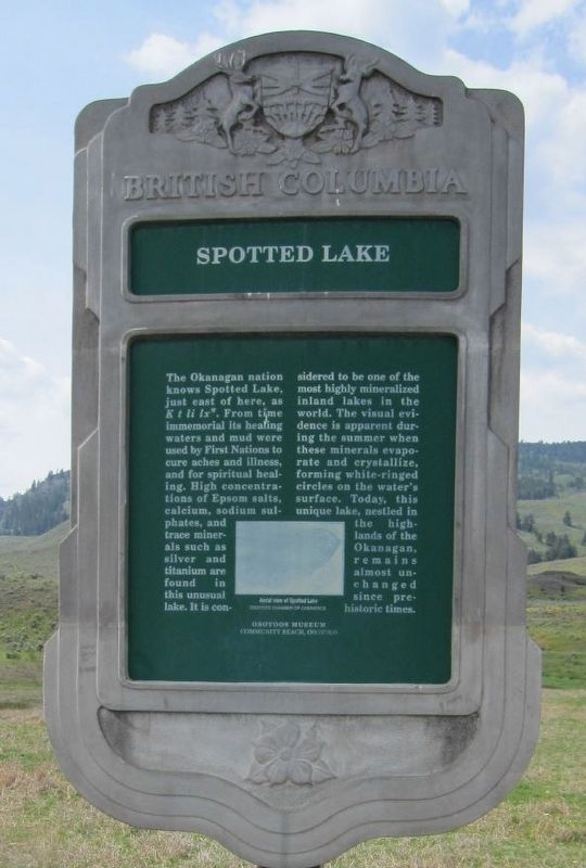
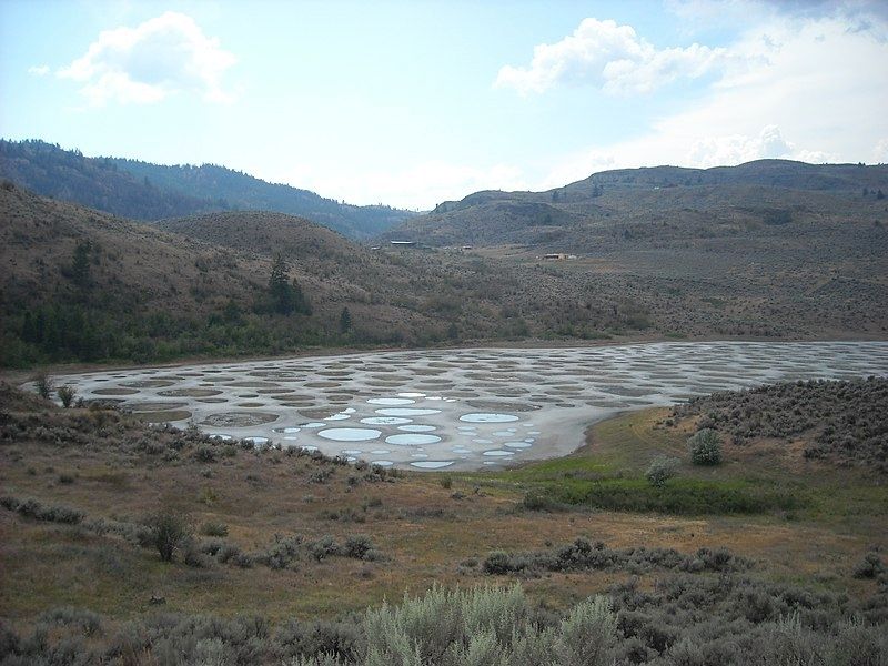
Spotted Lake

B.C. Ministry of Transportation and Infrastructure via Flickr (CC BY-NC-ND 2.0), November 15, 2016
1. Spotted Lake Marker
Caption: Aerial view of Spotted Lake. Osoyoos Chamber of Commerce
Erected by Province of British Columbia.
Topics. This historical marker is listed in these topic lists: Environment • Native Americans • Waterways & Vessels.
Location. 49° 5.061′ N, 119° 35.65′ W. Marker is near Osoyoos, British Columbia, in Okanagan-Similkameen. Marker is at the intersection of Crowsnest Highway (Provincial Highway 3) and Kobau Look-Out Forest Service Road, on the right when traveling south on Crowsnest Highway. Touch for map. Marker is in this post office area: Osoyoos BC V0H V0H, Canada. Touch for directions.
Other nearby markers. At least 3 other markers are within 16 kilometers of this marker, measured as the crow flies. Fairview Gold (approx. 10 kilometers away); Eagle Valley (approx. 12.7 kilometers away); Southern Crossroads (approx. 16.2 kilometers away).
Regarding Spotted Lake. The Okanagan Nation purchased the lake and more than 50 acres surrounding it in 2001. Public access to the lake, a sacred site to the Syilx People, is restricted.
Also see . . .
1. Spotted Lake Osoyoos Canada (YouTube). Drone footage of the unusual lake. (Uploaded by photorender, Oct. 8, 2017) (Submitted on February 19, 2022, by Duane and Tracy Marsteller of Murfreesboro, Tennessee.)
2. Spotted lake Khiluk. Pictures of the lake in summer, when the water largely evaporates and leaves mineral-rich circles behind. (UnusualPlaces.org) (Submitted on February 19, 2022, by Duane and Tracy Marsteller of Murfreesboro, Tennessee.)
Credits. This page was last revised on February 20, 2022. It was originally submitted on December 10, 2021, by Duane and Tracy Marsteller of Murfreesboro, Tennessee. This page has been viewed 191 times since then and 27 times this year. Photos: 1. submitted on December 10, 2021, by Duane and Tracy Marsteller of Murfreesboro, Tennessee. 2. submitted on February 19, 2022, by Duane and Tracy Marsteller of Murfreesboro, Tennessee.
