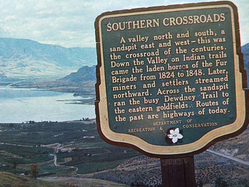
Near Osoyoos in Okanagan-Similkameen, British Columbia — Canada’s West Coast (North America)
Southern Crossroads

B.C. Ministry of Transportation and Infrastructure via Flickr (CC BY-NC-ND 2.0), July 7, 2016
1. Southern Crossroads Marker
Erected by British Columbia Department of Recreation and Conservation.
Topics. This historical marker is listed in these topic lists: Environment • Roads & Vehicles. A significant historical year for this entry is 1824.
Location. 49° 0.785′ N, 119° 24.013′ W. Marker is near Osoyoos, British Columbia, in Okanagan-Similkameen. Marker is on Crowsnest Highway (Provincial Highway 3) 0.2 kilometers west of Observatory Road, on the right when traveling west. Marker is in the Welcome to Osoyoos lookout. Touch for map. Marker is in this post office area: Osoyoos BC V0H 1V6, Canada. Touch for directions.
Other nearby markers. At least 6 other markers are within 24 kilometers of this marker, measured as the crow flies. Sidley B.C. 1895-1912 (approx. 10.5 kilometers away in the U.S.); Circle City (approx. 11 kilometers away in the U.S.); The Story of Molson (approx. 15 kilometers away in the U.S.); Old Molson (approx. 15.2 kilometers away in the U.S.); Spotted Lake (approx. 16.2 kilometers away); Fairview Gold (approx. 22.9 kilometers away).
Credits. This page was last revised on February 20, 2022. It was originally submitted on December 10, 2021, by Duane and Tracy Marsteller of Murfreesboro, Tennessee. This page has been viewed 170 times since then and 27 times this year. Photo 1. submitted on December 10, 2021, by Duane and Tracy Marsteller of Murfreesboro, Tennessee.
Editor’s want-list for this marker. Wide spot of marker and surrounding area in context • Confirm GPS coordinates • Can you help?