St. Simons Island in Glynn County, Georgia — The American South (South Atlantic)
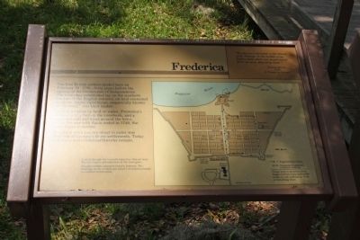
Frederica
" Frederica is situated on the Island of St. Simons, in the middle of an Indian field where our people found 30 or 40 acres cleared by them."
Francis Moore
1736
A Voyage to Georgia
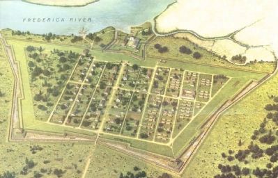
The first British settlers landed here on February 18, 1736 - forty years before the signing of the Declaration of Independence. The town they established lay on the southern frontier of the English colonies, on land contested by Spain. James Oglethorpe, respectfully known as "General," was their leader.
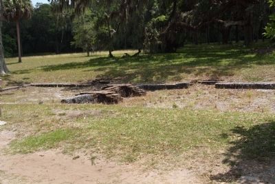
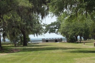
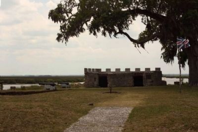
Fearing invasion by land or by water, Frederica's settlers built a fort on the riverbank, and a palisaded wall and moat around the town. When the war with Spain ended in 1748, the town began to decline.
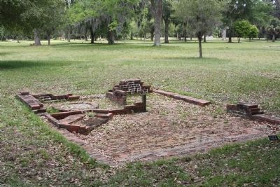
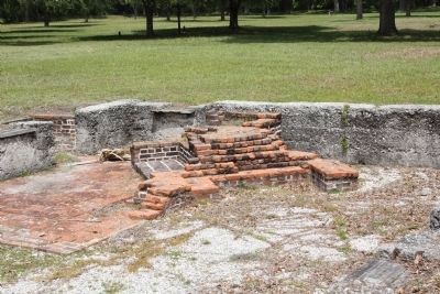
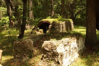
The ghost town you are about to enter was once one of Georgia's finest settlements. Today only ruins and eroded earthworks remain.
Erected by National Park Service.
Topics. This historical marker is listed in these topic lists: Colonial Era • Settlements & Settlers. A significant historical month for this entry is February 1794.
Location. 31° 13.41′ N, 81° 23.414′ W. Marker is on St. Simons Island, Georgia, in Glynn County. Marker can be reached from Frederica Dr.. At Fort Frederica. Touch for map. Marker is in this post office area: Saint Simons Island GA 31522, United States of America. Touch for directions.
Other nearby markers. At least 8 other markers are within walking distance of this marker. The Flesh Market (a few steps from this marker); The Town Wall (a few steps from this marker); Broad Street (within shouting distance of this marker); The Defender (within shouting distance of this marker); Tavernkeepers (within shouting distance of this marker); Shoemaker and Soldier (within shouting distance of this marker); Frederica - Huts and Houses (within shouting distance of this marker); A New House? (within shouting distance of this marker). Touch for a list and map of all markers in St. Simons Island.
Regarding Frederica. Wayside drawings on the exhibits are artist's
conceptions based on available information.
Also see . . .
1. Fort Frederica National Monument. NPS website entry:
Named for Frederick Louis, the Prince of Wales (1702-1754), Frederica was a military outpost consisting of a fort and town. (Submitted on May 11, 2009, by Mike Stroud of Bluffton, South Carolina.)
2. Fort Frederica. New Georgia Encyclopedia website entry (Submitted on May 13, 2009, by Mike Stroud of Bluffton, South Carolina.)
Photographed By Mike Stroud, May 10, 2009
3. The Town Wall, an additional marker
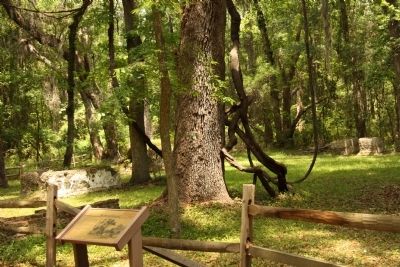
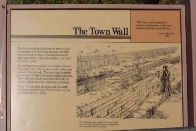
The tree- covered embankment in front of you
is a remnant of a mile-long earthen wall that
once enclosed the town. Construction of the
wall began about 1739 and probably continued
for several years.
The earthworks consisted of a sodden rampart
6 feet high, with a firing step on the inside and
a moat on the outside. The moat was bounded
by two rows of eight-foot posts called palisades.
These defenses would have been difficult for
enemy soldiers to cross, and none ever tried.
Today the palisades are gone and the earthworks
have been eroded, but remnants of the wall
and moat are visible.
The fortications surrounding the town resembled those at the fort. The earth removed in digging the moat was used to build the rampart.
" The town is surrounded by a rampart with flankers, of the same thickness with that round the fort...." London Magazine 1745
The fortications surrounding the town resembled those at the fort. The earth removed in digging the moat was used to build the rampart.
" The town is surrounded by a rampart with flankers, of the same thickness with that round the fort...." London Magazine 1745
Photographed By Mike Stroud, May 10, 2009
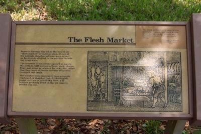
4. Frederica's The Flesh Market (Butcher Shop)
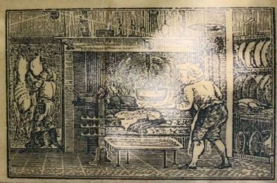
Records identify this lot as the site of the
"flesh market" or butcher shop. Some of
the animals slaughtered here were raised
on farm plots alloted to the settlers outside
of the town walls.
The trustees of the colony agreed to supply
the settlers with rations of beef, pork, cheese,
flour, and other provisions for one year. After
that they were expected to raise their own
livestock and crops.
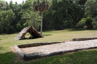
The butcher shop must have been a simple
clapboard or thatched hut. Archeologists
found no trace of a building here. The
butcher probably lived on a lot directly
behind this one.
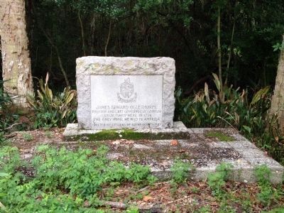
Photographed By Stuart Warren, August 1, 2014
11. Marker for home place of James E. Oglethorpe
This is the historical marker for the homeplace of James E. Oglethorpe, the founder of the Georgia Colony. It is a short walk from Fort Frederica, but well outside the fort walls.
Lat: 31°12'59.77"N
Lon: 81°22'42.01"W
This is the only remaining signs of the home built for James Oglethorpe. The marker is now directly across the street from the First African Baptist Church on Frederica Rd., in St. Simons Island, GA.
Credits. This page was last revised on October 11, 2021. It was originally submitted on May 11, 2009, by Mike Stroud of Bluffton, South Carolina. This page has been viewed 941 times since then and 7 times this year. Photos: 1, 2, 3. submitted on May 11, 2009, by Mike Stroud of Bluffton, South Carolina. 4, 5. submitted on May 13, 2009, by Mike Stroud of Bluffton, South Carolina. 6, 7, 8, 9, 10. submitted on May 11, 2009, by Mike Stroud of Bluffton, South Carolina. 11. submitted on August 6, 2014, by Stuart Warren of Merritt Island, Florida. 12, 13, 14. submitted on May 11, 2009, by Mike Stroud of Bluffton, South Carolina. • Craig Swain was the editor who published this page.
