St. Augustine in St. Johns County, Florida — The American South (South Atlantic)
Santo Domingo Redoubt
The Defensive System of Colonial St. Augustine
Inscription.
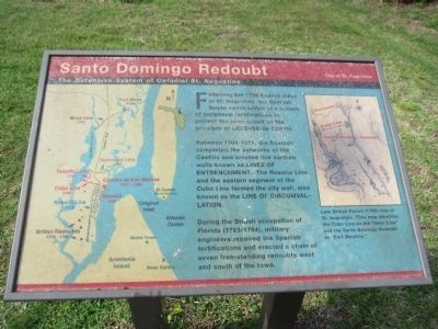
Following the 1702 English siege of St. Augustine, the Spanish began construction of a system of peripheral fortifications to protect the town based on the principle of defense-in-depth.
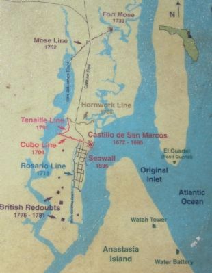
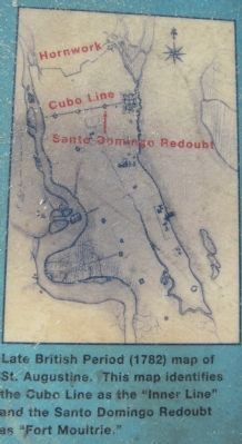
Between 1704-1821, the Spanish completed the outworks of the Castillo and erected five earthen walls known as lines of entrenchment. The Rosario Line and the eastern segment of the Cubo Line formed the city wall, also known as the line of circumvallation.
During the British occupation of Florida (1763-1784), military engineers repaired the Spanish fortifications and erected a chain of seven free-standing redoubts west and south of the town.
Erected by City of St. Augustine.
Topics. This historical marker is listed in these topic lists: Colonial Era • Forts and Castles. A significant historical year for this entry is 1702.
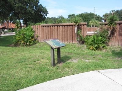
Location. 29° 53.869′ N, 81° 18.911′ W. Marker has been reported unreadable. Marker is in St. Augustine, Florida, in St. Johns County. Marker is at the intersection of Orange Street and Cordova Street, on the right when traveling west on Orange Street. Located beside a earthwork reconstruction of Santo Domingo Redoubt. Touch for map. Marker is in this post office area: Saint Augustine FL 32084, United States of America. Touch for directions.
Other nearby markers. At least 8 other markers are within walking distance of this location. A different marker also named Santo Domingo Redoubt (here, next to this marker); a different marker also named Santo Domingo Redoubt (a few steps from this marker); a different marker also named Santo Domingo Redoubt (within shouting distance of this marker); The 1886 Old Drugstore (within shouting distance of this marker); The Cubo Line (within shouting distance of this marker); Los Floridanos (within shouting distance of this marker); The Lynching of Isaac Barrett (within shouting distance of this marker); The Lynching of Isaac Barrett / Racial Violence in America (within shouting distance of this marker). Touch for a list and map of all markers in St. Augustine.
Credits. This page was last revised on December 16, 2021. It was originally submitted on August 27, 2011, by Craig Swain of Leesburg, Virginia. This page has been viewed 666 times since then and 42 times this year. Last updated on December 15, 2021. Photos: 1, 2, 3, 4. submitted on August 27, 2011, by Craig Swain of Leesburg, Virginia. • J. Makali Bruton was the editor who published this page.


