St. Augustine in St. Johns County, Florida — The American South (South Atlantic)
Cofradia Archaeological Site
English
Foundations of a Stone House
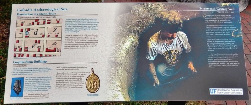
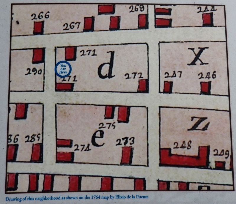
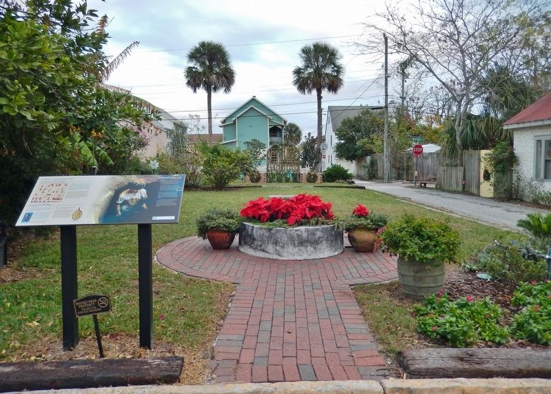
Wooden boards sit atop and mark the coquina stone foundations of a building that formed the street corner for more than a century (circa 1740 - 1870). Constructed by Spanish residents, the building over the years served as a home, a general store and a liquor store through the American Civil War. From 1889 until 1989 a 2-story brick building completely covered these old foundations and the rest of this park.
Coquina Stone Buildings
The Brotherhood of the Blessed Sacrament was the first known owner of two shell stone buildings that stood here from circa 1740 to 1850. The religious organization probably used this as income property, rented as homes or shops.
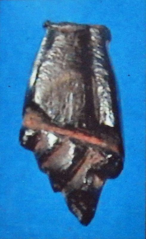
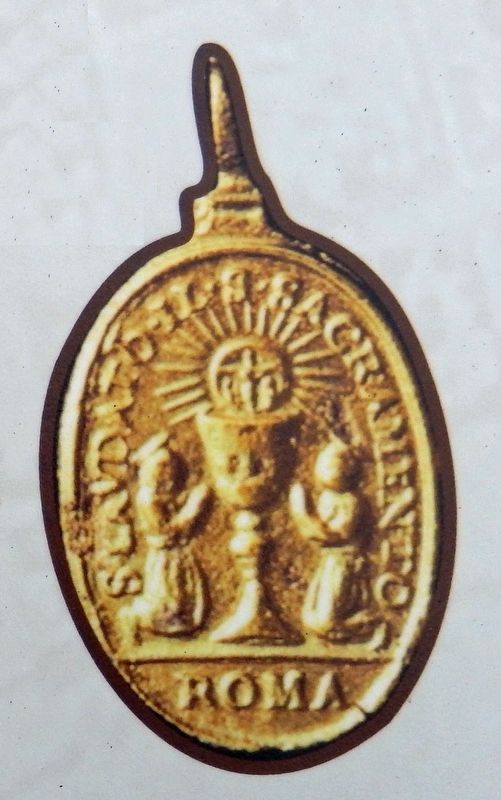
Among the many artifacts excavated here in 1990 were two religious objects lost centuries ago. A hand-shaped higa, an amulet hung around the necks of children for protection from the evil eye, and a Blessed Sacrament medal attest to the important role of religion in the lives of colonial Spaniards. After 1763 the buildings became private residences.
Seventeenth-Century Well
Inside this long-forgotten coquina stone well archaeologists found pieces of St Augustinians' lives from the late 1600s. One of the largest and earliest stonewalled wells in St. Augustine, it served perhaps as a public well for the neighborhood.
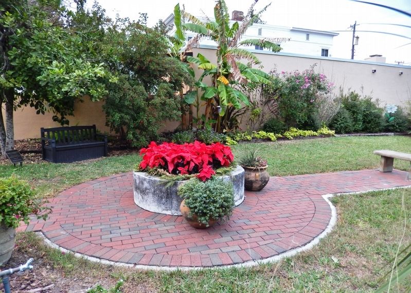
Archaeologists excavated remnants of furniture, chunks of a burned building, a cow skull, seeds from long-ago dinners, and even a small cactus with its thorns. Preservationists rebuilt the above-ground well curb that you see today. The original 17th-century well remains in the ground.
Español
Cimientos de una Casa de Mampostería
Por más de 125 años (c. 1740- 1870) estos tablones de madera marcaron los cimientos de piedra de coquina de un edificio que formaba la esquina de una calle. Fue construido por españoles residentes. Durante la Guerra Civil Americana, el edificio por muchos años sirvió como casa-habitación, tienda y licorería. De 1889 a 1989, un edificio de ladrillo de dos pisos cubrió por completo los antiguos cimientos y el resto del parque.
Casas de Ripio
La Cofradía del Santísimo Sacramento fue el primer dueño conocido de dos edificios de ripio que permanecieron aquí de c. 1740 a 1850. Es probable que hayan sido propiedades para alquilar como casa-habitación o tienda.
Dentro de los muchos artefactos que se excavaron aquí en 1990 hubo dos que fueron religiosos. Una "higa" en forma de mano que era un amuleto que colgaban alrededor del cuello de los niños para que los protegiera del "mal de ojo" y, una medalla del Santísimo Sacramento. Estos objetos atestiguan el papel tan importante que tenía la religión en la vida de los colonos españoles. Después de 1763 los edificios pasaron a ser residencias privadas.
Pozo de Siglo XVII
Dentro de las paredes de coquina de este pozo olvidado, los arqueólogos descubrieron vestigios que usaron los habitantes que vivieron en San Agustín a fines del siglo XVII. Es uno de los pozos de paredes de piedra más grande y temprano de San Agustín. Tal vez sirvió como pozo público para el vecindario.
Los arqueólogos excavaron restos de muebles, trozos de un edificio quemado, un cráneo de vaca, semillas de una posible comida, y un cactus pequeño que todavía tenía espinas. Los conservacionistas reconstruyeron el pozo de agua que quedaba en la superficie y es el que se ve hoy en día. El resto del pozo original todavía está debajo del suelo.
Erected by Historic St. Augustine, University of Florida.
Topics. This historical marker is listed in these topic lists: Anthropology & Archaeology • Churches & Religion • Colonial Era • Settlements & Settlers. A significant historical year for this entry is 1740.
Location. 29°
53.432′ N, 81° 18.676′ W. Marker is in St. Augustine, Florida, in St. Johns County. Marker is on Aviles Street just north of Bravo Lane, on the left when traveling south. Marker overlooks the courtyard and well at the northeast corner of the intersection. Touch for map. Marker is at or near this postal address: 32 Aviles St, Saint Augustine FL 32084, United States of America. Touch for directions.
Other nearby markers. At least 8 other markers are within walking distance of this marker. Father Miguel O'Reilly House (a few steps from this marker); Don Toledo/Gaspar Papy House (within shouting distance of this marker); Solana House (within shouting distance of this marker); Ximenez-Fatio House (within shouting distance of this marker); Signal From Shore (within shouting distance of this marker); a different marker also named The Ximenez-Fatio House (within shouting distance of this marker); a different marker also named The Ximenez-Fatio House (about 300 feet away, measured in a direct line); Sisters of St. Joseph - Florida Motherhouse (about 300 feet away). Touch for a list and map of all markers in St. Augustine.
Credits. This page was last revised on December 18, 2021. It was originally submitted on December 18, 2021, by Cosmos Mariner of Cape Canaveral, Florida. This page has been viewed 242 times since then and 36 times this year. Photos: 1, 2, 3, 4, 5, 6. submitted on December 18, 2021, by Cosmos Mariner of Cape Canaveral, Florida.
