Franklin in Williamson County, Tennessee — The American South (East South Central)
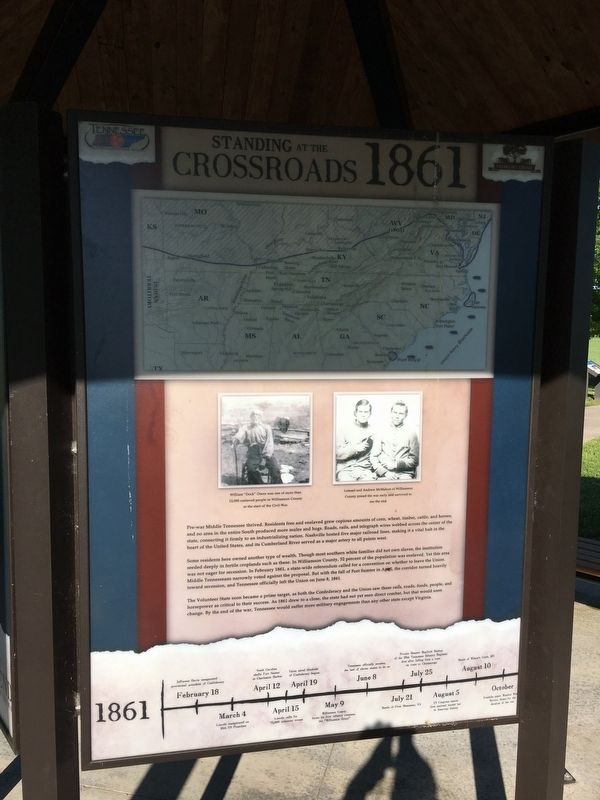
Standing at the Crossroads 1861
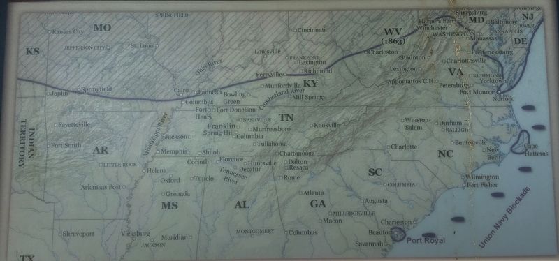
Some residents here owned another type of wealth. Though most southern white families did not own slaves, the institution seeded deeply in fertile croplands such as these. In Williamson County, 52 percent of the population was enslaved. Yet this area was not eager for secession. In February 1861, a state-wide referendum called for a convention on whether to leave the Union. Middle Tennesseans narrowly voted against the proposal. But with the fall of Fort Sumter in April, the corridor turned heavily toward secession, and Tennessee officially left the Union on June 8, 1861.
The Volunteer State soon became a prime target, as both the Confederacy and the Union saw these rails, roads, foods, people, and horsepower as critical to their success. As 1861 drew to a close, the state had not yet seen direct combat, but that would soon change. By the end of the war, Tennessee would suffer more military engagements than any other state except Virginia.
Erected by Franklin's Charge.
Topics. This historical marker is listed in these topic lists: African Americans • Agriculture • Railroads & Streetcars • War, US Civil. A significant historical month for this entry is February 1861.
Location. 35° 54.298′ N, 86° 51.519′ W. Marker is in Franklin, Tennessee, in Williamson County. Marker is on Eastern Flank Circle, 0.4 miles south of Lewisburg Pike (Business U.S. 431), on the right when traveling west. Located in the Eastern Flank Battlefield Park. Touch for map. Marker is at or near this postal address: 1345 Eastern Flank Cir, Franklin TN 37064, United States of America. Touch for directions.
Other nearby markers. At least 8 other markers are within walking distance of this marker. Becoming the Front Line 1862 (here, next to this marker); A Crucial War Zone 1863 (here, next to this marker); Hood's Retreat (here, next to this marker); The Final Campaign 1864 (here, next to this marker); The Battle of Franklin (here, next to this marker); Battle of Franklin, Eastern Flank (a few steps from this marker); a different marker also named Battle of Franklin, Eastern Flank (within shouting distance of this marker); a different marker also named Battle of Franklin, Eastern Flank (within shouting distance of this marker). Touch for a list and map of all markers in Franklin.
Credits. This page was last revised on December 21, 2021. It was originally submitted on May 10, 2017, by Brandon Stahl of Fairfax, Virginia. This page has been viewed 257 times since then and 18 times this year. Last updated on December 20, 2021, by Bradley Owen of Morgantown, West Virginia. Photos: 1, 2, 3, 4, 5. submitted on May 10, 2017, by Brandon Stahl of Fairfax, Virginia. • J. Makali Bruton was the editor who published this page.
