Pátzcuaro, Michoacán, Mexico — The Pacific Coast (and Central Highlands)
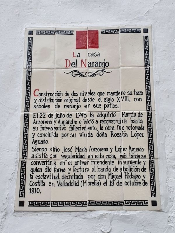
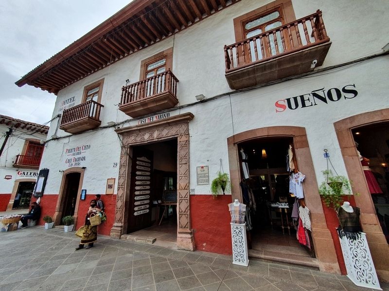
La Casa del Naranjo
Construcción de dos niveles que mantiene su trazo y distribución original desde el siglo XVIII, con árboles de naranjo en sus patios.
El 22 de julio de 1745 la adquirió Martín de Anzorena y Alejandre e inició a reconstruirla hasta su intempestivo fallecimiento, la obra fue retomada y concluida por su viuda doña Rosalía López Aguado.
Siendo niño José María Anzorena y López Aguado asistía con regularidad en esta casa, más tarde se convertiría en el primer intendente insurgente y quien dio forma y lectura al bando de abolición de la esclavitud, decretada por don Miguel Hidalgo y Costilla en Valladolid (Morelia) el 19 de octubre de 1810.
La Casa del Naranjo
The House of the Orange Trees
A construction of two levels that maintains its original layout and distribution since the eighteenth century, with orange trees in its courtyards.
On July 22, 1745, Martín de Anzorena y Alejandre acquired it and began to rebuild it until his untimely death, the work was resumed and completed by his widow Rosalía López Aguado.
As a child José María Anzorena y López Aguado regularly came to this house, later he would become the first insurgent intendant who gave shape to and announced the abolition of slavery, decreed by Miguel Hidalgo y Costilla in Valladolid (Morelia) on October 19, 1810.
Topics. This historical marker is listed in these topic lists: Civil Rights • Colonial Era • Wars, Non-US. A significant historical date for this entry is July 22, 1745.
Location. 19° 30.765′ N, 101° 36.527′ W. Marker is in Pátzcuaro, Michoacán. Marker is at the intersection of Ponce de León and Dr. Coss, on the right when traveling east on Ponce de León. Touch for map. Marker is in this post office area: Pátzcuaro MIC 61600, Mexico. Touch for directions.
Other nearby markers. At least 8 other markers are within walking distance of this marker. Casa de la Escalera Chueca (a few steps from this marker); Vasco de Quiroga (about 90 meters away, measured in a direct line); Ex Convent of Santa Catarina (House of the Eleven Courtyards) (about 90 meters away); Gertrudis Bocanegra (about 120 meters away); House of Eleven Courtyards (about 120 meters away); Execution of Gertrudis Bocanegra (about 120 meters away); 400th Anniversary of the Death of Vasco de Quiroga (about 120 meters away); Consecration of Michoacán's First Cathedral Altar (about 120 meters away). Touch for a list and map of all markers in Pátzcuaro.
Credits. This page was last revised on December 21, 2021. It was originally submitted on December 21, 2021, by J. Makali Bruton of Accra, Ghana. This page has been viewed 65 times since then and 6 times this year. Photos: 1, 2. submitted on December 21, 2021, by J. Makali Bruton of Accra, Ghana.

