Historic District in St. Augustine in St. Johns County, Florida — The American South (South Atlantic)
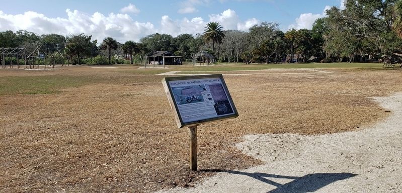
Continuing Archaeology
2015 Dig, Site B
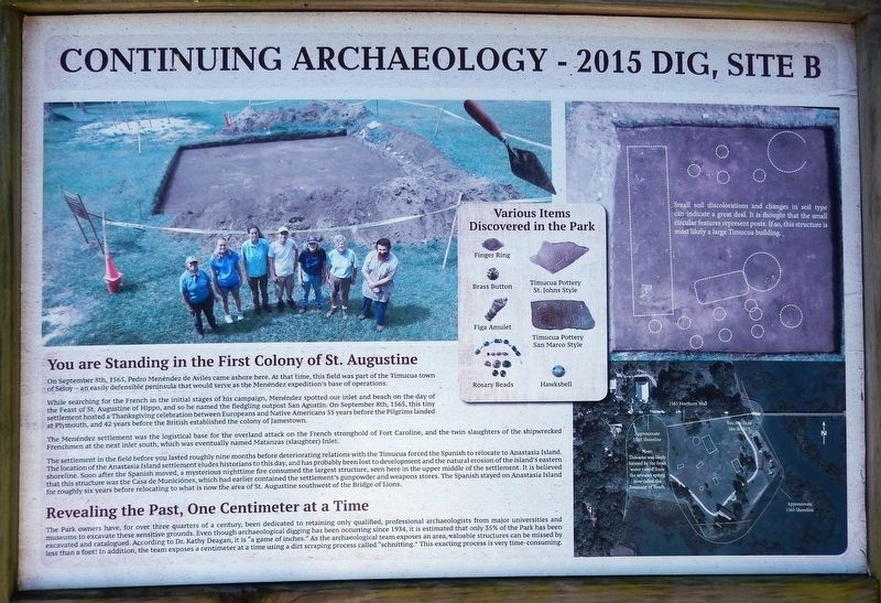
You are Standing in the First Colony of St. Augustine
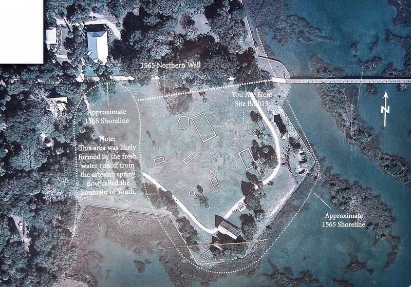
On September 8th, 1565, Pedro Menéndez de Aviles came ashore here. At that time, this field was part of the Timucua town of Seloy — an easily defensible peninsula that would serve as the Menéndez expedition's base of operations.
While searching for the French in the initial stages of his campaign, Menéndez spotted our inlet and beach on the day of the Feast of St. Augustine of Hippo, and so he named the fledgling outpost San Agustín. On September 8th, 1565, this tiny settlement hosted a Thanksgiving celebration between Europeans and Native Americans 55 years before the Pilgrims landed at Plymouth, and 42 years before the British established the colony of Jamestown.
The Menéndez settlement was the logistical base for the overland attack on the French stronghold of Fort Caroline, and the twin slaughters of the shipwrecked Frenchmen at the next inlet south, which was eventually named Matanzas (slaughter) Inlet.
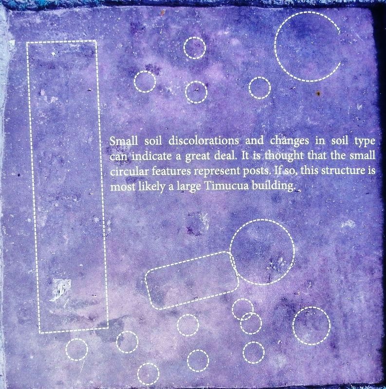
The settlement in the field before you lasted roughly nine months before deteriorating relations with the Timucua forced the Spanish to relocate to Anastasia Island. The location of the Anastasia Island settlement eludes historians to this day, and has probably been lost to development and the natural erosion of the island's eastern shoreline. Soon after the Spanish moved, a mysterious nighttime fire consumed the largest structure, seen here in the upper middle of the settlement. It is believed that this structure was the Casa de Municiónes, which had earlier contained the settlement's gunpowder and weapons stores. The Spanish stayed on Anastasia Island for roughly six years before relocating to what is now the area of St. Augustine southwest of the Bridge of Lions.
Revealing the Past, One Centimeter at a Time
The Park owners have, for over three quarters of a century, been dedicated to retaining only qualified, professional archaeologists from major universities and museums to excavate these sensitive grounds. Even though archaeological digging has been occurring since 1934, it is estimated that only 35% of the Park has been excavated and catalogued. According to Dr. Kathy Deagan, it is "a game of inches." As the archaeological team exposes an area, valuable structures can be missed by less than a foot! In addition, the team exposes a centimeter at a time using a dirt scraping process called "schnitting." This exacting process is very time-consuming.
Topics. This historical marker is listed in these topic lists: Anthropology & Archaeology • Colonial Era • Native Americans • Settlements & Settlers. A significant historical date for this entry is September 8, 1565.
Location. 29° 54.409′
N, 81° 18.826′ W. Marker is in St. Augustine, Florida, in St. Johns County. It is in the Historic District. Marker can be reached from Williams Street east of Magnolia Avenue. Marker is located along the interpretive trail in Ponce de León's Fountain of Youth Archaeological Park. Touch for map. Marker is at or near this postal address: 11 Magnolia Avenue, Saint Augustine FL 32084, United States of America. Touch for directions.
Other nearby markers. At least 8 other markers are within walking distance of this marker. Don Juan Ponce De Leon (a few steps from this marker); Sentinels of the Spanish Coast (within shouting distance of this marker); The Matchlock Arquebus (within shouting distance of this marker); First Muster of Militiamen in the Continental United States (within shouting distance of this marker); 17th & 18th Century Cannons / 17o y Cañones del 18o siglo (within shouting distance of this marker); Juan Ponce De León (within shouting distance of this marker); Site of the First Fort San Juan de Pinos (within shouting distance of this marker); The Fountain of Youth (within shouting distance of this marker). Touch for a list and map of all markers in St. Augustine.
Related markers. Click here for a list of markers that are related to this marker. Ponce de León's Fountain of Youth Archaeological Park
Also see . . . Archaeology at The Fountain of Youth Park.
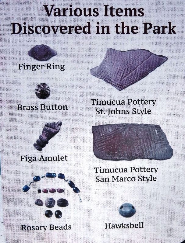
Shovel testing, auger sampling and test pit excavations throughout the property have shown that the sixteenth century Spanish presence at the site is restricted to an area of about 100 meters by 70 meters. The Spanish concentrated their occupation between two existing pre-Columbian shell middens, which radiocarbon dating has shown to have been occupied for more than 2,000 years when Menéndez arrived. The area between the middens, where the Spaniards settled, had been kept free of shell refuse and debris, and appears to have remained so as long as the site was occupied.(Submitted on December 26, 2021, by Cosmos Mariner of Cape Canaveral, Florida.)
Credits. This page was last revised on December 29, 2021. It was originally submitted on December 26, 2021, by Cosmos Mariner of Cape Canaveral, Florida. This page has been viewed 495 times since then and 42 times this year. Photos: 1, 2, 3, 4, 5. submitted on December 26, 2021, by Cosmos Mariner of Cape Canaveral, Florida.
