Georgetown in Northwest Washington in Washington, District of Columbia — The American Northeast (Mid-Atlantic)
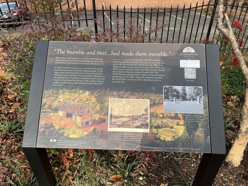
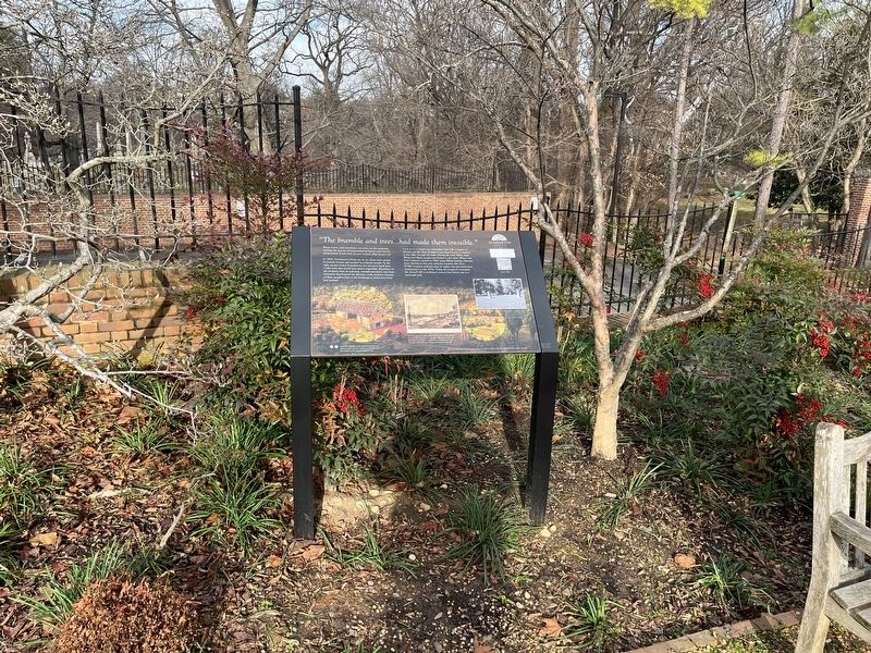
"The bramble and trees…had made them invisible"

Photographed By Devry Becker Jones (CC0), December 31, 2021
1. "The bramble and trees…had made them invisible" Marker
What is seen, and sometimes not seen, on the landscape informs the process of understanding history and historic preservation. If you look up and around, what do you see?
In 1804, Dumbarton House sat on an urban farm owned by Joseph Nourse and worked by enslaved people. To the right are the buried foundations of a two-story bank barn. Under your feet would have grown vegetables. Elsewhere on the property were an icehouse, smokehouse-dairy, and three structures that housed the laborers. Little evidence remains of these people's lives or the buildings in which they lived and worked.
Look up to compare two cemeteries: Oak Hill Cemetery to the left and Mt. Zion-Female Union Band Society Cemetery to the right through the trees. During the early 1800s, both white and Black people were buried in the latter. When Oak Hill Cemetery opened in 1849, many White families reburied their relatives in this new, exclusive location. Mt. Zion-FUBS Cemetery suffered years of neglect and as saved from development in the 1970s. Today, the nonprofit managing Mt. Zion-FUBS is working to restore this historic site as a memorial park.
[Captions:]
Artist Peter Waddell imagined what the bank barn and enslaved people's quarters would have looked like in his 2017 painting of the property's original 8 acres.
You can see the port of Georgetown in this aquatint by George Parkyns "View of the Suburbs of the City of Washington" from 1795. Before DC was established, Georgetown was a bustling trade center where free, indentured, and enslaved people worked side by side."
The cemetery is believed to have been a stop on the Underground Railroad and is now on the National Register of Historic Places.
Title quote taken from "At 2 Georgetown Cemeteries, History in Black and White," New York Times, October 20, 2016.
Erected by The National Society of the Colonial Dames of America.
Topics and series. This historical marker is listed in these topic lists: Abolition & Underground RR • African Americans • Agriculture • Cemeteries & Burial Sites • Settlements & Settlers. In addition, it is included in the The Colonial Dames of America, National Society of series list. A significant historical date for this entry is October 20, 2016.
Location. 38° 54.654′ N, 77° 3.315′ W. Marker is in Northwest Washington in Washington, District of Columbia. It is in Georgetown. Marker can be reached from Q Street Northwest just west of 27th Street Northwest, on the right when traveling west. Touch for map. Marker is at or near this postal address: 2715 Q St NW, Washington DC 20007, United States of America. Touch for directions.
Other nearby markers. At least 8 other markers are within walking

Photographed By Devry Becker Jones (CC0), December 31, 2021
2. "The bramble and trees…had made them invisible" Marker
Credits. This page was last revised on January 30, 2023. It was originally submitted on December 31, 2021, by Devry Becker Jones of Washington, District of Columbia. This page has been viewed 121 times since then and 13 times this year. Photos: 1, 2. submitted on December 31, 2021, by Devry Becker Jones of Washington, District of Columbia.