
Chesapeake City in Cecil County, Maryland — The American Northeast (Mid-Atlantic)
Byway Destinations
⎯⎯⎯
Chesapeake City
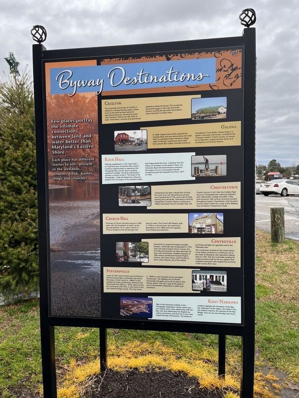
Byway Destinations
Few places portray the intimate connections between land and water better than Maryland's Eastern Shore.
Each place has different stories to tell—present in the wetlands, wharves, fields, homes, shops and churches.
Cecilton
The crossroads community of Cecilton is nestled in a diverse farming region, where much of the land has been placed in agricultural preserves, ensuring its future rural character. Visitors can view fields of grain, horse farms, nurseries and greenhouse operations along the byway. The occasional horse and buggy on the road and Amish farmers working the land with horse-drawn plows hard back to earlier times.
Galena
In 1608, Captain John Smith explored the Sassafras River and was welcomed by the tribal chief of a palisaded Native American village called Tockwogh, located just a few miles from present-day Galena. Formerly known as Georgetown Cross Roads, Galena today is a quaint crossroads community. Considered the "Antiques Capital" of Kent County, it's known for its attractive, dogwood-lined streets and scrumptious community dinners.
Rock Hall
Officially established in
this page online
Chestertown
Chestertown has been a Royal Port of Entry, the scene of its own Revolutionary protest over imported tea (1774), and a hub of trade, farming and cultural life. Stroll back in time by visiting Kent County's historic courthouse (c. 1860), Emmanuel Church, Fountain Park, the Charles Sumner G.A.R. Hall, the Geddes-Piper House (a Chesapeake Bay Gateways Network Site), Washington College (founded 1782), and numerous 18th-century structures located throughout historic Chestertown. Visit the Kent County Visitor Center for a copy of the Walking Tour of Historic Chestertown Guide.
Church Hill
The
Centreville
Named for its central and easily accessible location, Centreville was incorporated in 1794 and is the seat of Queen Anne's County. Pre-Civil War and Victorian era styles decorate the town with vivid history. Notable examples of 18th-century architecture include Wright's Chance, the Tucker House, and Providence Farm, which features one of the earliest surviving examples of a gambrel roof in the Tidewater area.
The courthouse, located on the central green, is the oldest courthouse in continuous use in the State of Maryland, with operations dating back to 1796. Visit the Centreville Landing for a look at homes built by the sea captains and maritime merchants who shaped the economy of the Corsica River area.
Stevensville
Lovers of 19th-century history and architecture will find Stevensville a
Photographed by Devry Becker Jones (CC0), January 2, 2022
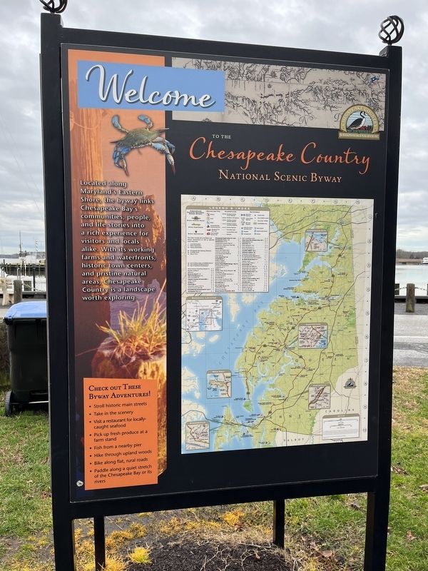
3. Welcome to the Chesapeake Country National Scenic Byway side of the marker
Kent Narrows
Take in the interactive exhibits at the Chesapeake Exploration Center, where you can explore man's close relationship with the Bay, how that relationship has shaped our culture and history, and how we in turn have shaped the Bay environment. The hands-on exhibits highlight the formation of the Bay, the settlement of the region, the tobacco era, the seafood industry, the opening of the Bay Bridge, how we can save the Bay, and much more!
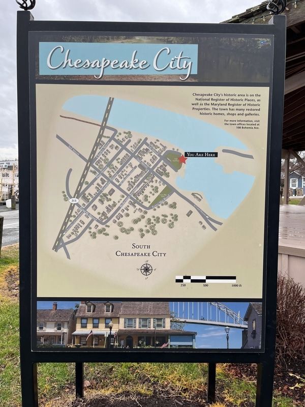
Chesapeake City
Chesapeake City's historic area is on the National Register of Historic Places, as well as the Maryland Register of Historic Properties. The town has many restored historic
Photographed by Devry Becker Jones (CC0), January 2, 2022
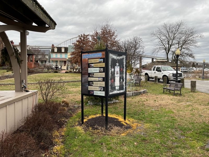
4. Byway Destinations / Chesapeake City Marker
Topics. This historical marker is listed in these topic lists: Architecture • Colonial Era • Exploration • Indigenous Peoples and Communities • Settlements & Settlers • War, US Revolutionary • Waterways & Vessels. A significant historical year for this entry is 1608.
Location. 39° 31.633′ N, 75° 48.683′ W. Marker is in Chesapeake City, Maryland, in Cecil County. It is at the intersection of Bohemia Avenue and 1st Street, on the right when traveling east on Bohemia Avenue. Touch for map. Marker is at or near this postal address: 20 Bohemia Ave, Chesapeake City MD 21915, United States of America. Touch for directions.

Regionally, this marker is in Greater Wilmington, on the Eastern Shore, and in Greater Philadelphia. It is also in the American Mid-Atlantic, on the Delmarva Peninsula, in the Tidewater, in the Chesapeake Bay Region, and on the Eastern Seaboard. Globally, it is in the North Atlantic Region, North America, the Western Hemisphere, the Western World, and the Anglosphere. Historically, it finds itself in what was once one of the original Thirteen Colonies
Photographed by Adam Margolis, January 10, 2022
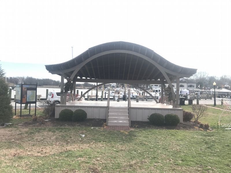
5. Byway Destinations / Chesapeake City Marker
Other nearby markers. At least 8 other markers are within walking distance of this marker: A Historic Hub of Commerce (a few steps from this marker); “Bygone Days” (within shouting distance of this marker); Long Bridge (within shouting distance of this marker); Pell Gardens (within shouting distance of this marker); Franklin Hall (within shouting distance of this marker); The Bayard House (within shouting distance of this marker); Cropper House (within shouting distance of this marker); Brady-Rees House (within shouting distance of this marker). Touch for a list and map of all markers in Chesapeake City.
Credits. This page was last revised on January 18, 2022. It was originally submitted on January 2, 2022, by Devry Becker Jones of Washington, District of Columbia. This page has been viewed 533 times since then and 18 times this year. Photos: 1, 2, 3, 4. submitted on January 2, 2022, by Devry Becker Jones of Washington, District of Columbia. 5. submitted on January 10, 2022, by Adam Margolis of Mission Viejo, California.
