Mishicot in Manitowoc County, Wisconsin — The American Midwest (Great Lakes)
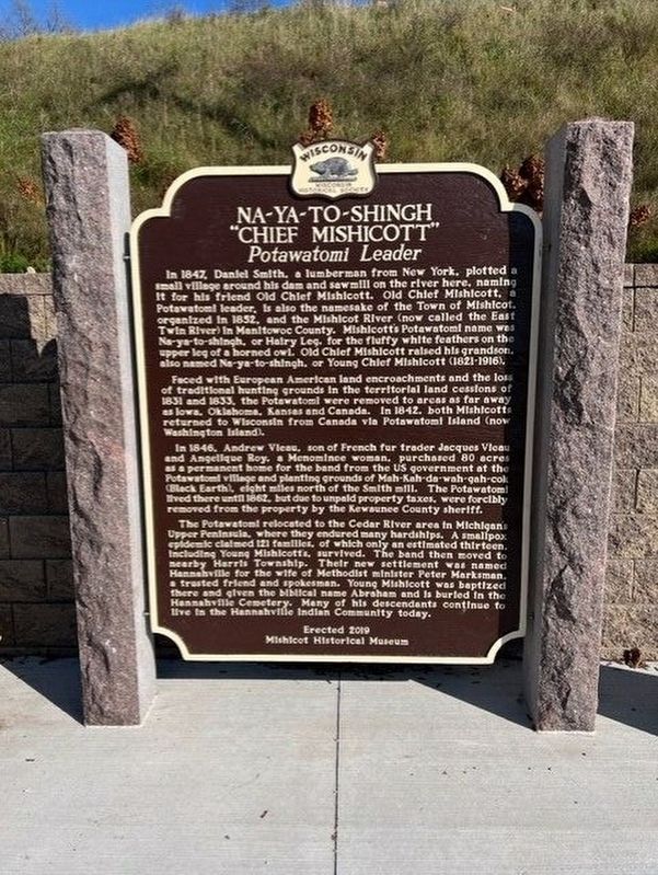
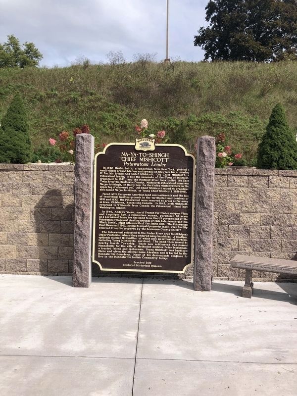
Na-Ya-to-Shingh "Chief Mishicott" Potawatomi Leader
In 1847, Daniel Smith, a lumberman from New York, plotted a small village around his dam and sawmill on the river here, naming it for his friend Old Chief Mishicott. Old Chief Mishicott, a Potawatomi leader, is also the namesake of the Town of Mishicot, organized in 1852, and the Mishicot River (now called the East Twin River) in Manitowoc County. Mishicott’s Potawatomi name was Na-ya-to-shingh, or Hairy Leg, for the fluffy white feathers on the upper leg of a horned owl. Old Chief Mishicott raised his grandson, also named Na-ya-to-shingh, or Young Chief Mishicott (1821-1916).
Faced with European American land encroachment and the loss of traditional hunting grounds in the territorial land cessions of 1831 and 1833, the Potawatomi were removed to areas as far away as Iowa, Oklahoma, Kansas, and Canada. In 1842, both Mishicotts returned to Wisconsin from Canada via Potawatomi Island (now Washington Island).
In 1846, Andrew Vieau, son of French fur trader Jacques Vieau and Angelique Roy, a Menominee woman, purchased 80 acres as a permanent home for the band from the US government at the Potawatomi village and planting grounds of Mah-Kah-da-wah-gah-cok (Black Earth), eight miles north of the Smith mill. The Potawatomi lived there until 1862, but due to unpaid property taxes, were forcibly removed from the property by the Kewaunee County sheriff.
The Potawatomi relocated to the Cedar River area in Michigan’s Upper Peninsula, where they endured many hardships. A smallpox epidemic claimed 121 families, of which only an estimated thirteen, including young Mishicott’s, survived. The band then moved to nearby Harris Township. Their new settlement was named Hannahville for the wife of Methodist minister Peter Marksman, a trusted friend and spokesman. Young Mishicott was baptized there and given the biblical name Abraham and is buried in the Hannahville Cemetery. Many of his decedents continue to live in the Hannahville Indian community today.
Erected 2021 by Mishicot Historical Museum. (Marker Number 596.)
Topics and series. This historical marker is listed in these topic lists: Industry & Commerce • Law Enforcement • Native Americans • Settlements & Settlers. In addition, it is included in the Wisconsin Historical Society series list. A significant historical year for this entry is 1847.
Location. 44° 14.447′ N, 87° 38.633′ W. Marker is in Mishicot, Wisconsin, in Manitowoc County. Marker is on East Main Street (State Highway 147) 0.1 miles east of North State Street (County Road B), on the left when traveling east. The marker is located below the Mishicot Public Cemetery
along East Main Street. Touch for map. Marker is in this post office area: Mishicot WI 54228, United States of America. Touch for directions.
Other nearby markers. At least 8 other markers are within 8 miles of this marker, measured as the crow flies. Two Rivers War Memorial (approx. 5.6 miles away); Tisch Mills (approx. 6.1 miles away); Grover/Smith Cabin (approx. 6.8 miles away); Rawley Point Lighthouse (approx. 7 miles away); Steamer Vernon (approx. 7.3 miles away); Two Rivers' North Pier Lighthouse (approx. 7.3 miles away); Two Rivers Post Office (approx. 7.3 miles away); St. Luke Catholic Church (approx. 7.3 miles away).
Credits. This page was last revised on June 19, 2023. It was originally submitted on January 5, 2022, by Fitzie Heimdahl of Eau Claire, Wisconsin. This page has been viewed 759 times since then and 60 times this year. Last updated on June 18, 2023, by Devon Polzar of Port Washington, Wisconsin. Photos: 1, 2. submitted on January 5, 2022, by Fitzie Heimdahl of Eau Claire, Wisconsin. • J. Makali Bruton was the editor who published this page.

