College Hill in Providence in Providence County, Rhode Island — The American Northeast (New England)
Rochambeau's Army in Rhode Island
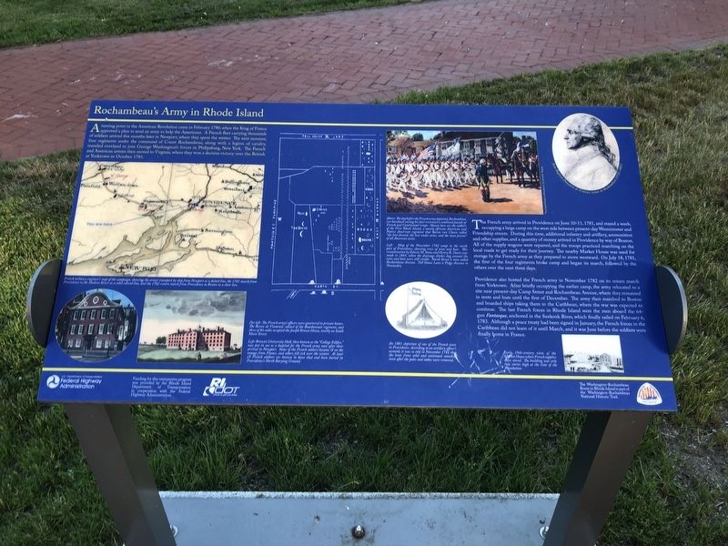
A turning point in the American Revolution came in February 1780, when the King of France approved a plan to send an army to help the Americans. A French fleet carrying thousands of soldiers arrived five months later in Newport, where they spent the winter. The next summer, four regiments under the command of Count Rochambeau, along with a legion of cavalry, traveled overland to join George Washington's forces in Philipsburg, New York. The French and American armies then moved to Virginia, where they won a decisive victory over the British at Yorktown in October 1781.
The French army arrived in Providence on June 10-11, 1781, and stayed a week, occupying a large camp on the west side between present-day Westminster and Friendship streets. During this time, additional infantry and artillery, ammunition and other supplies, and a quantity of money arrived in Providence by way of Boston. All of the supply wagons were repaired, and the troops practiced marching on the local roads to get ready for their journey. The nearby Market House was used for storage by the French army as they prepared to move westward. On July 18, 1781, the first of the four regiments broke camp and began its march, followed by the others over the next three days.
Providence also hosted the French army in November 1782 on its return march from Yorktown. After briefly occupying the earlier camp, the army relocated to a site near present-day Camp Street and Rochambeau Avenue, where they remained in tents and huts until the first of December. The army then marched to Boston and boarded ships taking them to the Caribbean, where the war was expected to continue. The last French forces in Rhode Island were the men aboard the 64-gun Fantasque, anchored in the Seekonk River, which finally sailed on February 16, 1783. Although a peace treaty had been signed in February, the French forces in the Caribbean did not learn of it until March, and it was June before the soldiers were finally home in France.
[Captions:]
Above: The day before the French army departed, Rochambeau (on horseback raising his hat) reviewed a combined parade of French and Continental troops. Shown here are the soldiers of the First Rhode Island, a mostly African American and Native American regiment that Baron von Closen called "the best dressed, the best under arms, and the most precise" of all American units.
Left: Map of the November 1782 camp in the north part of Providence, showing rows of tents and huts. This reconstruction by Edwin M. Stone and Henry R. Davis was made in 1865, when the drainage ditches dug around the tents and huts were still visible. North Street is now called Rochambeau
French military engineer's map of the campaign, showing the army's transport by ship from Newport as a dotted line, the 1781 march from Providence to the Hudson River as a solid colored line, and the 1782 return march from Providence to Boston as a clear line.
Far left: The French army's officers were quartered in private homes. The Baron de Viomenil, colonel of the Bourbonnais regimen, and three of his aides occupied the Joseph Brown House, nearby on South Main Street.
Left: Brown's University Hall, then known as "College Edifice," was put in use as a hospital for the French army soon after their arrival in Newport. Some of the French soldiers became ill on the voyage from France, and others fell sick over the winter. At least 18 French soldiers are known to have died and been buried in Provience's North Burying Ground.
An 1881 depiction of one of the French tents in Providence. According to an artillery officer's account, it was so cold in November 1782 that the tents froze solid and continued standing even after the poles and stakes were removed.
Erected by Federal Highway Administration, U.S. Department of Transportation; Rhode Island Department of Transportation; National Park Service, U.S. Department of the Interior.
Topics and series. This historical marker is listed in these topic lists: African Americans • Native Americans • War, US Revolutionary • Waterways & Vessels. In addition, it is included in the Former U.S. Presidents: #01 George Washington, and the The Washington-Rochambeau Route series lists. A significant historical month for this entry is February 1780.
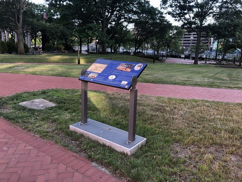
Location. 41° 49.49′ N, 71° 24.44′ W. Marker is in Providence, Rhode Island, in Providence County. It is in College Hill. Marker is at the intersection of Main Street (U.S. 44) and Hopkins Street, on the right when traveling south on Main Street. Touch for map. Marker is at or near this postal address: 31 S Main St, Providence RI 02903, United States of America. Touch for directions.
Other nearby markers. At least 8 other markers are within walking distance of this marker. Rhode Island World War II Memorial (a few steps from this marker); Rhode Island Holocaust Memorial (within shouting distance of this marker); World War I Memorial (within shouting distance of this marker); River Relocation Project and Providence River Park (about 300 feet away, measured in a direct line); Rhode Island Korean Veterans Memorial (about 300 feet away); The Crawford Street Bridge (about 300 feet away); Luigi Scala (about 300 feet away); Stephen Hopkins (about 300 feet away). Touch for a list and map of all markers in Providence.
Credits. This page was last revised on February 8, 2023. It was originally submitted on June 22, 2020, by Devry Becker Jones of Washington, District of Columbia. This page has been viewed 306 times since then and 30 times this year. Last updated on January 6, 2022, by Carl Gordon Moore Jr. of North East, Maryland. Photos: 1, 2. submitted on June 22, 2020, by Devry Becker Jones of Washington, District of Columbia.

