East Gull Lake in Cass County, Minnesota — The American Midwest (Upper Plains)
In Death, A Story of Life: The Gull Lake Burial Mounds
Inscription.
Grave Goods
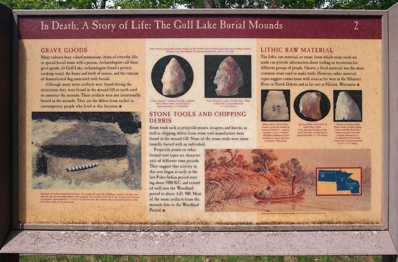
Many cultures bury valued possessions, items of everyday life, or special burial items with a person. Archaeologists call these grave goods. At Gull Lake, archaeologists found a pottery cooking vessel, the bones and teeth of a moose, and the remains of domesticated dog associated with burials.
Although many more artifacts were found during the excavation, they were found in the mound fill or earth used to construct the mounds. These artifacts were not intentionally buried in the mounds. They are the debris from earlier or contemporary people who lived at this location.
Stone Tools and Chipping Debris
Stone tools such as projectile points, scrapers, and knives, as well as chipping debris from stone tool manufacture were found in the mound fill. None of the stone tools were intentionally buried with an individual.
Projectile points or other formal tool types are characteristic of different time periods. They suggest that activity in this area began as early as the late-Paleo-Indian period starting about 7000 B.C. and extended well into the Woodland period to about A.D. 900. Most of the stone artifacts from the mounds date to the Woodland Period.
Lithic Raw Material
The lithic raw material, or stone, from which stone tools are made can provide information about trading or territories for different groups of people. Quartz, a local material, was the most common stone used to make tools. However, other material types suggest connections with areas as far west as the Missouri River in North Dakota and as far east as Hixton, Wisconsin.
Captions:
Example of archaeological pit feature. The dark soil is pit fill, defining a shallow pit that was dug in the surrounding lighter color subsoil. The portion of the pit in the foreground has been excavated. Approximately 2 1/2 by 3 1/2 feet in size. The stick in the excavated portion of the pit is the north arrow and scale.
Side-Notched projectile points similar to the Prairie Side-Notched type from the northern plains dating to the late-Middle Woodland around A.D. 600 to A.D. 800.
From Mound 1, made of locally available Swan River Chert, actual size is approximately 1 x 3/4 inches.
From Mound 7, made of Knife River Flint, actual size is approximately 1 x 1 3/4 inches.
Mid-section of late-Paleo-Indian projectile dating to around 7000 B.C., approximately 1 1/2 x 3 inches. Silicified Sandstone from prehistoric stone quarries at Hixton, Wisconsin.
Informal flake tool made of Knife River Flint. Note sharpened edge on the tool's left side. Actual size is approximately 1 x 3/4 inches.
Portion of broken
knife blade made of high quality chert probably from limestone outcrops in southeastern Minnesota or southwestern Wisconsin. Actual size is approximately 1 1/2 x 1 1/2 inches.
Indian spearing fish 3 miles below Fort Snelling, courtesy of the Minnesota Historical Society
Erected by U.S. Army Corps of Engineers. (Marker Number 2.)
Topics. This historical marker is listed in these topic lists: Anthropology & Archaeology • Cemeteries & Burial Sites • Native Americans. A significant historical year for this entry is 600 CE.
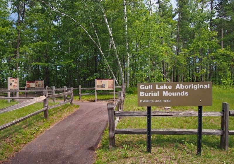
Location. 46° 24.662′ N, 94° 21.136′ W. Marker is in East Gull Lake, Minnesota, in Cass County. Marker can be reached from the intersection of Gull Lake Drive and Gull Lake Dam Road, on the left when traveling east. The marker is in Gull Lake Recreation Area, at the beginning of the trail through the Gull Lake Aboriginal Burial Mounds. Touch for map. Marker is at or near this postal address: 10867 E Gull Lake Drive, Brainerd MN 56401, United States of America. Touch for directions.
Other nearby markers. At least 8 other markers are within 9 miles of this marker, measured as the crow flies. In Death, a Story of Life: The Gull Lake Burial Mounds (here, next to this marker); a different marker also named In Death, a Story of Life: The Gull Lake Burial Mounds (a few steps from this marker); Geology of Minnesota (approx. 3 miles away); The Present Location of the Lake Hubert Depot (approx. 7.7 miles away); Lake Hubert Depot (approx. 7.7 miles away); Reconciliation (approx. 8 miles away); All Veterans Memorial (approx. 8.1 miles away); Former Northern Pacific Railway Water Tower (approx. 8.1 miles away). Touch for a list and map of all markers in East Gull Lake.
Credits. This page was last revised on October 5, 2022. It was originally submitted on January 9, 2022, by McGhiever of Minneapolis, Minnesota. This page has been viewed 288 times since then and 26 times this year. Photos: 1. submitted on January 9, 2022, by McGhiever of Minneapolis, Minnesota. 2. submitted on August 28, 2022, by McGhiever of Minneapolis, Minnesota. • J. Makali Bruton was the editor who published this page.

