
Near Middlesboro in Bell County, Kentucky — The American South (East South Central)
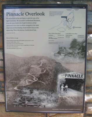
Pinnacle Overlook
Photographed by Craig Swain, September 5, 2010
1. Pinnacle Overlook Marker
This marker (and the Gateway to Kaintuck) are duplicated just a few yards away at the entrance to the stroller/wheelchair trail. Photos on the marker show the overlook as it appeared earlier in the 20th century.
Journal of James Smith, 1792
Know before you go
During a thunderstorm move away from the overlook. Lighting strikes here often.
Don't leave valuables visible in vehicles.
Stay on trails to avoid injury. Shortcuts start erosion.
Watch out for snakes. Rocks provide great habitat for copperheads and rattlesnakes.
Don't write on rocks or handrails.
Leave what you find here for others to enjoy.
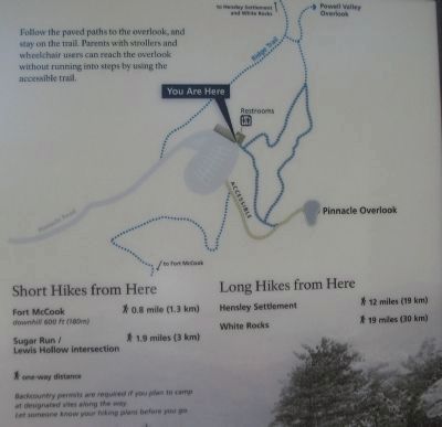
Follow the paved paths to the overlook, and stay on the trail. Parents with strollers and wheelchair users can reach the overlook without running into steps by using the accessible trail.
Short Hikes from Here
Fort McCook - * 0.8 mile (1.3 km) downhill 600 feet (180 m)
Sugar Run / Lewis Hollow Intersection - * 1.9 miles (3 km)
Long Hikes from Here
Hensley Settlement - * 12 miles (19 km)
White Rocks - * 19 miles (30 km)
* One-way distance
Backcountry permits are required if you plan to camp at designated sites along the way. Let someone know your hiking plans before you go.
Remember,
this page online
Erected by Cumberland Gap National Historical Park - National Park Service - Department of the Interior.
Topics. This historical marker is listed in these topic lists: Landmarks • Natural Features. A significant historical year for this entry is 1792.
Location. 36° 36.391′ N, 83° 39.994′ W. Marker is near Middlesboro, Kentucky, in Bell County. It is on Pinnacle Road, on the right when traveling east. Located at the parking lot for Pinnacle Overlook in Cumberland Gap National Historical Park. Touch for map. Marker is in this post office area: Middlesboro KY 40965, United States of America. Touch for directions.

Regionally, this marker is in Eastern Kentucky and in the Cumberland Plateau. It is also in the American South, specifically in the Upper South, in Appalachia, and specifically in Southern Appalachia. Globally, it is in North America, the Western Hemisphere, the Western World, and the Anglosphere. Historically, it finds itself in what was once the territory of the Mississippian Culture and also the Antebellum South.
Other nearby markers. At least 8 other markers are within
Photographed by Craig Swain, September 5, 2010
2. Trail Map for Area around Pinnacle Overlook
Other markers no longer nearby. Waiting for the Battle that Never Came (was about 300 feet away, measured in a direct line but has been permanently removed); Powell's Valley (was about 500 feet away in Virginia but has been confirmed missing); A Maze of Mountains (was about 500 feet away in Virginia but has been confirmed missing); Named for a British Lord (was about 500 feet away in Virginia but has been confirmed missing).
Regarding Pinnacle Overlook. "Lighting strikes here often." -- presumably should have been "Lightning", not "Lighting".
Also see . . . Cumberland Gap National Historical Park.
Photographed by Craig Swain, September 5, 2010
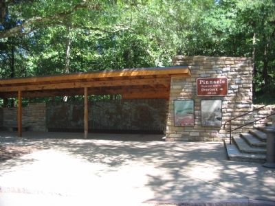
3. Pinnacle Overlook Markers
Note the relief behind the markers to the left.
Photographed by Craig Swain, September 5, 2010
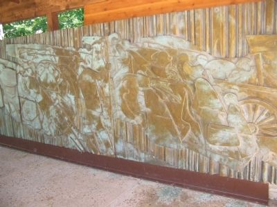
4. Relief Artwork at Pinnacle Overlook
Photographed by Craig Swain, September 5, 2010
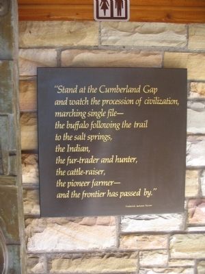
5. Passage from Frederick Jackson Turner
"Stand at the Cumberland Gap and watch the procession of civilization, marching single file - the buffalo following the trail to the salt springs, the Indian, the fur-trader and hunter, the cattle-raiser, the pioneer farmer - and the frontier has passed by."
Photographed by Craig Swain, September 5, 2010
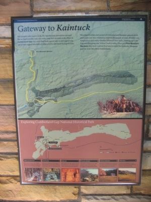
6. Gateway to Kaintuck
Standard park orientation marker collocated at the site:
For travelers who had to walk, the Appalachian mountains seemed like an impenetrable wall, 600 miles long and 150 miles wide. Here at Cumberland Gap you could find both a good way in and a good way out of that rugged labyrinth of ridges, coves, and meandering streams.
Woodland buffalo and parties of Cherokee and Shawnee passed north and south over this wilderness road for thousands of years. Frontier-era longhunters and settler families followed their trails, climbing up to the Gap and dropping into Yellow Creek's valley. Once past Pine Mountain Narrows, they were well on their way to reach the Kentucky bluegrass and the rich Ohio River bottomlands.
For travelers who had to walk, the Appalachian mountains seemed like an impenetrable wall, 600 miles long and 150 miles wide. Here at Cumberland Gap you could find both a good way in and a good way out of that rugged labyrinth of ridges, coves, and meandering streams.
Woodland buffalo and parties of Cherokee and Shawnee passed north and south over this wilderness road for thousands of years. Frontier-era longhunters and settler families followed their trails, climbing up to the Gap and dropping into Yellow Creek's valley. Once past Pine Mountain Narrows, they were well on their way to reach the Kentucky bluegrass and the rich Ohio River bottomlands.
Credits. This page was last revised on August 30, 2022. It was originally submitted on September 19, 2010, by Craig Swain of Leesburg, Virginia. This page has been viewed 1,939 times since then and 39 times this year. Last updated on January 21, 2022, by Carl Gordon Moore Jr. of North East, Maryland. Photos: 1, 2, 3, 4, 5, 6. submitted on September 19, 2010, by Craig Swain of Leesburg, Virginia. • J. Makali Bruton was the editor who published this page.
