
Frisco in Dare County, North Carolina — The American South (South Atlantic)
Welcome to Frisco
| — | Outer Banks National Scenic Byway | — |
Photographed by Tom Bosse, September 19, 2021
1. Welcome to Frisco Marker
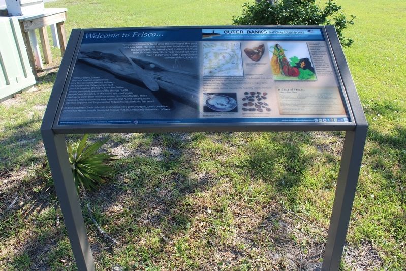
Hatteras Island, known the as Croatoan, is where the very first recorded contact between the English and Native people took place in America. O July 4, 1584, the Native people peacefully welcomed the strange “turtle people” near this spot. To the native eye, the English explorers clad in their medieval armor, resembled turtles. Three Croatoan Natives from this area were the first Native Americans to travel to England and be presented to Queen Elizabeth and her court.
English explorers’ trade interests in America were primarily gold, pearls and deer pelts while Native people treasured English metals particularly in the form of axes.
Native people introduced explorers to foods such as corn, beans, and squash. This trio is widely known as The Three Sisters. This ancient practice of companion planting is a complex system that benefits all three crops and when
this page online
Recorded observations support the notion that the Croatoans lived here in harmony and balance with the natural world.
Native people had been welcoming other tribes for trade prior to the European contact of 1584.
Today’s residents continue to practice the hospitality extended centuries ago.
(sidebar)
Outer Banks National Scenic Byway
The Outer Banks National Scenic Byway traverses one of the nation’s great coastal landscapes. Tidal marshes, wind-swept dunes, lonesome beaches and beautiful sounds line the 138-mile route. Two national seashores are home to four lighthouses. Two national wildlife refuges highlight the region’s rich biological diversity. You are invited to experience the maritime heritage of 21 traditional villages and communities.
(captions)
Ancient dugout canoe Frisco Native American Museum Collection
Cooking pot, reassembled form pottery shards. 1,000 to 4,000 years old Frisco Native American Museum Collection
Outer Banks History Map John Mitchem
The Three Sisters: Corn, Beans, and Squash, sustainers of life Ronnie Francisco artwork
A Taste of Frisco…
Three Sisters Stew
2 cups mushrooms
2 tsps sunflower oil
½ tsp nutmeg
2 cups vegetable stock
2 cups cooked red kidney or black beans
2 cups onions, chopped
2 tsps dill or thyme, chopped
1 butternut squash, peeled, seeded, cubed (4 cups)
2 cups hominy
4-6 garlic cloves, minced
½ tsp sage, chopped
Salt and cracked pepper
¼ - ½ cup white corn flour
1. Clean & quarter mushrooms.
2. Sauté onions and garlic in sunflower oil on medium heat, stirring untilonions are translucent. Season with dill or thyme ad sage. Cook 2 minutes, stirring continuously.
3. Add squash and stock. Cover. Bring to a boil. Reduce heat, simmer, uncovered until squash is tender (20 to 25 minutes).
4. Add corn and beans. Simmer. Add mushrooms. Season with salt and pepper.
5. Make a paste of white corn flour and water. Add a cup of hot stew liquid. Stir. Add this broth back in the stew and blend.
To serve: top with roasted pumpkin seeds. Optional: add 1” pieces of cooked fish or venison. Serve with hot cornbread.
Erected by Federal

Photographed by Tom Bosse, September 19, 2021
2. Welcome to Frisco Marker
Topics and series. This historical marker is listed in these topic lists: Colonial Era • Exploration • Indigenous Peoples and Communities • Settlements & Settlers. In addition, it is included in the Outer Banks National Scenic Byway series list. A significant historical date for this entry is July 4, 1584.
Location. 35° 15.481′ N, 75° 35.343′ W. Marker is in Frisco, North Carolina, in Dare County. It is at the intersection of State Highway 12 and Timber Trail, on the left when traveling north on State Highway 12. Touch for map. Marker is in this post office area: Frisco NC 27936, United States of America. Touch for directions.

Regionally, this marker is in North Carolina’s Coastal Plain and on the Outer Banks. It is also in the American South, specifically in the Upper South, in the Tidewater, and on the Eastern Seaboard. Globally, it is in the North Atlantic Region, North America, the Western Hemisphere, the Western World, and the Anglosphere. Historically, it finds itself in what was once the territory of the Mississippian Culture, one of the original Thirteen Colonies, one of the Confederate States of America, and the Antebellum South.
Other nearby markers. At least 8 other markers are within 4 miles of this marker, measured as the crow flies: Mitchell Demonstrates Air Power (approx. 2.6 miles away); Commonwealth War Graves Commission (approx. 3.2 miles away); Honoring Their Sacrifice (approx. 3.2 miles away); Welcome to Buxton… (approx. 3.3 miles away); Life at the Light (approx. 3.4 miles away); Keepers of the Light (approx. 3½ miles away); Light House Move Path (approx. 3½ miles away); Lighthouse Move Path (approx. 3½ miles away).
Another marker is no longer nearby. "Paukenschlag" (was approx. 3.2 miles away but has been replaced with another marker now near it).
Credits. This page was last revised on January 26, 2022. It was originally submitted on January 24, 2022, by Tom Bosse of Jefferson City, Tennessee. This page has been viewed 646 times since then and 27 times this year. Photos: 1, 2. submitted on January 24, 2022, by Tom Bosse of Jefferson City, Tennessee. • Bernard Fisher was the editor who published this page.
