Mount Pleasant in Charleston County, South Carolina — The American South (South Atlantic)
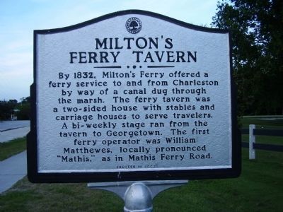
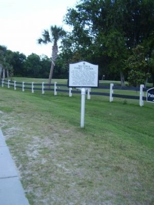
Milton's Ferry Tavern
Erected 2002.
Topics. This historical marker is listed in these topic lists: Industry & Commerce • Roads & Vehicles • Settlements & Settlers • Waterways & Vessels. A significant historical year for this entry is 1832.
Location. 32° 47.798′ N, 79° 53.965′ W. Marker is in Mount Pleasant, South Carolina, in Charleston County. Marker is on Patriots Point Road. Touch for map. Marker is at or near this postal address: 175 Patriots Point Road, Mount Pleasant SC 29464, United States of America. Touch for directions.
Other nearby markers. At least 8 other markers are within walking distance of this marker. Arthur Ravenel, Jr. Bridge (approx. 0.2 miles away); Patriots Point Naval & Maritime Museum/The Medal of Honor Museum (approx. 0.2 miles away); Channel 2 & Suzie Q (approx. ¼ mile away); USS Yorktown (CV~10) (approx. 0.3 miles away); Cold War Submarine Memorial (approx. 0.3 miles away); USS Pollack (SSN 603) USS Haddo (SSN 604) (approx. 0.4 miles away); In Memoriam • USS Thresher and USS Scorpion (approx. 0.4 miles away); World War II Submarine Lost Boat Memorial (approx. 0.4 miles away). Touch for a list and map of all markers in Mount Pleasant.
Also see . . . USC Institute for Southern Studies, Volume 14: XIV: 34. Winter, 1967 ...Geodetic Aerial Map3 has an area marked Abandoned Ferry Wharf at the outer end of a cause- way. These are the ruins of the old Cooper River Ferry Commission's Wharf. At the causeway's other end a circle-labeled Chimney marks the spot where Milton Ferry Tavern (later called Hunt's Ferry Tavern) once stood. (Submitted on May 20, 2009, by Mike Stroud of Bluffton, South Carolina.)
Credits. This page was last revised on December 12, 2019. It was originally submitted on May 17, 2009, by Stanley and Terrie Howard of Greer, South Carolina. This page has been viewed 1,245 times since then and 33 times this year. Photos: 1, 2, 3. submitted on May 17, 2009, by Stanley and Terrie Howard of Greer, South Carolina. • Syd Whittle was the editor who published this page.


