Mount Pleasant in Charleston County, South Carolina — The American South (South Atlantic)
Vaughn Edward Kee
| — | August 13, 1960 - December 13, 1985 | — |
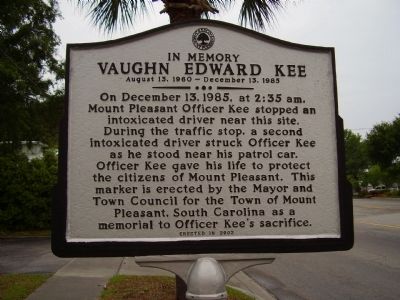
Photographed by Stanley and Terrie Howard, May 17, 2009
1. Vaughn Edward Kee Marker
Erected 2003.
Topics. This historical marker is listed in these topic lists: Law Enforcement • Roads & Vehicles. A significant historical date for this entry is December 13, 1985.
Location. 32° 47.661′ N, 79° 51.6′ W. Marker is in Mount Pleasant, South Carolina, in Charleston County. It is on Ben Sawyer Boulevard (State Highway 703). Touch for map. Marker is at or near this postal address: 1233 Ben Sawyer Blvd, Mount Pleasant SC 29464, United States of America. Touch for directions.

Regionally, this marker is in the Lowcountry. It is also in the American South, specifically in the Deep South, and on the Eastern Seaboard. Globally, it is in the North Atlantic Region, North America, the Western Hemisphere,
this page online
Other nearby markers. At least 8 other markers are within walking distance of this marker: Rifle Range Road (approx. ¼ mile away); Jasper Green/ Sergeant William Jasper (approx. ¾ mile away); General William Moultrie / Moultrie Schools (approx. ¾ mile away); Edmund Jenkins / Ocean Grove Cemetery (approx. 0.8 miles away); The King's Highway / Coleman Boulevard (approx. 0.8 miles away); "The Kings Highway" (approx. 0.9 miles away); Mount Pleasant Academy (approx. one mile away); Friendship A.M.E. Church (approx. one mile away). Touch for a list and map of all markers in Mount Pleasant.
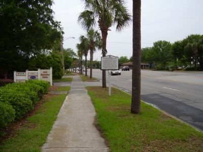
Photographed by Stanley and Terrie Howard, May 17, 2009
2. Vaughn Edward Kee Marker
Credits. This page was last revised on December 12, 2019. It was originally submitted on May 17, 2009, by Stanley and Terrie Howard of Greer, South Carolina. This page has been viewed 1,282 times since then and 13 times this year. Photos: 1, 2. submitted on May 17, 2009, by Stanley and Terrie Howard of Greer, South Carolina. • Kevin W. was the editor who published this page.
