Big Bog State Recreation Area near Waskish in Beltrami County, Minnesota — The American Midwest (Upper Plains)
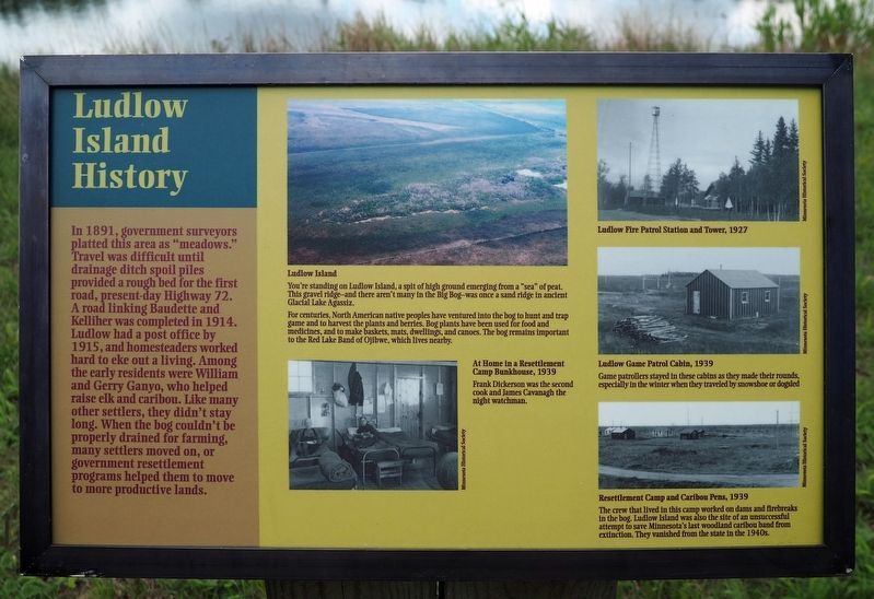
Ludlow Island History
Photographed by McGhiever, August 30, 2021
1. Ludlow Island History marker
In 1891, government surveyors platted this area as "meadows." Travel was difficult until drainage ditch spoil piles provided a rough bed for the first road, present-day Highway 72. A road linking Baudette and Kelliher was completed in 1914. Ludlow had a post office by 1915, and homesteaders worked hard to eke out a living. Among the early residents were William and Gerry Ganyo, who helped raise elk and caribou. Like many other settlers, they didn't stay long. When the bog couldn't be properly drained for farming, many settlers moved on, or government resettlement programs helped them to move to more productive lands.
[Captions:]
Ludlow Island
You're standing on Ludlow Island, a spit of high ground emerging from a "sea" of peat. This gravel ridge—and there aren't many in the Big Bog—was once a sand ridge in ancient Glacial Lake Agassiz.
For centuries, North American native peoples have ventured into the bog to hunt and trap game and to harvest the plants and berries. Bog plants have been used for food and medicines, and to make baskets, mats, dwellings, and canoes. The bog remains important to the Red Lake Band of Ojibwe, which lives nearby.
At Home in a Resettlement Camp Bunkhouse, 1939
Frank Dickerson was the second cook and James Cavanaugh the night watchman.
Ludlow Fire Patron Station and Tower, 1927
Ludlow Game Patrol Cabin, 1939
Game patrollers stayed in these cabins as they made their rounds, especially in the winter when they traveled by snowshoe or dogsled.
Resettlement Camp and Caribou Pens, 1939
The crew that lived in this camp worked on dams and firebreaks in the bog. Ludlow Island was also the site of an unsuccessful attempt to save Minnesota's last woodland caribou band from extinction. They vanished from the state in the 1940s.
Erected by Minnesota
this page online
Topics. This historical marker is listed in these topic lists: Agriculture • Indigenous Peoples and Communities • Settlements & Settlers. A significant historical year for this entry is 1891.
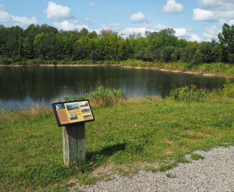
Location. 48° 17.206′ N, 94° 33.965′ W. Marker is near Waskish, Minnesota, in Beltrami County. It is in the Big Bog State Recreation Area. It can be reached from State Highway 72 2 miles south of County Road 77, on the left when traveling north. The marker is in the northern unit of Big Bog State Recreation Area (fee area), on the gravel trail around Ludlow Pond. Marker is on the east side of the pond a short walk north from the parking lot. Touch for map. Marker is in this post office area: Waskish MN 56685, United States of America. Touch for directions.

Regionally, this marker is in Minnesota’s Northland. It is also in the American Midwest and in the Corn Belt. Globally, it is in North America, the Great North Woods, the Western Hemisphere, the Western World, and the Anglosphere. Historically, it finds itself in what was once Rupert’s Land, the territory of the Mississippian Culture,
Photographed by McGhiever, August 31, 2021
2. Marker on the trail around Ludlow Pond
Other nearby markers. At least 8 other markers are within 9 miles of this marker, measured as the crow flies: Fire in the Big Bog (about 300 feet away, measured in a direct line); The Big Bog's Caribou Band (approx. 0.3 miles away); The Bog That Couldn't Be Tamed (approx. half a mile away); The Patterned Peatland: Rare and Valuable (approx. 0.9 miles away); Before the Big Bog: One Big Lake (approx. 0.9 miles away); The Old Waskish Town Site (approx. 8.1 miles away); Historic Waskish Hatchery 1941–1979 (approx. 8.1 miles away); Journey along the waters… (approx. 8.1 miles away). Touch for a list and map of all markers in Waskish.
Credits. This page was last revised on May 16, 2025. It was originally submitted on January 30, 2022, by McGhiever of Minneapolis, Minnesota. This page has been viewed 497 times since then and 31 times this year. Photos: 1, 2. submitted on January 30, 2022, by McGhiever of Minneapolis, Minnesota. • Devry Becker Jones was the editor who published this page.
