North End in Boston in Suffolk County, Massachusetts — The American Northeast (New England)
Seventeenth Century Copp’s Hill
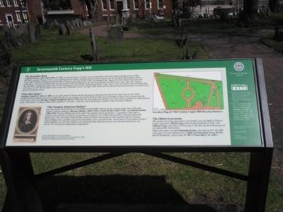
The Kennebec Raid
Captain Thomas Lake (1615-1676) (C-143) was born in Tetney, County Lincoln, England in 1615 and settled in Boston in the 1650s. He and his partner, Thomas Clarke, set up trading posts in Maine, including one at Arrowsic Island near the mouth of the Kennebec River. Capt. Lake’s business prospered until the Native American uprisings of the 1670s. On Sabbath Day, August 20, 1676, Samuel Sewall wrote in his diary: “we heard amazing news of sixty persons killed at Quinebeck, by barbarous Indians, of which were Capt. Lake, Mr. Collicot, Mr. Padeshell.” During the attack Lake fled the trading post, but was later captured and killed. Capt. Lake’s body was found several months later, still frozen. In 1677 the remainder of his corpse was “honorably buried” at Copp’s Hill. Some say that the lead shot from his body was melted and poured into the gravestone.
”The Old Citizen”
Nicholas Upshall (d. 1666) (A-409) was an early settler of Boston and the proprietor of the Red Lion Inn in the North End. In the 1650s, Upshall became a Quaker and was banished from Boston for helping imprisoned Quakers Anne Austin and Mary Fisher. On his return only the intervention of his wife, Dorothy (Capen) Upshall (d. 1675) (C-38), kept him from long-term detention at Castle Island. Upshall was immortalized as the “Old Citizen” in Henry Wadsworth Longfellow’s Christus: A Mystery and in the poetry of Quaker John Greenleaf Whittier.
”The Greatest American Puritan”
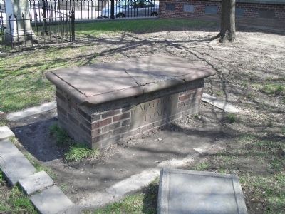
Near the Charter Street entrance is the Mather Tomb (I-23), wherein lie the remains of the most celebrated family of Puritan ministers: Increase Mather (1639-1723), Cotton Mather (1663-1728), and Samuel Mather (1706-1785.) Increase Mather has been called “the greatest American puritan.” A graduate of Harvard in 1656, he was actively involved in the political and religious life of Massachusetts Bay in Boston and in the British Isles. His son Cotton followed him to Harvard and to the ministry of the Second Church in Boston. Cotton Mather was a prolific writer and commentator and is considered the “most famous of the puritan divines.” Samuel Mather, son of Cotton Mather, also graduated from Harvard and served at the Second Church, but left in 1742 to found an independent congregation.
The Oldest Gravestone
The earliest surviving gravestone is the double stone (C-264) of William Copp’s grandsons: David Copp, who was born and died in 1661, and Thomas Copp, who died in 1678 at age 3. The hill and the burying ground are named after their family.
Other early stones include Nathanial Saxton, who died in 1677 (C-270) at the age of 19; the double stone of John and Susannah Sweet (H-44); and the beautifully carved stone (C-30) of Grace Berry (d. 1695.)
Topics and series. This historical marker is listed in these topic lists: Cemeteries & Burial Sites • Colonial Era. In addition, it is included in the Quakerism series list. A significant historical year for this entry is 1615.
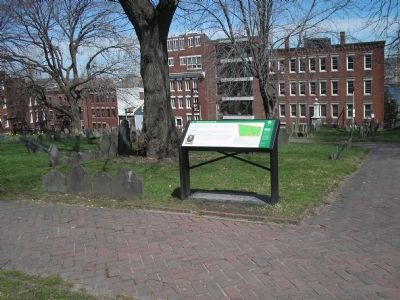
Location. 42° 22.049′ N, 71° 3.365′ W. Marker is in Boston, Massachusetts, in Suffolk County. It is in North End. Marker can be reached from Hull Street, on the left when traveling east. Marker is located along the walking trail in Copp's Hill Burying Ground. Touch for map. Marker is in this post office area: Boston MA 02113, United States of America. Touch for directions.
Other nearby markers. At least 8 other markers are within walking distance of this marker. From Colonial Burying Ground to Victorian Park (a few steps from this marker); African Americans at Copp’s Hill (a few steps from this marker); Unusual Gravestones (within shouting distance of this marker); Gravestone Art: Skulls, Wings, and Other Symbols (within shouting distance of this marker); Copp’s Hill Burying Ground (within shouting distance of this marker); Copp’s Hill and the American Revolution (within shouting distance of this marker); a different marker also named Copp's Hill Burying Ground (within shouting distance of this marker); Welcome to Copp’s Hill Burying Ground (within shouting distance of this marker). Touch for a list and map of all markers in Boston.
More about this marker. The top of the marker contains a “Location Map of 17th Century Copp’s Hill Burying Markers.” The bottom left of the marker features a picture of “’Crescentius Matherus’ (Increase Mather) Woodcut by Stuart, 1724. Re-strike from original block, (1903). Courtesy of the Massachusetts Historical Society.”
The right side of the marker contains Copp’s Hill Facts
•Until 1833 there were no trees in Copp’s Hill Burying Ground. In that year $50 was allocated for purchase of trees.
•Several people buried here were born in the 16th century. Joana Phillipes (C-452) was born around 1595 and died in 1675 at the age of 80. “The Old Citizen” Nicholas Upshall was born around 1596.
Related markers. Click here for a list of markers that are related to this marker. Take a tour of the markers found in Copp’s Hill Burying Ground.
Also see . . . Copp's Hill Burying Ground. Details of the Freedom Trail from the City of Boston website. (Submitted on May 12, 2009, by Bill Coughlin of Woodland Park, New Jersey.)
Credits. This page was last revised on January 30, 2023. It was originally submitted on May 12, 2009, by Bill Coughlin of Woodland Park, New Jersey. This page has been viewed 1,686 times since then and 25 times this year. Last updated on February 8, 2022, by Carl Gordon Moore Jr. of North East, Maryland. Photos: 1, 2, 3. submitted on May 12, 2009, by Bill Coughlin of Woodland Park, New Jersey. • J. Makali Bruton was the editor who published this page.


