Hayes in Gloucester County, Virginia — The American South (Mid-Atlantic)
The Algonquian Landscape
Machicomoco State Park
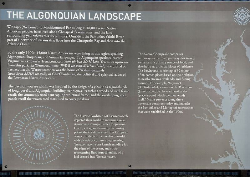
By early 1600s, 15,000 Native Americans were living in this region speaking Algonquian, Iroquoian, and Siouan languages. To Algonquian speakers, eastern Virginia was known as Tsenacomacoh (sehn-uh-kuh-MAH-kah). Ten miles upstream from this park sits Werowocomoco (WAYR-uh-wah-KOH-muh-koh), the capital of Tsenacommacah. Werowocomoco was the home of Wahunsenacawh (wah-hoon-SEHN-uh-kah), or Chief Powhatan, the political and spiritual leader of the Powhatan Native Americans.
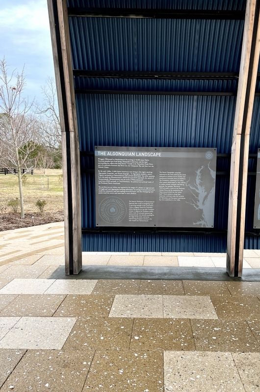
The pavilion you are within was inspired by the design ofa yihakin (a regional-style of longhouse) and Algonquian building techniques: its arching wood and steel frame recalls the commonly used bent sapling structural frame, and the overlapping steel panels recall the woven reed mats used to cover yihakins.
The historic Powatans of Tsenacomacoh depicted their world in intriguing ways. A surviving example is the Conjuration Circle, a diagram drawn by Pamunkey priests during the era just after European contact. It depicts the Powhatan world, with a circle of cornmeal representing Tsenacomacoh, corn kernels standing for the edges of the ocean, and sticks representing European colonists, who had crossed into Tsenacomacoh.
The Native Chesapeake comprises waterways as the main pathways for travel, wetlands as a primary source of food, and riverfronts as principal places of residence. The Powhatans, consisting of 32 tribes, often named places based on their relation to nearby streams, wetlands, and fishing to nearby streams, wetlands, and fishing grounds. For example, Wayanock ( WAY-uh-Naha), a town on the Powhatan (James) River, can be translated as the “place around which the River winds itself.” Native presence along these waterways continues today and includes the Pamunkey and Mattaponi reservations that were established in the 1600s.
Erected 2021 by State of Virginia.
Topics. This historical marker is listed in these topic lists: Anthropology & Archaeology • Colonial Era • Native Americans. A significant historical year for this entry is 1600.
Location. 37° 17.894′ N, 76° 32.198′ W. Marker is in Hayes, Virginia, in Gloucester County. Marker can be reached from Blackberry Circle east of Timberneck Farm Road (Virginia Route 1324), on the right when traveling east. Located on the grounds of Machicomoco State Park. Touch for map. Marker is at or near this postal address: 3601 Timberneck Farm Road, Hayes VA 23072, United States of America. Touch for directions.
Other nearby markers. At least 8 other markers are within walking distance of this marker. History and Community (here, next to this marker); Managing a Dynamic Landscape (here, next to this marker); Peacemaking and Mobility (a few steps from this marker); Authority and Ceremony (a few steps from this marker); Persistence (a few steps from this marker); Timberneck House Renovation at Machicomoco State Park (about 300 feet away, measured in a direct line); Early Timberneck Graveyard (about 300 feet away); Powhatan’s Chimney (approx. half a mile away). Touch for a list and map of all markers in Hayes.
Also see . . .
1. Virginia’s Machicomoco State Park—A “Special Meeting Place”. (Submitted on February 11, 2022, by Brandon D Cross of Flagler Beach, Florida.)
2. Machicomoco State Park. Virginia Department of Conservation and Recreation (Submitted on February 13, 2022.)
Credits. This page was last revised on February 18, 2022. It was originally submitted on February 11, 2022, by Brandon D Cross of Flagler Beach, Florida. This page has been viewed 477 times since then and 16 times this year. Photos: 1, 2. submitted on February 11, 2022, by Brandon D Cross of Flagler Beach, Florida. • Bernard Fisher was the editor who published this page.

