Penn's Landing in Philadelphia in Philadelphia County, Pennsylvania — The American Northeast (Mid-Atlantic)
William Penn's Philadelphia
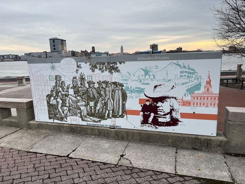
Penn's Unterhandlung mit den Indianern (Penn's Treaty with the Indians) by George Gilbert c. 1830. Courtesy of the Library Company of Philadelphia.
Penn lived in the city's first tavern, the Blue Anchor, when he came to Philadelphia in 1682. This view shows the tavern about 1700. Courtesy of the Library Company of Philadelphia.
State House (Independence Hall) from a 1777 map by Scull and Heap, engraving by William Faden. From an original map in the collection of the Division of Geography and Maps at the Library of Congress.
Workman with the head of William Penn from the statue on top of City Hall by Alexander Stirling Calder, 1892. Courtesy of Philadelphia City Archives.
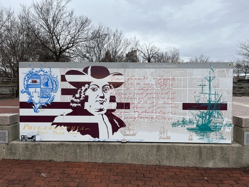
Cartouche, title and scale from a 1762 map of Philadelphia by Nicholas Scull, surveyor. From an original map in the collection of the Division of Geography and Maps at the Library of Congress.
Topics. This historical marker is listed in these topic lists: Arts, Letters, Music • Colonial Era • Indigenous Peoples and Communities • Industry & Commerce • Peace • Settlements & Settlers. A significant historical year for this entry is 1830.
Location. 39° 56.811′ N,
this page online

Regionally, this marker is in Southeast Pennsylvania. It is also in the American Northeast and in the Mid-Atlantic. Globally, it is in North America, the Western Hemisphere, the Western World, and the Anglosphere. Historically, it finds itself in what was once the Haudenosaunee (Iroquois) Confederacy, New Netherland, and one of the original Thirteen Colonies.
Other nearby markers. At least 8 other markers are within walking distance of this marker: 1702 (a few steps from this marker); Philadelphia Firsts (a few steps from this marker); 1754 (within shouting distance of this marker); The Growth of the City / The Trees of the City (within shouting distance of this marker); The Pennsylvania Slave Trade (within shouting distance of this marker); Glomar Explorer (within
Credits. This page was last revised on February 2, 2024. It was originally submitted on March 1, 2022, by Devry Becker Jones of Washington, District of Columbia. This page has been viewed 292 times since then and 29 times this year. Photos: 1, 2. submitted on March 1, 2022, by Devry Becker Jones of Washington, District of Columbia.
