
Throggs Neck in the Bronx in Bronx County, New York — The American Northeast (Mid-Atlantic)
S.S. United States
World's Fasted Passenger Ship
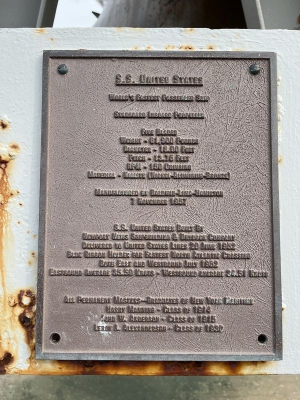
Starboard Inboard Propeller
Five Bladed
Weight - 61,900 Pounds
Diameter - 18.00 Feet
Pitch - 13.75 Feet
RPM - 100 Cruising
Material - Nialite (Nickel-Aluminum-Bronze)
Manufactured by Baldwin-Lina-Hamilton
7 November 1957
S.S. United States built by
Newport News Shipbuilding & Drydock Company
Delivered to United States lines 20 June 1952
Blue Ribbon holder for Fast North Atlantic Crossing
Both East and Westbound July 1952
Eastbound average 35.59 Knots - Westbound average 34.51 Knots
All permanent masters--graduates of New York Martime
Harry Manning - Class of 1914
John W. Anderson - Class of 1915
Leroy J. Alexanderson - Class of 1930
Topics. This historical marker is listed in these topic lists: War, Cold • Waterways & Vessels. A significant historical date for this entry is June 20, 1952.
Location. 40° 48.4′ N, 73° 47.505′ W. Marker is in Bronx, New York, in Bronx County. It is in Throggs Neck. It is on Erben Avenue 0.6 miles east of Crowninshield Street, on the left when traveling east. Touch for map. Marker is in this post office area: Bronx NY 10465, United States of America. Touch for directions.

Regionally,
this page online
Other nearby markers. At least 8 other markers are within 2 miles of this marker, measured as the crow flies: Commodore Leroy J. Alexanderson (here, next to this marker); Fort Schuyler (within shouting distance of this marker); The U.S.S. St. Marys (about 500 feet away, measured in a direct line); a different marker also named Fort Schuyler (about 500 feet away); The U.S.S. Newport (about 500 feet away); 502 Lee Road (approx. 1.1 miles away); Battery King (approx. 1.1 miles away); Thorne-Wilkins Cemetery (approx. 1.2 miles away). Touch for a list and map of all markers in Bronx.
Other markers no longer nearby. Main Magazine of Fort Totten (was approx. one mile away but has been permanently removed); Fort Totten Park (was approx. 1.1 miles away but has been permanently
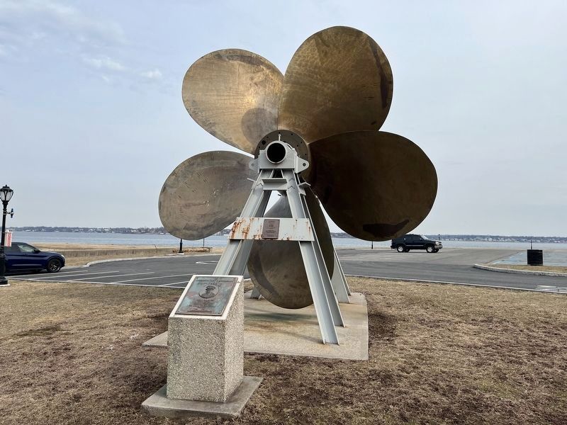
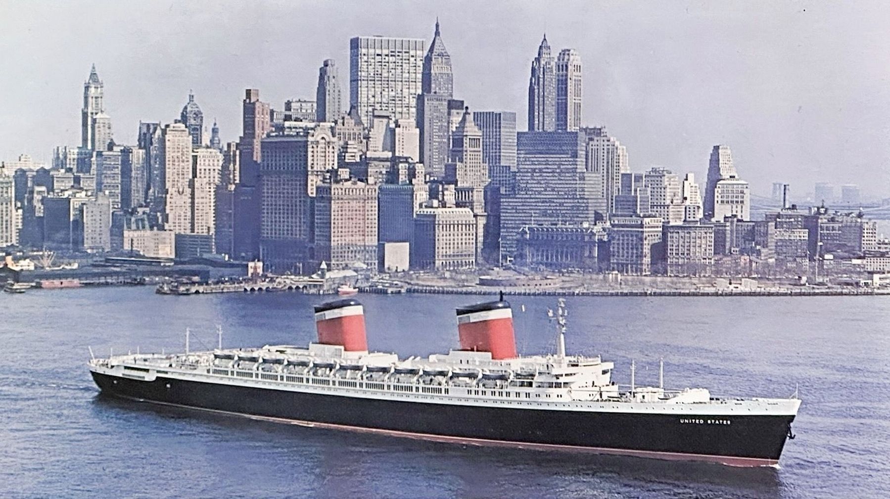
Regarding S.S. United States. The ship used four propellers, two four-bladed screws outboard, and two five-bladed screws inboard.
The ship’s speed record has never been broken.
Related marker. Click here for another marker that is related to this marker. A 4-bladed propeller in Manhattan. (the other 4-bladed propeller is at the United States Merchant Marine Academy Museum in Kings Point NY)
Photographed by Craig Baker
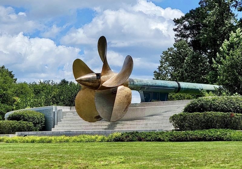
3. S.S. United States Propeller
The other 5-bladed propeller is in Newport News VA, at US-60 & Avenue of The Arts.
by Robert F Sisson/National Geographic/Getty, 1954
4. S.S. United States
Credits. This page was last revised on August 22, 2026. It was originally submitted on March 10, 2022, by Devry Becker Jones of Washington, District of Columbia. This page has been viewed 428 times since then and 56 times this year. Photos: 1, 2. submitted on March 10, 2022, by Devry Becker Jones of Washington, District of Columbia. 3, 4. submitted on August 16, 2026, by Craig Baker of Sylmar, California.
