Hastings-on-Hudson in Westchester County, New York — The American Northeast (Mid-Atlantic)
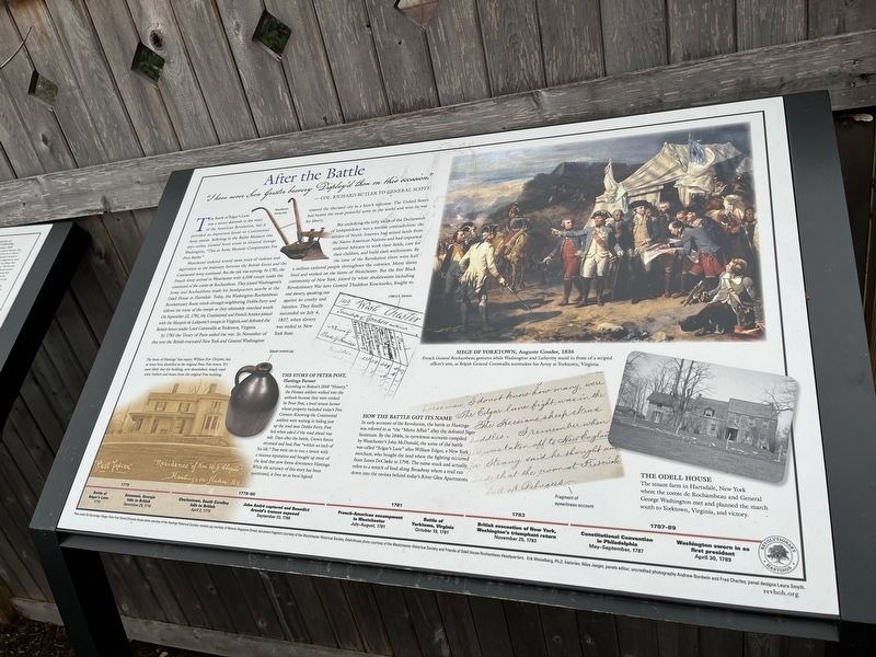
After the Battle
"I have never Seen Greater bravery Display'd than on this occasion."
—Col. Richard Butler to General Scott
The Battle of Edgar's Lane was a minor skirmish in the story of the American Revolution, but it provided an important boost to Continental Army morale. Referring to the Baylor Massacre two days earlier, General Scott wrote to General George Washington, "This in Some Measure Compensates For Poor Baylor."
Westchester endured several more years of violence and deprivation as the stalemate between the British forces and the Continental Army continued. But the tide was turning. In 1781, the French Army arrived in Westchester with 4,500 troops under the command of the comte de Rochambeau. They joined with Washington's Army and Rochambeau made his headquarters nearby at the Odell House in Hartsdale. Today, the Washington-Rochambeau Revolutionary Route winds through neighboring Dobbs Ferry and follows the route of the troops as they ultimately marched south. On September 22, 1781, the Continental and French Armies joined with the Marquis de Lafayette's troops in Virginia and defeated the British forces under Lord Cornwallis at Yorktown, Virginia.
In 1783 the Treaty of Paris ended the war. In November of that year the British evacuated New York and General Washington entered the liberated city to a hero's welcome. The United States had beaten the most powerful army in the world and won its war for liberty.
But underlying the lofty ideals of the Declaration of Independence was a terrible contradiction: the settlers of North America had seized the lands from the Native American Nations and had imported enslaved Africans to work their fields, care for their children, and build their settlements. By the time of the Revolution there were half a million enslaved people throughout the colonies. Many slaves lived and worked on the farms of Westchester. But the free Black community of New York, joined by white abolitionists including Revolutionary War hero General Thaddeus Kosciuszko, fought to end slavery, speaking out against its cruelty and injustice. They finally succeeded on July 4, 1827, when slavery was ended in New York State.
The home of Hastings' first mayor, William Few Chrystie, has at times been identified as the original Peter Post tavern. It's more likely that the building, now demolished, simply used some timbers and stones from the original Post building.
The Story of Peter Post, Hastings Farmer
According to Bolton's 1848 "History," the Hessian soldiers walked into the ambush because they were tricked by Peter Post, a local tenant farmer whose property included today's
How the Battle Got Its Name
In early accounts of the Revolution, the battle in Hastings was referred to as "the "Mertz Affair" after the defeated Jäger lieutenant. By the 1840s, in eyewitness accounts compiled by Westchester's John McDonald, the scene of the battle was called "Edgar's Lane" after William Edgar, a New York merchant, who bought the land where the fighting occurred from James DeClarke in 1798. The name stuck and actually refers to a stretch of land along Broadway where a trail ran down into the ravines behind today's River Glen Apartments.
Siege of Yorktown, Auguste Couder, 1836
French General Rochambeau gestures while Washington and Lafayette stand in front of a striped officer's tent, as British General Cornwallis surrenders his Army at Yorktown Virginia.
The Odell House
The tenant farm in Hartsdale, New York, where the comte de Rochambeau and General George Washington met and planned the march south to Yorktown, Virginia, and victory.
[Timeline:]
1778
Battle of Edgar's Lane: 1778
Savannah, Georgia falls to British: December 29, 1778
1779-80
Charlestown, South Carolina falls to British: April 2, 1779
John André captured and Benedict Arnold's treason exposed: September 23, 1780
1781
French-American encampment in Westchester: July-August, 1781
Battle of Yorktown, Virginia: October 19, 1781
1783
British evacuation of New York, Washington's triumphant return: November 25, 1783
1787-89
Constitutional Convention in Philadelphia: May-September, 1787
Washington sworn in as first president: April 30, 1789
Topics and series. This historical marker is listed in these topic lists: Abolition & Underground RR • African Americans • Native Americans • War, US Revolutionary. In addition, it is included in the Former U.S. Presidents: #01 George Washington series list. A significant historical date for this entry is April 2, 1779.
Location. 40° 59.885′ N, 73° 52.902′ W. Marker is in Hastings-on-Hudson, New York, in Westchester County. Marker is at the intersection of Broadway (U.S. 9) and Warburton Avenue, on the right when traveling south on Broadway. Touch for map. Marker is in this post office area: Hastings on Hudson NY 10706, United States of America. Touch for directions.
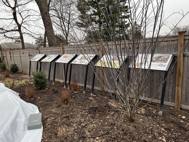
Other nearby markers. At least 8 other markers are within walking distance of this marker. The Battle of Edgar's Lane (here, next to this marker); The Hessians: Hired by the King (here, next to this marker); Washington's Continental Army (here, next to this marker); Seven Years of Fear: Hastings and the Neutral Ground (here, next to this marker); The American Revolution in 1778 (here, next to this marker); Community Gardens in Zinsser Park / Los Jardines Comunitarios en el Parque Zinsser (a few steps from this marker); The Skirmish of Edgar's Lane (a few steps from this marker); a different marker also named Battle of Edgar's Lane (within shouting distance of this marker). Touch for a list and map of all markers in Hastings-on-Hudson.
Credits. This page was last revised on March 12, 2022. It was originally submitted on March 12, 2022, by Devry Becker Jones of Washington, District of Columbia. This page has been viewed 191 times since then and 18 times this year. Photos: 1, 2. submitted on March 12, 2022, by Devry Becker Jones of Washington, District of Columbia.

