Near Key West in Monroe County, Florida — The American South (South Atlantic)
Water in "Dry" Tortugas
Fort Jefferson
| — | Dry Tortugas National Park | — |

Photographed by Vince Jackson, March 4, 2022
1. Water in "Dry" Tortugas Marker
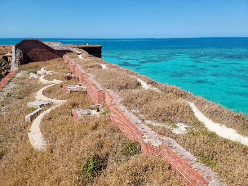
Garden Key receives about 30 inches of rain a year. Rain falling on the fort's top tier filtered down through sand to drainpipes in the walls and into 109 cisterns beneath the casemates on the fort's first level. The cisterns could hold a total of 1.5 million gallons.
Cracks in the settling fort allowed salt water to enter most of the cisterns but did not affect the 92,000-gallon cistern on the parade field. That cistern is still in use today.
(caption)
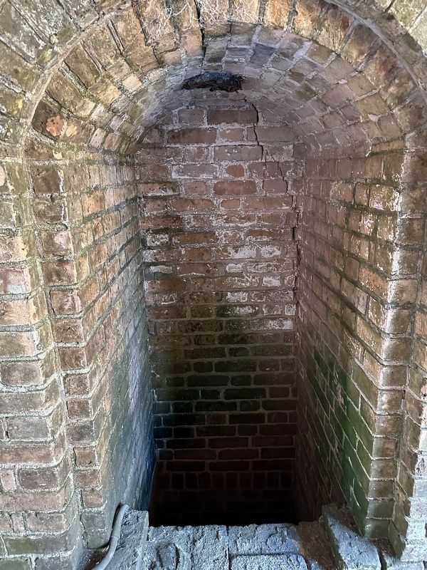
The opening in the wall on your right held a water filter. Notice the crack (arrow) at the keystone of the arch, where the embedded iron pipe has rusted and expanded, damaging the surrounding wall. Also look for the old cistern openings in the floor and the original pipes for the hand pumps on the ground to your right.
Erected by National Park Service, U.S. Department of the Interior.
Topics. This historical marker is listed in these topic lists: Forts and Castles • Parks & Recreational Areas • War, US Civil.
Location. 24° 37.677′ N,
this page online

Regionally, this marker is on the Florida Keys. It is also in the American South and on the Gulf Coast. Globally, it is in the North Atlantic Region, North America, a Gulf of Mexico state, the Western Hemisphere, the Western World, and the Anglosphere. Historically, it finds itself in what was once New Spain, the territory of the Mississippian Culture, one of the Confederate States of America, and the Antebellum South.
Other nearby markers. At least 8 other markers are within walking distance of this marker: Building a City on the Sea (a few steps from this marker); Gunrooms (a few steps from this marker); Touring Fort Jefferson (a few steps from this marker); Dr. Mudd's Cell (a few steps from this marker); Deadly Crossfire (a few steps from this marker); Intricate Gun Rooms (within shouting distance of this marker); Makeshift Living Quarters
Photographed by Vince Jackson, March 4, 2022
2. Sand covered top level
The first filter of the freshwater system of Fort Jefferson
Also see . . . Dry Tortugas National Park. National Park Service (Submitted on March 17, 2022.)
Photographed by Pete Skillman, November 20, 2023
3. Water in "Dry" Tortugas Marker
Credits. This page was last revised on December 16, 2025. It was originally submitted on March 17, 2022, by Vince Jackson of Toano, Virginia. This page has been viewed 2,176 times since then and 169 times this year. Photos: 1, 2. submitted on March 17, 2022, by Vince Jackson of Toano, Virginia. 3. submitted on January 29, 2024, by Pete Skillman of Wilmington, Delaware. • Bernard Fisher was the editor who published this page.
