Clair-Mel City in Tampa in Hillsborough County, Florida — The American South (South Atlantic)
The Berlin blockade
(24 June 1948 - 12 May 1949)
| — | Hillsborough County Veterans Memorial Park | — |
Photographed by Brandon D Cross, March 7, 2022
1. The Berlin blockade Marker
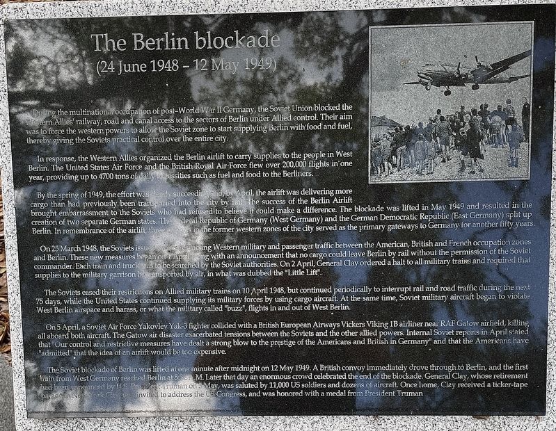
During the multinational occupation of post-World War Il Germany, the Soviet Union blocked the Western Allies’ railway, road and canal access to the sectors of Berlin under Allied control. Their aim was to force the western powers to allow the Soviet zone to start supplying Berlin with food and fuel, thereby giving the Soviets practical control over the entire city.
In response, the Western Allies organized the Berlin airlift to carry supplies to the people in West Berlin. The United States Air Force and the British Royal Air Force flew over 200,000 flights in one year, providing up to 4700 tons of daily life necessities such as fuel and food to the Berliners.
By the spring of 1949, the effort was clearly succeeding and, by April, the airlift was delivering more cargo than had previously been transported into the city by rail. The success of the Berlin Airlift brought embarrassment to the Soviets who had refused to believe it could make a difference. The blockade was lifted in May 1949 and resulted in the creation of two separate German states. The Federal Republic of Germany (West Germany) and the German
this page online
On 25 March 1948, the Soviets issued orders restricting Western military and passenger traffic between the American, British and French occupation zones and Berlin. These new measures began on1 April along with an announcement that no cargo could leave Berlin by rail without the permission of the Soviet commander, Each train and truck was to be searched by the Soviet authorities. On 2 April General Clay ordered a halt to all military trains and required that supplies to the military garrison be transported by air, in what was dubbed the "Little Lift"
The Soviets eased their restrictions on Allied military trains on 10 April 1948, but continued periodically to interrupt rail and road traffic during the next 75 days, while the United States continued supplying its military forces by using cargo aircraft. At the same time, Soviet military aircraft began to violate West Berlin airspace and harass, or what the military called
Photographed by Brandon D Cross, March 7, 2022
2. The Berlin blockade Marker
On 5 April, a Soviet Air Force Yakovlev Yak-3 fighter collided with a British European Airways Vickers Viking 1B airliner near RAF Gatow airfield, killing all aboard both aircraft. The Gatow air disaster exacerbated tensions between the Soviets and the other allied powers. Internal Soviet reports in April stated that “Our control and restrictive measures have dealt a strong blow to the prestige of the Americans and British in Germany" and that the Americans have “admitted" that the idea of an airlift would be to expensive.
The Soviet blockade of Berlin was lifted at one minute after midnight on 12 May 1949. A British convoy immediately drove through to Berlin, and the first train from West Germany reached Berlim at 5:32 A.M. Later that day an enormous crowd celebrated the end of the blockade. General Clay, whose retirement had been announced by U.S. President Truman on 3 May, was saluted by 11,000 US soldiers and dozens of aircraft. Once home, Clay received a ticker-tape parade in New York City and invited to address the US Congress, and was honored with a medal from President Truman.
Erected by Hillsborough County.
Topics. This memorial is listed in these topic lists: Air & Space • Industry & Commerce • Roads & Vehicles • War, Cold. A significant historical date for this entry is March 25, 1948.
Location. 27° 58.645′ N, 82° 21.677′ W. Memorial is in Tampa, Florida, in Hillsborough County. It is in Clair-Mel City. It can be reached from U.S. 301 0.2 miles south of East Dr. Martin Luther King Jr. Boulevard, on the right when traveling south. Marker located within Hillsborough County Veterans Memorial Park. Touch for map. Memorial is at or near this postal address: 3602 N US Highway 301, Tampa FL 33619, United States of America. Touch for directions.

Regionally, this memorial is on Florida’s Tampa Bay. It is also in the American South and on the Gulf Coast. Globally, it is in the North Atlantic Region, North America, a Gulf of Mexico state, the Western Hemisphere, the Western World, and the Anglosphere. Historically, it finds itself in what was once New Spain, the territory of the Mississippian Culture, one of the Confederate States of America, and the Antebellum South.
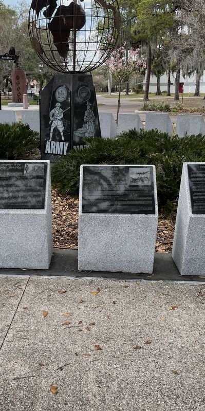
Other nearby markers. At least 8 other markers are within walking distance of this marker: 1958 Lebanon crisis (here, next to this marker); United States occupation of the Dominican Republic (1916-1924) (here, next to this marker); Cuban missile crisis October 1962 (here, next to this marker); United States occupation of Haiti (here, next to this marker); United States occupation of the Dominican Republic (1965-1966) (here, next to this marker); United Task Force (1992-1993) (here, next to this marker); United States Invasion of Panama (1991) (here, next to this marker); Mayaguez Incident (1975) (here, next to this marker). Touch for a list and map of all markers in Tampa.
Also see . . .
1. Berlin Blockade. Wikipedia entry (Submitted on January 30, 2026, by Larry Gertner of New York, New York.)
2. Veterans Memorial Park & Museum. Hillsborough County website entry (Submitted on January 30, 2026, by Larry Gertner of New York, New York.)
Credits. This page was last revised on January 30, 2026. It was originally submitted on March 23, 2022, by Brandon D Cross of Flagler Beach, Florida. This page has been viewed 394 times since then and 26 times this year. Photos: 1, 2. submitted on March 23, 2022, by Brandon D Cross of Flagler Beach, Florida. • Devry Becker Jones was the editor who published this page.
