Near Manassas in Prince William County, Virginia — The American South (Mid-Atlantic)
Henry Hill Walking Tour
Retracing the Battle
| — | First Battle of Manassas | — |
Photographed by Craig Swain, May 4, 2008
1. Henry Hill Walking Tour Marker
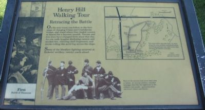
Some of the bloodiest fighting occurred at Ricketts' artillery, twenty yards ahead.
Topics. This historical marker is listed in this topic list: War, US Civil.
Location. This marker has been replaced by another marker nearby. It was located near 38° 48.809′ N, 77° 31.294′ W. Marker was near Manassas, Virginia, in Prince William County. It could be reached from Sudley Road (State Road 234) half a mile south of Lee Highway (U.S. 29), on the right when traveling north. The trailhead for the Henry Hill Walking tour of the Manassas National Battlefield Park. Located just north of the park visitor center. An admission fee is charged for entrance to the park. Touch for map. Marker was in this post office area: Manassas VA 20109, United
this page online

Regionally, this marker was in the Washington Metropolitan Area, in Northern Virginia, and in the Piedmont. It was also in the American South, specifically in the Upper South, in the Mid-Atlantic, and on the Eastern Seaboard. Globally, it was in the North Atlantic Region, North America, the Western Hemisphere, the Western World, and the Anglosphere. Historically, it found itself in what was once the territory of the Mississippian Culture, one of the original Thirteen Colonies, one of the Confederate States of America, and the Antebellum South.
Other nearby markers. At least 8 other markers are within walking distance of this location: Henry Hill (here, next to this marker); Artillery Duel (within shouting distance of this marker); Position 7th G.A. Regt. (about 300 feet away, measured in a direct line); The War Over Memory (about 300 feet away); General Barnard Elliott Bee (about 300 feet away); a different marker also named 7th Georgia Markers (about 300 feet away); Thomas Jonathan Jackson (about 300 feet away); Colonel Thomas (about 400 feet away). Touch for a list and map
Photographed by Craig Swain, May 4, 2008
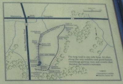
2. Trail Map
Other markers no longer nearby. The Fight for Ricketts' Guns (was within shouting distance of this marker but has been reported to have been replaced with another marker now near it); 7th Georgia Markers (was about 300 feet away but has been replaced with another marker now near it).
More about this marker. On the upper right is a map of the trail with the caption, The loop trail is one mile long. At sites along the way exhibits and push-button recordings portray men and events that decided the battle's outcome. On the lower center is a photograph of Civil War soldiers with the explanation, Most of the recruits had never been shot at before. At several exhibits, recorded messages describe the nightmare in the soldiers' own words - quotations from survivors' letters and diaries.
This marker was replaced by a new one named Henry Hill (see nearby markers).
Related markers. Click here for a list of markers that are related to this marker. Virtual tour by markers of the Henry Hill Walking tour portion of the Manassas Battlefield.
Also see . . . Manassas Battlefield. National Park
Photographed by Craig Swain, May 4, 2008
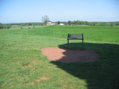
3. Start of the Henry Hill Walking Tour
Photographed by Craig Swain, May 4, 2008
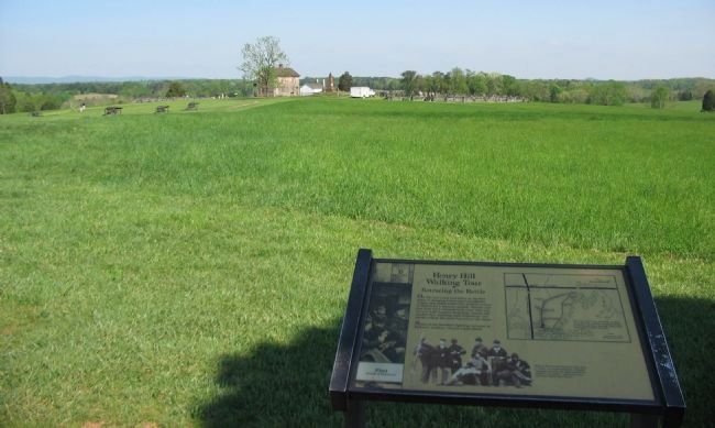
4. The Battlefield
Looking past the marker, on the left are cannon positioned where Ricketts' battery stood during the battle. In the center distance is the Henry House.
Credits. This page was last revised on April 17, 2022. It was originally submitted on June 9, 2008, by Craig Swain of Leesburg, Virginia. This page has been viewed 2,688 times since then and 39 times this year. Last updated on March 26, 2022, by Connor Olson of Menomonee Falls, Wisconsin. Photos: 1, 2, 3, 4. submitted on June 9, 2008, by Craig Swain of Leesburg, Virginia. • J. Makali Bruton was the editor who published this page.
