Lexington in Fayette County, Kentucky — The American South (East South Central)
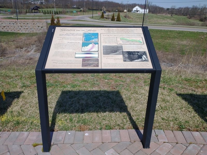
Geology And The Land
The early explorers and surveyors recognized unusually good soil by its appearance, physical qualities and vegetation - even if they didn't comprehend the geology beneath.
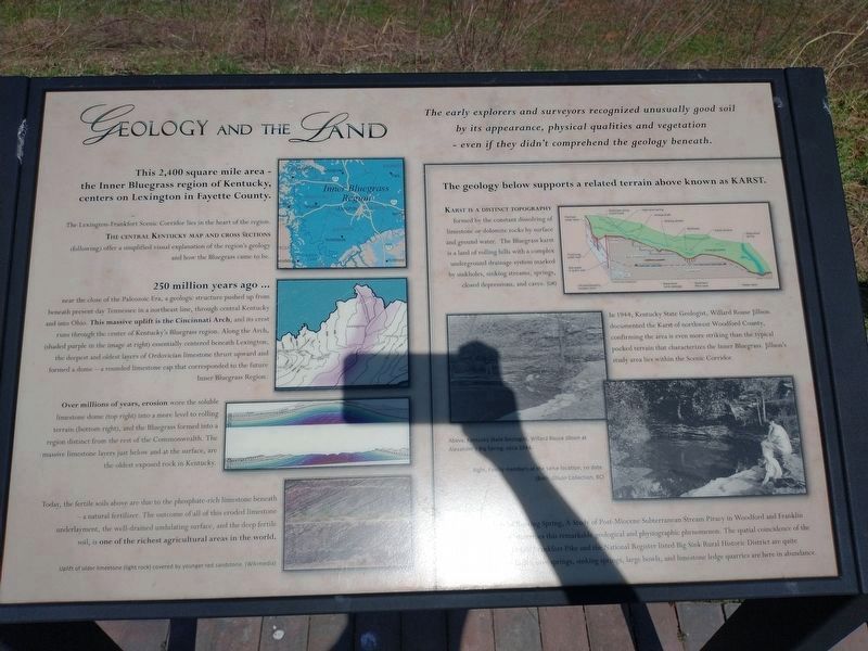
This 2,400 square mile area - the Inner Bluegrass region of Kentucky, centers on Lexington in Fayette County.
The Lexington-Frankfort Scenic Corridor lies in the heart of the region. The Central Kentucky Map and Cross Sections (following) offer a simplified visual explanation of the region's geology and how the Bluegrass came to be.
250 million years ago ...
near the close of the Paleozoic Era, a geologic structure pushed up from beneath present day Tennessee in a northeast line, through central Kentucky and into Ohio. This massive uplift is the Cincinnati Arch, and its crest runs through the center of Kentucky's Bluegrass region. Along the Arch, (shaded purple in the image at right) essentially centered beneath Lexington, the deepest and oldest layers of Ordovician limestone thrust upward and formed a dome - a rounded limestone cap that corresponded to the future Inner Bluegrass Region.
Over millions of years, erosion wore the soluble limestone dome (top right) into a more level to rolling terrain (bottom right), and the Bluegrass formed into a region distinct from the rest of the Commonwealth. The massive limestone layers just below and at the surface, are the oldest exposed rock in Kentucky.
Today, the fertile soils above are due to the phosphate-rich limestone beneath a natural fertilizer. The outcome of all of this eroded limestone underlayment, the well-drained undulating surface, and the deep fertile soil, is one of the richest agricultural areas in the world.
Uplift of older limestone (light rock) covered by younger red sandstone. (Wikimedia)
The geology below supports a related terrain above known as Karst.
Karst is a Distinct Topography formed by the constant dissolving of limestone or dolomite rocks by surface and ground water. The Bluegrass karst is a land of rolling hills with a complex underground drainage system marked by sinkholes, sinking streams, springs, closed depressions, and caves. (UK)
In 1944, Kentucky State Geologist, Willard Rouse Jillson documented the Karst of northwest Woodford County, confirming the area is even more striking than the typical pocked terrain that characterizes the Inner Bluegrass. Jillson's study area lies within the Scenic Corridor.
Above, Kentucky State Geologist, Willard Rouse Jillson at Alexander's Big Spring, circa 1944.
Right, Family members at the same location, no date. (Both, Jillson Collection, BC)
Jillson's "Geology of Roing Spring, A Study of Post-Miocene Subterranean Stream Piracy in Woodford and Franklin Counties, Kentucky" describes this remarkable geological and physiographic phenomenon. The spatial coincidence of the underlying geology to Old Frankfort Pike and the National Register listed Big Sink Rural Historic District are quite remarkable, Surface faults, Cove springs, sinking springs, large bowls, and limestone ledge quarries are here in abundance.
Topics. This historical marker is listed in these topic lists: Exploration • Natural Features. A significant historical year for this entry is 1944.
Location. 38° 4.126′ N, 84° 33.445′ W. Marker is in Lexington, Kentucky, in Fayette County. Marker is at the intersection of Old Frankfort Pike (Route 1681) and Alexandria Drive, on the right when traveling east on Old Frankfort Pike. Touch for map. Marker is at or near this postal address: 2450 Old Frankfort Pike, Lexington KY 40510, United States of America. Touch for directions.
Other nearby markers. At least 8 other markers are within walking distance of this marker. Americas First West (here, next to this marker); The Settlers (here, next to this marker); Create An Agri-culture (a few steps from this marker); Breed Only The Best (a few steps from this marker); Gentlemen Farmers and Burley Tobacco (a few steps from this marker); the International Thoroughbred Landscape (a few steps from this marker); Calumet Farm (a few steps from this marker); Preservation and Conservation (a few steps from this marker). Touch for a list and map of all markers in Lexington.
Credits. This page was last revised on April 1, 2022. It was originally submitted on March 28, 2022, by Craig Doda of Napoleon, Ohio. This page has been viewed 165 times since then and 19 times this year. Photos: 1, 2, 3. submitted on March 28, 2022, by Craig Doda of Napoleon, Ohio. • Devry Becker Jones was the editor who published this page.


