
Lexington in Fayette County, Kentucky — The American South (East South Central)
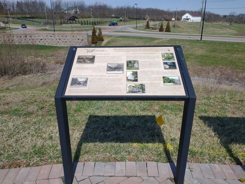
The Settlers
Photographed by Craig Doda, March 21, 2022
1. The Settlers Marker
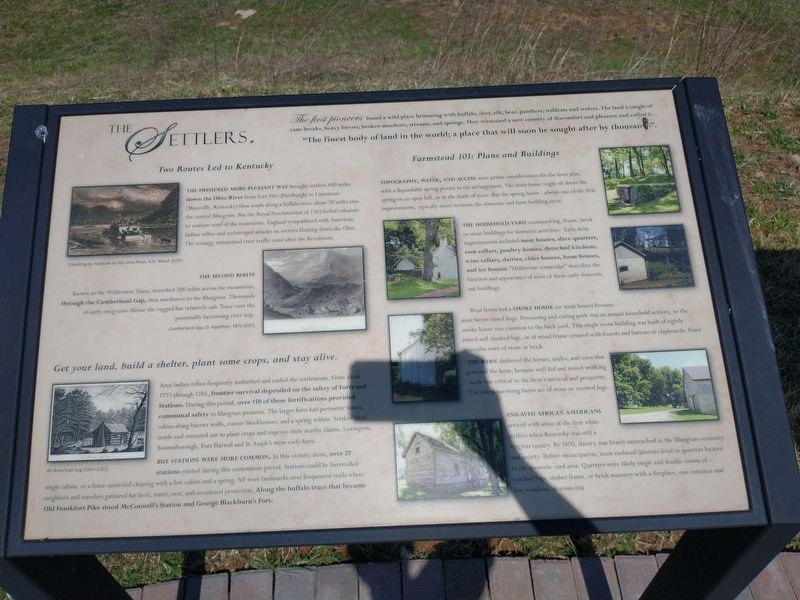
The first pioneers found a wild place brimming with buffalo, deer, elk, bear, panthers, wildcats and wolves. The land a tangle of cane breaks, heavy forests, broken meadows, streams, and springs. They witnessed a new country of discomfort and pleasure and called it… "The finest body of land in the world; a place that will soon be sought after by thousand".
Two Routes Led to Kentucky
The Presumed More Pleasant Way brought settlers 400 miles down the Ohio River from Fort Pitt (Pittsburgh) to Limestone (Maysville, Kentucky) then south along a buffalo trace about 70 miles into the central Bluegrass. But the Royal Proclamation of 1763 forbid colonists to venture west of the mountains. England sympathized with American Indian tribes and encouraged attacks on settlers floating down the Ohio. The strategy minimized river traffic until after the Revolution.
The Second Route
known as the Wilderness Trace, stretched 200 miles across the mountains, through the Cumberland Gap, then northwest to the Bluegrass. Thousands of early emigrants choose the rugged but relatively safe Trace over the potentially harrowing
this page online
Get your land, build a shelter, plant some crops, and stay alive.
Area Indian tribes frequently ambushed and raided the settlements. From about 1773 through 1785, frontier survival depended on the safety of Forts and Stations. During this period, over 150 of these fortifications provided communal safety to bluegrass pioneers. The larger forts had perimeter fences, cabins along barrier walls, corner blockhouses, and a spring within. Settlers lived inside and ventured out to plant crops and improve their nearby claims. Lexington, Boonesborough, Fort Harrod and St. Asaph's were early forts.
But Stations Were More Common. In this vicinity alone, over 27 stations existed during this contentious period. Stations could be barricaded single cabins, or a fence-encircled clearing with a few cabins and a spring. All were landmarks near frequented trails where neighbors and travelers gathered for food, water, rest, and occasional protection. Along the buffalo trace that became Old Frankfort Pike stood McConnell's Station and George Blackburn's Fort.
Farmstead 101: Plans and Buildings
Topography, Water, And Access
Photographed by Craig Doda, March 21, 2022
2. The Settlers Marker
The Household Yard contained log, frame, brick or stone buildings for domestic activities. Early farm improvements included meat houses, slave quarters, root cellars, poultry houses, detached kitchens, wine cellars, dairies, cider houses, loom houses, and ice houses. "Utilitarian vernacular” describes the function and appearance of most of these early domestic out buildings.
Most farms had a Smoke House (or meat house) because most farms raised hogs. Processing and curing pork was an annual household activity, so the smoke house was common to the back yard. This single room building was built of tightly joined and chinked logs, or of wood frame covered with boards and battens or clapboards. Finer examples were of stone or brick.
The Barn sheltered the horses, mules, and oxen that powered the farm, because well

Photographed by Craig Doda, March 21, 2022
3. The Settlers Marker
Enslaved African American arrived with some of the first white settlers when Kentucky was still a Virginia county. By 1800, slavery was firmly entrenched in the Bluegrass economy and society. Before emancipation, most enslaved laborers lived in quarters located in the domestic yard area. Quarters were likely single and double rooms of notched logs, timber frame, or brick masonry with a fireplace, one entrance and few windows.
Topics. This historical marker is listed in these topic lists: African Americans • Architecture • Indigenous Peoples and Communities • Settlements & Settlers. A significant historical year for this entry is 1763.
Location. 38° 4.125′ N, 84° 33.445′ W. Marker is in Lexington, Kentucky, in Fayette County. It is at the intersection of Old Frankfort Pike (Kentucky Route 1681) and Alexandria Drive, on the left when traveling east on Old Frankfort Pike. Touch for map. Marker is at or near this postal address: 2450 Old Frankfort Pike, Lexington KY 40510, United States of America. Touch for directions.

Regionally, this marker is in Kentucky’s Bluegrass Region. It is also in the American South and specifically in the Upper South. Globally, it is in North America, the Western Hemisphere, the Western World, and the Anglosphere. Historically, it finds itself in what was once the territory of the Mississippian Culture and also the Antebellum South.
Other nearby markers. At least 8 other markers are within walking distance of this marker: Geology And The Land (here, next to this marker); Americas First West (here, next to this marker); Create An Agri-culture (a few steps from this marker); Breed Only The Best (a few steps from this marker); Gentlemen Farmers and Burley Tobacco (a few steps from this marker); the International Thoroughbred Landscape (a few steps from this marker); Calumet Farm (a few steps from this marker); Preservation and Conservation (a few steps from this marker). Touch for a list and map of all markers in Lexington.
Credits. This page was last revised on April 4, 2022. It was originally submitted on March 28, 2022, by Craig Doda of Napoleon, Ohio. This page has been viewed 318 times since then and 18 times this year. Photos: 1, 2, 3. submitted on March 28, 2022, by Craig Doda of Napoleon, Ohio. • Devry Becker Jones was the editor who published this page.
