Near Chickamauga in Walker County, Georgia — The American South (South Atlantic)
Bailey's Crossroads
Chickamauga Campaign Heritage Trail
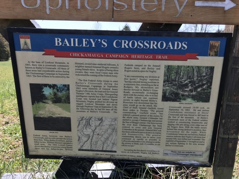
The first Federal Army troops to enter Bailey's Crossroads during the Chickamauga Campaign in September 1863 were elements of General James Negley's Division, the lead unit for General Thomas' 14th Army Corps. Disregarding intelligence reports that a full Confederate Corps was located just behind Pigeon Mountain, Negley pushed his division up rugged Lookout Mountain and down through Stephens' Gap on September 8. By the following day he had his men off the mountain at Bailey's Crossroads. The Federals camped on the Amauel Rogers farm, and Bailey and Rogers acted as spies for Negley.
"I am concentrating my division at this point," Negley reported, "having selected strong positions in a concentric line, extending as far as Rodgers. My skirmishers are thrown forward to Bailey's Cross-Roads, occasionally exchanging shots with the enemy, who is in line of battle (about one regiment cavalry in sight) beyond Bailey's. Rosecrans was determined that his army would go on the attack. His Chief of Staff, General Garfield, issued these orders to Thomas: "The general commanding," Garfield wrote, "has ordered a general pursuit of the enemy by the whole army. General Crittenden has started to occupy Chattanooga and pursue the line of Bragg's retreat. Our force across the river from Chattanooga has been ordered to cross and join General Crittenden in the pursuit. General McCook has been ordered to move at once on Alpine and Summerville. The general commanding directs you to move your command as rapidly as possible to LaFayette and make every attempt to strike the enemy in flank, and, if possible, to cut off his escape."
Accepting the fact that he would have to move on LaFayette, Negley left Bailey's Crossroads around 10:00 a.m. on September 10, 1863. He met serious Confederate resistance at Davis' Crossroads and was forced to fall back to the foot of the mountain. At Bailey's Crossroads most of the Federal soldiers worked at constructing breastworks and digging rifle pits along a low ridge east of the Rogers farm. With the trains secure behind this strong defensive position, they bivouacked for the night. While Confederate losses are not known, Federal sources indicate that Negley's division lost around fifty men killed and wounded. The nightfall of September 11 brought an end to any serious fighting in the area around Bailey's Crossroads.
Captions (left to right):
• Wartime road
• From the map of Col. William E. Merrill, Chief Engineer, Army of the Cumberland
• Federal earthworks
Erected by Chickamauga Campaign Heritage Trail; sponsored by Wilson Funeral Home.
Topics and series. This historical marker is listed in these topic lists: African Americans • War, US Civil. In addition, it is included in the Chickamauga Campaign Heritage Trail series list. A significant historical month for this entry is September 1863.
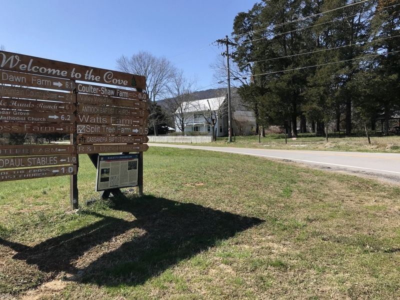
Location. Marker has been reported missing. It was located near 34° 46.245′ N, 85° 24.255′ W. Marker was near Chickamauga, Georgia, in Walker County. Marker was at the intersection of Georgia Route 193 and West Cove Road, on the right when traveling south on State Route 193. Touch for map. Marker was in this post office area: Chickamauga GA 30707, United States of America. Touch for directions.
Other nearby markers. At least 8 other markers are within 6 miles of this location, measured as the crow flies. Stephens Gap (approx. 1.1 miles away); Martin Davis House and Farm (approx. 2.3 miles away); Skirmish at McLemore’s Cove (approx. 3.1 miles away); a different marker also named Skirmish at McLemore’s Cove (approx. 3.1 miles away); a different marker also named Skirmish at McLemore’s Cove (approx. 3.1 miles away); Cooper's Gap (approx. 3.6 miles away); Gowan’s (Gower’s) Ford And Widow Glenn’s Grave (approx. 5.4 miles away); Catlett’s Gap (approx. 5.8 miles away). Touch for a list and map of all markers in Chickamauga.
Credits. This page was last revised on March 28, 2022. It was originally submitted on March 7, 2021, by Duane and Tracy Marsteller of Murfreesboro, Tennessee. This page has been viewed 416 times since then and 52 times this year. Last updated on March 28, 2022, by Darren Jefferson Clay of Duluth, Georgia. Photos: 1, 2. submitted on March 7, 2021, by Duane and Tracy Marsteller of Murfreesboro, Tennessee. 3. submitted on March 28, 2022, by Darren Jefferson Clay of Duluth, Georgia. • J. Makali Bruton was the editor who published this page.


