
Araby View near Frederick in Frederick County, Maryland — The American Northeast (Mid-Atlantic)
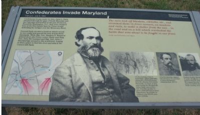
Confederates Invade Maryland
Photographed by Craig Swain, July 7, 2007
1. Confederates Invade Maryland Marker
7:00 a.m, July 9, 1864
Confederate troops under Lt. Gen. Jubal A. Early streamed through the gaps of South Mountain and the Catoctins and headed south past Frederick. Bound for Washington, D.C., they were stopped here at the Best family farm by Union troops defending the bridges over the Monocacy River.
General Early decided a head-on attack would be too costly and spread his men across these farmlands. While Maj. Gen. Stephen D. Ramseur pinned down the Union center, Early sent Brig. Gen. John McCausland and Maj. Gen. John C. Breckinridge around to the southwest, hoping to find a place to ford the river and attack the Union's left flank.
The men took off blankets, oilcloths, etc., and stretched them in fence corners, on muskets and rails, to make a shelter from the sun...in the road and on a hill which overlooked the battle that was about to be fought in our front.
1st Sgt. John H. Worsham, 21st Virgina.
Erected by Monocacy National Battlefield
National Parks Service.
Topics. This historical marker is listed in this topic list: War, US Civil. A significant historical month for this entry is July 1774.
Location. This marker has been replaced by another marker nearby.
this page online

Regionally, this marker was in the Washington Metropolitan Area and in Central Maryland. It was also in the American Mid-Atlantic. Globally, it was in North America, the Western Hemisphere, the Western World, and the Anglosphere. Historically, it found itself in what was once one of the original Thirteen Colonies and also the Antebellum South.
Other nearby markers. At least 8 other markers are within walking distance of this location: 1862 Antietam Campaign (here, next to this marker); The Lost Order (here, next to this marker); L'Hermitage (here, next to this marker); Caught in the Crossfire (here,
Photographed by Bill Coughlin, April 12, 2011
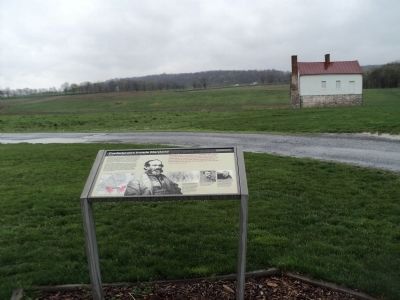
2. Confederates Invade Maryland marker at the Best Farm
The marker is seen here at its new location at the Best Farm, stop 1 on the Monocacy Battlefield driving tour.
Another marker is no longer nearby. Best Family Farm (was here, next to this marker but has been reported to have been replaced with another marker now near it).
More about this marker. On the lower left is a map showing this phase in the battle. A portrait of Gen. Early is in the center.
On the lower right is a series of drawings and photographs. From left to right, the first is a drawing captioned, "On the morning of July 9, Jubal Early, demanded a $200,000 ransom from the citizens of Frederick. Previously, on July 6, as they were leaving the Shenandoah Valley, Early ordered Brig. Gen. John McCausland to exact a $200,000 ransom from Hagerstown. By mistake he obtained only $20,000, plus some clothing."
The center of the three pictures is a portrait of "John Breckinridge" who "had served as vice president in James Buchanan's administration, 1857-61."
On the right

Photographed by Craig Swain, July 7, 2007
3. The Battle Map
This marker was replaced by a new one named L'Hermitage (see nearby markers)
Related markers. Click here for a list of markers that are related to this marker. This marker is among several describing the battle of Monocacy, to "tour" the battlefield using the related HMBd markers sites.
Also see . . . Battle of Monocacy. National Parks Service Site for the Battle. (Submitted on October 31, 2007, by Craig Swain of Leesburg, Virginia.)
Photographed by Craig Swain, January 29, 2007
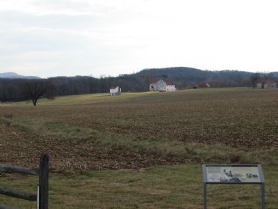
4. Previous Location of Marker
This marker was next to the UDC and Maryland Monuments along Urbana Pike (MD 355), but were moved in the summer of 2007. Ramseur's Division marched forward from this point, directed just to the north of the Best Farm. Much of the ground between this point and the farm was covered by a grove of trees at the time of the battle.
Photographed by Brandon Fletcher, June 25, 2009
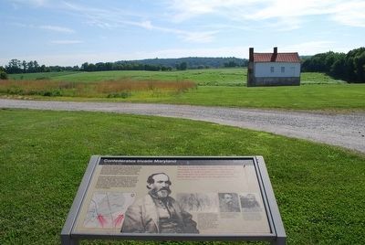
5. Confederates Invade Maryland Marker
Summer time
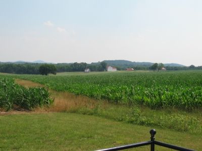
Photographed by Craig Swain, July 7, 2007
6. View from the Urbana Pike Pulloff
The same view of Ramseur's line of march, taken in the summer, almost on the anniversary of the battle.
Credits. This page was last revised on June 28, 2024. It was originally submitted on October 31, 2007, by Craig Swain of Leesburg, Virginia. This page has been viewed 2,136 times since then and 18 times this year. Last updated on March 28, 2022, by Connor Olson of Menomonee Falls, Wisconsin. Photos: 1. submitted on October 31, 2007, by Craig Swain of Leesburg, Virginia. 2. submitted on April 23, 2011, by Bill Coughlin of Woodland Park, New Jersey. 3, 4. submitted on October 31, 2007, by Craig Swain of Leesburg, Virginia. 5. submitted on August 9, 2015, by Brandon Fletcher of Chattanooga, Tennessee. 6. submitted on October 31, 2007, by Craig Swain of Leesburg, Virginia. • J. Makali Bruton was the editor who published this page.
