Near Frederick in Frederick County, Maryland — The American Northeast (Mid-Atlantic)
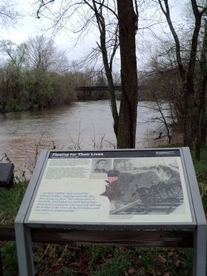
Fleeing for Their Lives
8:30 a.m. - 5:00 p.m. July 9, 1864
— Monocacy National Battlefield, National Park Service, U.S. Department of the Interior —
Distressed that their main escape route had been burned, the stranded Federal skirmishers fought on as they faced periodic Confederate attacks. Late in the afternoon, they gradually fell back towards the Baltimore & Ohio bridge.
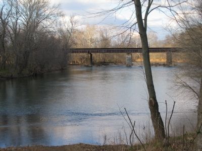
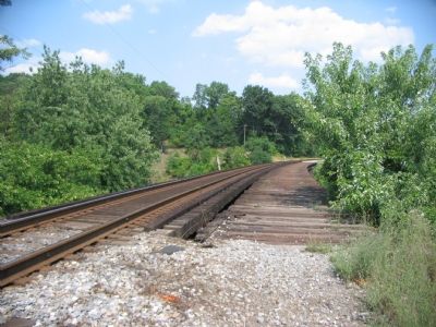
About 5:00 p.m., they noticed their compatriots retreating across the Gambrill Mill property toward the Baltimore Pike and fled across the railroad bridge to join them. The skirmishers had protected the Union center and the escape route toward Baltimore. "Your people," Maj. Gen. Lew Wallace wrote 1st Lt. George E. Davis, "held their position with great tenacity."
… we kept together and crossed the railroad bridge, stepping upon the ties, there being no floor. The enemy were at our heels, and before we could get away…[took some] prisoners. One man fell through the bridge to the river, forty feet below, and was taken to Andersonville.
1st Lt. George E. Davis
Erected by National Park Service, U.S. Department of the Interior.
Topics. This historical marker is listed in this topic list: War, US Civil. A significant historical month for this entry is July 1864.
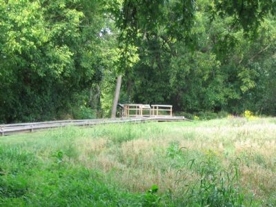
Location. This marker has been replaced by another marker nearby. It was located near 39° 22.159′ N, 77° 23.288′ W. Marker was near Frederick, Maryland, in Frederick County. Marker could be reached from Urbana Pike (State Highway 355), on the right when traveling north. Located along a walking trail at the Gambrill Mill (stop five on the driving tour of Monocacy Battlefield), which on a lane off the right side (east) of Urbana Pike. The marker is located on an overlook of the Monocacy River. Touch for map. Marker was in this post office area: Frederick MD 21704, United States of America. Touch for directions.
Other nearby markers. At least 8 other markers are within walking distance of this location. Burning the Bridge (within shouting distance of this marker); Desperate Escape (within shouting distance of this marker); Retreat (about 700 feet away, measured in a direct line); CPL Kirk J Bosselmann (about 800 feet away); A Bold Plan (approx. 0.2 miles away); Edgewood (approx. 0.2 miles away); Caring for the River (approx. 0.2 miles away); a different marker also named A Bold Plan (approx. 0.2 miles away). Touch for a list and map of all markers in Frederick.
More about this marker. Beside the text is a portrait of "First Lt. George E. Davis of the 10th Vermont Infantry," who "received the Medal of Honor for his heroic leadership in defense of the bridges." The portrait is complemented by an image of the Medal of Honor. On the right of the marker is a drawing of the Union skirmishers retreating, "After holding off Confederates most of the day,
Union skirmishers fled to safety across the railroad bridge."
This marker was replaced by a new one named Desperate Escape (see nearby markers).
Related markers. Click here for a list of markers that are related to this marker. This marker is among several describing the battle of Monocacy, to "tour" the battlefield using the related HMBd markers sites.
Also see . . . Battle of Monocacy. National Park Service site. (Submitted on November 2, 2007, by Craig Swain of Leesburg, Virginia.)
Credits. This page was last revised on April 27, 2022. It was originally submitted on November 2, 2007, by Craig Swain of Leesburg, Virginia. This page has been viewed 1,571 times since then and 18 times this year. Last updated on March 28, 2022, by Connor Olson of Kewaskum, Wisconsin. Photos: 1. submitted on November 2, 2007, by Craig Swain of Leesburg, Virginia. 2. submitted on April 23, 2011, by Bill Coughlin of Woodland Park, New Jersey. 3, 4, 5. submitted on November 2, 2007, by Craig Swain of Leesburg, Virginia. • Devry Becker Jones was the editor who published this page.


