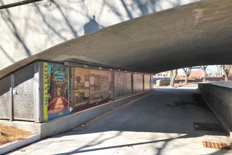
Downtown in Sioux Falls in Minnehaha County, South Dakota — The American Midwest (Upper Plains)
Course
— 8th Street Bridge —
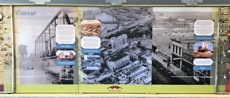
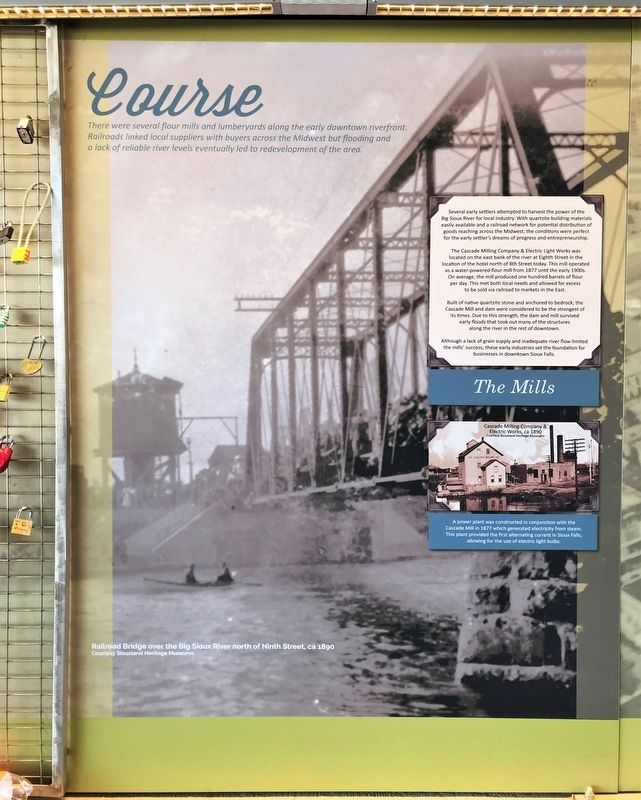
There were several flour mills and lumberyards along the early downtown riverfront. Railroads linked local suppliers with buyers across the Midwest but flooding and a lack of reliable river levels eventually led to a redevelopment of the area.
The Mills
Several early settlers attempted to harvest the power of the Big Sioux River for local industry. With quartzite building materials easily available and a railroad network for potential distribution of goods reaching across the Midwest, the conditions were perfect for the early settler's dreams of progress and entrepreneurship.
The Cascade Milling Company & Electric Light Works was located on the east bank of the river at Eighth Street in the location of the hotel north of 8th Street today. This mill operated as a water-powered flour mill from 1877 until the early 1900s. On average, the mill produced one hundred barrels of flour per day. This met both local needs and allowed for excess to be sold via railroad to markets in the East.
Built of native quartzite stone and anchored to bedrock, the Cascade Mill and dam were considered to be the strongest of its times. Due to this strength, the dam and mill survived early floods that took out many of the structures along the river in the rest of downtown.
Although a lack of grain supply and inadequate river flow limited the mills' success, these early industries set the foundation for businesses in downtown Sioux Falls.
image:
Cascade Milling Company & Electric Works, ca 1890
Courtesy Siouxland Heritage Museums
A power plant was constructed in conjunction with the Cascade Mill in 1877 which generated electricity from steam. This plant provided the first alternating current in Sioux Falls, allowing for the use of electric light bulbs.
image:
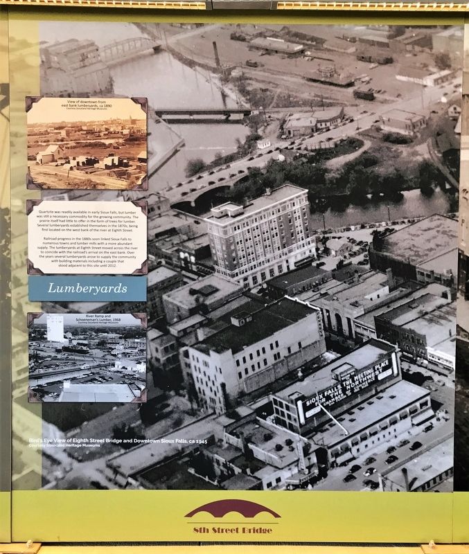
View of downtown from east bank lumberyards, ca 1890
Courtesy Siouxland Heritage Museums
Lumberyards
Quartzite was readily available in early Sioux Falls, but lumber was still a necessary commodity for the growing community. The prairie itself had little to offer in the form of trees for lumber. Several lumberyards established themselves in the 1870s, being first located on the west bank of the river at Eighth Street.
Railroad progress in the 1880s soon linked Sioux Falls to numerous towns and lumber mills with a more abundant supply. The lumberyards at Eighth Street moved across the river to coincide with the railroad's arrival on the east bank. Over the years several lumberyards arose to supply the community with building materials including a couple that stood adjacent to this site until 2012.
image:
River Ramp and Schoeneman's Lumber, 1968
Courtesy Siouxland Heritage Museums
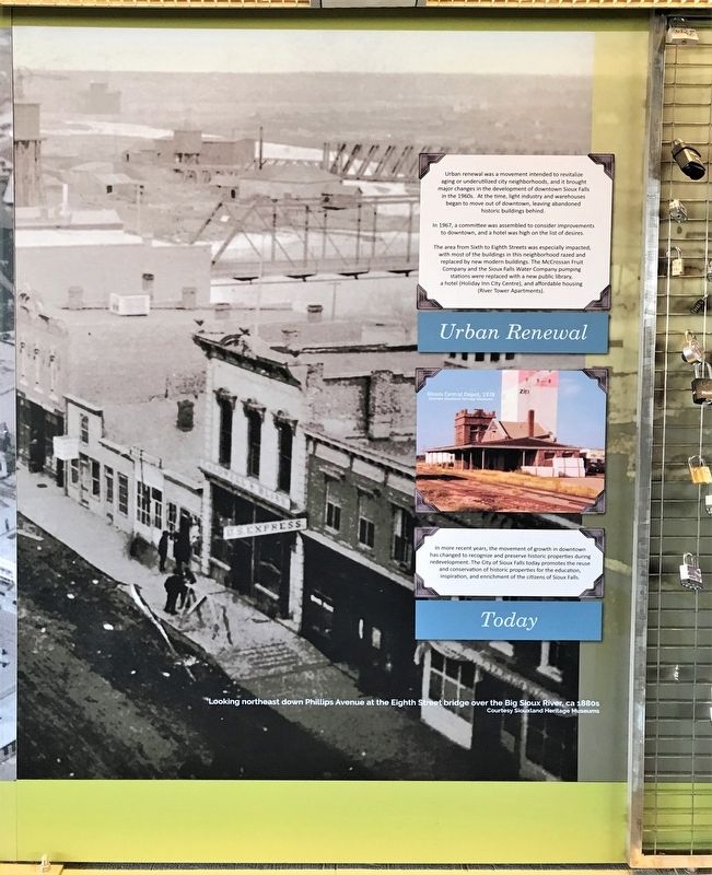
Urban Renewal
Urban renewal was a movement intended to revitalize aging or underutilized city neighborhoods, and it brought major changes in the development of downtown Sioux Falls in the 1960s. At the time, light industry and warehouses began to move out of downtown, leaving abandoned historic buildings behind.
In 1967, a committee was assembled to consider improvements to downtown, and a hotel was high on the list of desires.
The area from Sixth to Eighth Streets was especially impacted, with most of the buildings in this neighborhood razed and replaced by new modern buildings. The McCrossan Fruit Company and the Sioux Falls Water Company pumping stations were replaced with a new public library, a hotel (Holiday Inn City Centre), and affordable housing (River Tower Apartments).
image:
Illinois Central Depot, 1978
Courtesy Siouxland Heritage Museums
Today
In more recent years, the movement of growth in downtown has changed to recognize and preserve historic properties during redevelopment. The City of Sioux Falls today promotes the reuse and conservation of historic properties for the education, inspiration, and enrichment of the citizens of Sioux Falls.
Backgrounds:
(left) Railroad Bridge over the Big Sioux River north of Ninth Street, ca 1890
Courtesy Siouxland Heritage Museums
(middle) Bird's Eye View of Eighth Street Bridge and Downtown Sioux Falls, ca 1945
Courtesy Siouxland Heritage Museums
(right) Looking northeast down Phillips Avenue at the Eighth Street bridge over the Big Sioux River, ca 1880s
Courtesy Siouxland Heritage Museums
Erected 2021 by Confluence and the City of Sioux Falls.
Topics. This historical marker is listed in these topic lists: Agriculture • Industry & Commerce • Waterways & Vessels. A significant historical year for this entry is 1877.
Location. 43° 32.915′ N, 96° 43.562′ W. Marker is in Sioux Falls, South Dakota, in Minnehaha County. It is in Downtown. Marker can be reached from East 8th Street east of North Phillips Avenue, on the right when traveling east. Located on the west side of the Big Sioux River, under the Eighth Street Bridge in Downtown Sioux Falls. Touch for map. Marker is at or near this postal address: 144 N Phillips Ave, Sioux Falls SD 57104, United States of America. Touch for directions.
Other nearby markers. At least 8 other markers are within walking distance of this marker. Launch (here, next to this marker); Overflow (here, next to this marker); Traverse (a few steps from this marker); 8th Street Bridge (a few steps from this marker); Cascade Mill (within shouting distance of this marker); Cigar Manufacturing (within shouting distance of this marker); Lumberyards (within shouting distance of this marker); Fort Dakota (within shouting distance of this marker). Touch for a list and map of all markers in Sioux Falls.
Related markers. Click here for a list of markers that are related to this marker.
Credits. This page was last revised on July 16, 2023. It was originally submitted on April 6, 2022. This page has been viewed 75 times since then and 7 times this year. Photos: 1. submitted on April 6, 2022. 2, 3, 4, 5. submitted on April 7, 2022.
