Near Sharpsburg in Washington County, Maryland — The American Northeast (Mid-Atlantic)
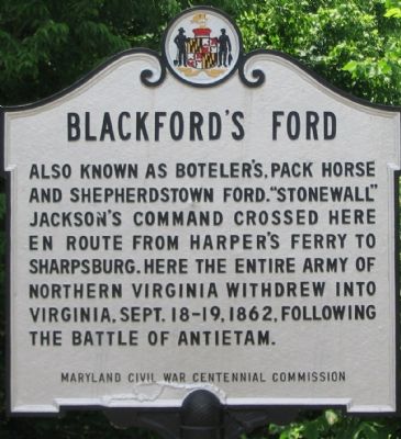
Blackford’s Ford
Erected by Maryland Civil War Centennial Commission.
Topics. This historical marker is listed in these topic lists: Roads & Vehicles • War, US Civil. A significant historical year for this entry is 1862.
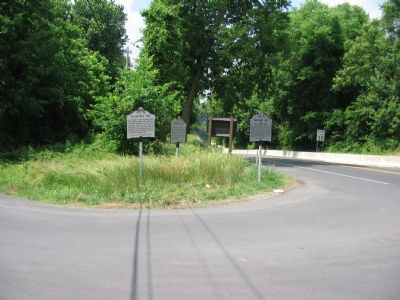
Location. 39° 26.278′ N, 77° 47.802′ W. Marker is near Sharpsburg, Maryland, in Washington County. Marker is at the intersection of Shephardstown Pike (Maryland Route 34) and Canal Road, on the left when traveling south on Shephardstown Pike. Touch for map. Marker is in this post office area: Sharpsburg MD 21782, United States of America. Touch for directions.
Other nearby markers. At least 8 other markers are within walking distance of this marker. Swearingen’s Ferry and Pack Horse Ford (a few steps from this marker); The James Rumsey Bridge / The Battle of Antietam or Sharpsburg (a few steps from this marker); Ferry Hill Place (about 400 feet away, measured in a direct line); Ferry Hill (about 400 feet away); a different marker also named Ferry Hill Place (about 500 feet away); A View into the Past (approx. 0.2 miles away); a different marker also named Blackford's Ford (approx. 0.2 miles away); Shepherdstown (approx. 0.2 miles away). Touch for a list and map of all markers in Sharpsburg.
Related markers. Click here for a list of markers that are related to this marker. To better understand the relationship, study each marker in the order shown.
Credits. This page was last revised on September 23, 2017. It was originally submitted on July 27, 2007, by Craig Swain of Leesburg, Virginia. This page has been viewed 2,787 times since then and 25 times this year. Last updated on August 1, 2007, by Craig Swain of Leesburg, Virginia. Photos: 1, 2. submitted on July 27, 2007, by Craig Swain of Leesburg, Virginia. 3. submitted on July 28, 2007, by Craig Swain of Leesburg, Virginia. • J. J. Prats was the editor who published this page.


