Providence Township near Grand Rapids in Lucas County, Ohio — The American Midwest (Great Lakes)
The Towpath Trail
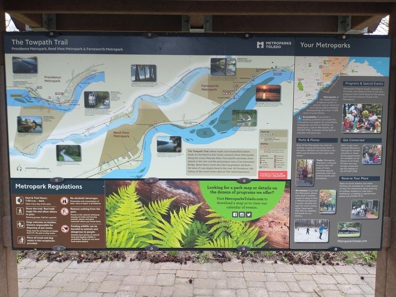
Providence Dam: A roller dam across the Maumee River is a scenic spot to fish or just relax. The dam was built to divert water into the canal.
Providence Dam Area Providence Dam Shelter (reservable) Rangers & Maintenance Overlook
The Plaza Area The Isaac Ludwig Mill Lock No. 44 Heritage Center
The Isaac Ludwig Mill: A working, water-powered saw and grist mill.
Historic Area The Canal Experience Information Ticket Booth "Volunteer” Dock Kimble's Landing Mill Parking
The "Volunteer” Canal Boat: The 60-passenger "Volunteer” operates on a restored section of the Miami & Erie Canal. The boat, which is towed by mules, is a replica of the vessels that carried people and supplies on the canal system.
The Islands: Three islands in the Maumee River- Indian, Butler and Missionary - can be seen from Farnsworth. They are owned by the Ohio Division of Wildlife.
The Towpath Trail: is a stone, all-purpose trail connecting Farnsworth, Bend View and Providence Metroparks.
Bend View Shelter: Bend View is a scenic vantage point to enjoy a dramatic 90-degree bend in the Maumee. A WPA shelter there is available for rent.
Indianola Area Wheelchair Access to River Barrier Free Fishing Dock
Farnsworth Shelters: The Roche de Bout and Indianola shelters at Farnsworth are available for rent. Both offer scenic locations for reunions, parties and meetings.
Interurban Bridge: The ruins of a concrete, earth-filled Bridge that once carried the interurban rail system across the Maumee can still be seen from Famsworth.
Boat Launch: A boat launch for small boats and personal watercraft is located at Farmsworth. Nearby is a floating, handicap accessible fishing platform.
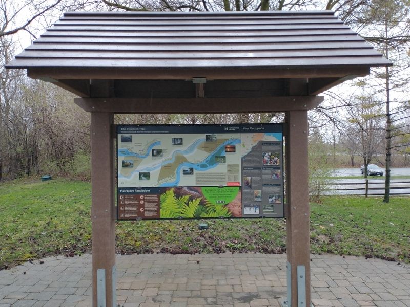
The Towpath Trail, where mules once towed flat bottom boats on the Miami & Erie Canal, connects three Metroparks along the scenic Maumee River. Farnsworth overlooks three islands in the river and the picturesque ruins of an Interurban Bridge. Bend View's name describes its greatest attribute - the view of a 90-degree bend in the river. At Providence, the history of the canal comes alive at The Canal Experience.
Topics and series. This historical marker is listed in these topic lists: Industry & Commerce • Parks & Recreational Areas • Waterways & Vessels. In addition, it is included in the The Miami & Erie Canal series list.
Location. 41° 25.056′ N, 83° 52.146′ W. Marker is near Grand Rapids, Ohio, in Lucas County. It is in Providence Township. Marker is on Towpath Trail south of Buckeye Trail, on the right when traveling south. Touch for map. Marker is at or near this postal address: 13827 Towpath Trail, Grand Rapids OH 43522, United States of America. Touch for directions.
Other nearby markers. At least 8 other markers are within walking distance of this marker. Foundations From The Past (about 300 feet away, measured in a direct line); Tempers Explode As Dams Get Built (about 400 feet away); Water's Way: Flood And Ice (about 400 feet away); Providence Historical District (approx. 0.2 miles away); The 150th Anniversary of the Great Starvation (approx. ¼ mile away); St. Patrick Church (approx. ¼ mile away); In Memory Of Julie Pontasch (approx. 0.3 miles away); M. J. Wright Pavillion (approx. 0.3 miles away). Touch for a list and map of all markers in Grand Rapids.
Credits. This page was last revised on February 6, 2023. It was originally submitted on April 14, 2022, by Craig Doda of Napoleon, Ohio. This page has been viewed 95 times since then and 12 times this year. Photos: 1, 2. submitted on April 14, 2022, by Craig Doda of Napoleon, Ohio. • Devry Becker Jones was the editor who published this page.

