Old Town in Alexandria, Virginia — The American South (Mid-Atlantic)
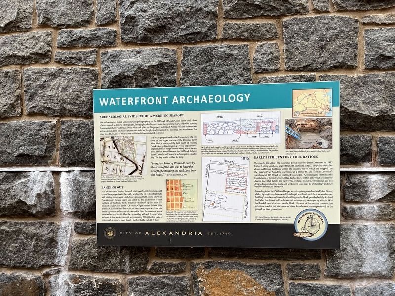
Waterfront Archaeology
Alexandria Heritage Trail
— City of Alexandria, est. 1749 —
Archaeological Evidence of a Working Seaport
The archaeologists tasked with researching this property on the 200 block of South Union Street used a host of sources such as historic photographs, lithographs, deeds, court cases, newspapers, maps, and other primary documents to better united what what took place on this property in the past. Armed with this information, archaeologists then conducted excavations to locate the physical remains of the buildings and warehouses that once stood here, and to recover the artifacts that accumulated over time.
In 1749, in preparation for the development of a new town on the upper reaches of the Potomac River, John West Jr. surveyed the land north of Hunting Creek. George Washington, a 17-year-old surveyor's apprentice made a copy of West's map which showed most of what would become the 200 block between South Union St. and Strand St. submerged in a shallow bay. The bay would not last for long.
"every purchaser of Riverside Lotts by the terms of the sale was to have the benefit of extending the said Lotts into the River…" — Town Trustees, 1760
Banking Out
In 1760 the town Trustees decreed that waterfront lot owners could extend their properties to the east by leveling the 10-15 foot high bluffs and infilling the crescent bay below, a process that became known as "banking out." George Gilpin was one of the first landowners to bank out land on this block. By the 1790s his wharf took up the entire 200 block of South Union Street. Of course, Gilpin himself did not fill in the block. Enslaved and free African Americans played a critical role in the expansion and success of Alexandria. Over the course of several decades laborers literally filled the crescent bay with soil. A conservative estimate is that workers moved approximately 300,000 cubic yards of soil, which is equal to more than 14 football fields, each 10 ft. deep.
Early 19th-Century Foundations,br> The map to the left is a fire insurance policy issued to James Lawrason in 1815 for his 3-story warehouse at 203 Strand St. (outlined in red). The policy describes eleven additional buildings within the vicinity, two of which are mapped on the policy: Peter Saunders' warehouse at 2 Prince St. and Thomas Lawrason's warehouse at 205 Strand St. (outlined in orange). Archaeologists identified the foundations of three structures (blue dashed lines) within the project area (yellow dashed line) that date to the early 19th century. These three buildings are not depicted on any historic maps and are known to us only by archaeology and may be those referenced in the plat.
According to tax
[Captions:]
A Plan of Alexandria, Now Bellhaven [1749]. (Courtesy of Library of Congress, Geography and Map Division with modern street overlay and property boundaries by Wetland Studies and Solutions, Inc.).
By the early 19th century the waterfront had been banked out so that there was no longer any evidence of the shallow bay. (A Plan for Alexandria in the Territory of Columbia, State of Virginia [1803], Courtesy of Fairfax Circuit Court Historic Records Center).
On the left, the north foundation wall for an early 19th-century structure, Building 3. On the right, an internal wall with a possible fireplace. In the 18th and early 19th century, builders in Alexandria commonly used stone from regional quarries for building foundations. By the middle of the 19th century builders switched to brick for their foundations. The foundation depicted above was built with stone, and later modified with brick piers. (Wetland Studies and Solutions, Inc.)
Intact wood floor in Building 3, facing south. (Wetland Studies and Solutions, Inc.)
1815 Mutual Assurance Soci ety policy plat (not to scale) (Courtesy of Alexandria Library Special Collections.
Erected by City of Alexandria, Virginia.
Topics and series. This historical marker is listed in these topic lists: African Americans • Anthropology & Archaeology • Colonial Era • Exploration • Industry & Commerce • Settlements & Settlers • Waterways & Vessels. In addition, it is included in the Former U.S. Presidents: #01 George Washington, and the Virginia, The City of Alexandria series lists. A significant historical year for this entry is 1749.
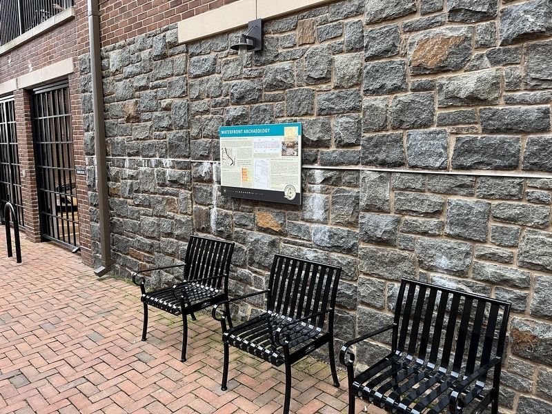
Location. 38° 48.154′ N, 77° 2.409′ W. Marker is in Alexandria, Virginia. It is in Old Town. Marker can be reached from Strand Street just south of Prince Street, on the right when traveling south. Touch for map. Marker is at or near this postal address: 211 Strand St, Alexandria VA 22314, United States of America. Touch for directions.
Other nearby markers. At least 8 other markers are within walking distance of this marker. Industrialization of the Strand (a few steps from this marker); ODBC (within shouting distance of this marker); A Rich History on the Alexandria Waterfront (within shouting distance of this marker); a different marker also named ODBC (within shouting distance of this marker); The River Queen (about 300 feet away, measured in a direct line); Shipbuilding at Point Lumley (about 400 feet away); 115 Prince Street (about 400 feet away); Pioneer Mill (about 400 feet away). Touch for a list and map of all markers in Alexandria.
Credits. This page was last revised on May 25, 2023. It was originally submitted on April 15, 2022, by Devry Becker Jones of Washington, District of Columbia. This page has been viewed 114 times since then and 19 times this year. Photos: 1, 2. submitted on April 15, 2022, by Devry Becker Jones of Washington, District of Columbia.

