Near Maumee in Lucas County, Ohio — The American Midwest (Great Lakes)
Turkey Foot Rock

Photographed by Daulton Cox, July 7, 2026
1. Turkey Foot Rock Marker
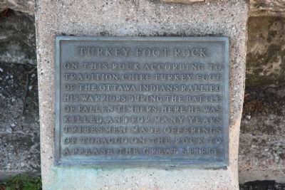
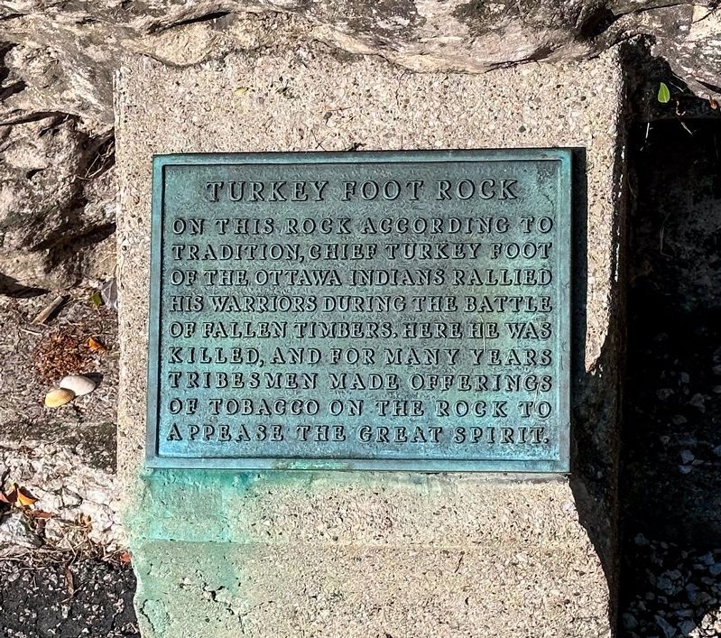
On this rock according to tradition, Chief Turkey Foot of the Ottawa Indians rallied his warriors during the Battle of Fallen Timbers. Here he was killed and for many years tribesmen made offerings of tobacco on the rock to appease the Great Spirit.
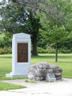
Native American Memorial marker
In memory of all the American Indians who gave their lives at this place, including members of the following tribes.
Chippewa • Ottawa • Delaware • Potawatami • Miami • Shawnee • Mingo • Wyandot
Dedicated August 20, 1994 at the 200th Anniversary Commemoration of the Battle of Fallen Timbers.
Topics. This memorial is listed in these topic lists: Indigenous Peoples and Communities • Landmarks • Wars, US Indian. A significant historical date for this entry is August 20, 1794.
Location. 41° 32.598′ N, 83° 41.804′ W. Memorial is near Maumee, Ohio, in Lucas County. It can be reached from Fallen Timbers Lane half a mile north of U.S. 24, on the left when traveling west. This marker is located about a mile southwest of the intersection of US 23 and US 24, just off of US 24 at the Fallen Timbers Lane exit, almost midway between the villages
this page online

Regionally, this memorial is on the Lake Erie Shore and in the Toledo Metropolitan Area. It is also in the American Midwest and in the Corn Belt. Globally, it is in North America, on the Great Lakes, in the Western Hemisphere, in the Western World, and in the Anglosphere. Historically, it finds itself in what was once the Viceroyalty of New France, the Haudenosaunee (Iroquois) Confederacy, the territory of the Mississippian Culture, and the Northwest Territory.
Other nearby markers. At least 8 other markers are within walking distance of this marker: American Indians at the Battle of Fallen Timbers (here, next to this marker); Fallen Timbers Battle Monument (a few steps from this marker); Fallen Timbers Battle Memorial (a few steps from this marker); Battle of Fallen Timbers (about 300 feet away); Fighting Forces (approx. 0.4 miles away); A Long March (approx. 0.4 miles away); a different marker also named Battle of Fallen Timbers (approx. half a mile away); Cover and Camouflage

Photographed by Daulton Cox, July 7, 2026
2. Turkey Foot Rock Marker
Other markers no longer nearby. Fallen Timbers (was about 300 feet away, measured in a direct line but has been permanently removed); Maumee River Rapids (was approx. 0.3 miles away but has been permanently removed); Fallen Timbers Battlefield (was approx. 0.3 miles away but has been confirmed missing); Hull's Crossing/Turkey Foot Rock (was approx. 0.4 miles away but has been confirmed missing).
More about this memorial. This monument is located in Fallen Timbers State Park, between US 24 and the Maumee River.
Related marker. Click here for another marker that is related to this marker. To better understand the relationship, study each marker in the order shown.
Also see . . . The flip side of Turkey Foot Rock. Jim Murphy, a retired Ohio State University librarian who has a master of science degree in geology from Case Western Reserve University, shares his research on the complicated history of Lucas County's Turkey Foot Rock (on an Adobe Acrobat Document format). (Submitted on January 14, 2010, by Dale K. Benington of Toledo, Ohio.)
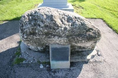
Photographed by Dale K. Benington, May 12, 2009
3. Turkey Foot Rock Marker
Photographed by Dale K. Benington, May 12, 2009
4. Turkey Foot Rock Marker
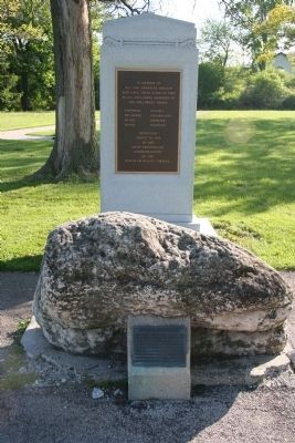
Photographed by Dale K. Benington, May 12, 2009
5. Turkey Foot Rock Marker
View of Turkey Foot Rock in foreground, situated in front of memorial monument dedicated to the Native Americans who lost their lives at the battlesite.
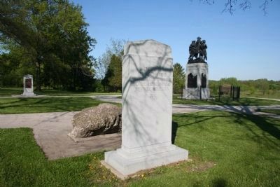
Photographed by Dale K. Benington, May 12, 2009
6. Turkey Foot Rock Marker
View of Native American Memorial and Turkey Foot Rock in immediate foreground, with the Fallen Timbers Battle Memorial in the background.
Photographed by David Ben-Ariel, June 13, 2009
7. Turkey Foot Rock and Native American Memorial
Photographed by J.T. Lambrou
8. Turkey Foot Rock Marker
Credits. This page was last revised on July 30, 2026. It was originally submitted on June 2, 2009, by Dale K. Benington of Toledo, Ohio. This page has been viewed 6,404 times since then and 330 times this year. Photos: 1, 2. submitted on July 15, 2026, by Daulton Cox of Muncie, Indiana. 3, 4, 5, 6. submitted on June 2, 2009, by Dale K. Benington of Toledo, Ohio. 7. submitted on June 15, 2009, by David Ben-Ariel of Toledo, Ohio. 8. submitted on July 20, 2024, by J.T. Lambrou of New Boston, Michigan. • Syd Whittle was the editor who published this page.
