Near Big Cedar in Le Flore County, Oklahoma — The American South (West South Central)
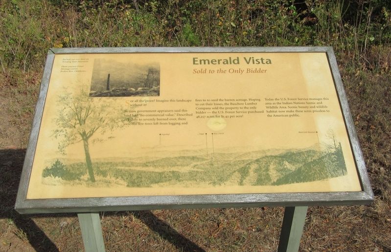
Emerald Vista
Sold to the Only Bidder
See all the green? Imagine this landscape without it!
In 1930, government appraisers said this land had "no commercial value." Described as lightly to severely burned over, there were too few trees left from logging and fires to re-seed the barren acreage. Hoping to cut their losses, the Buschow Lumber Company sold the property to the only bidder - the U.S. Forest Service purchased 48,257 acres for $1.42 per acre!
Today the U.S. Forest Service manages this area as the Indian Nations Scenic and Wildlife Area. Scenic beauty and wildlife habitat now make these acres priceless to the American public.
Captions: Burned, cut-over land on Winding Stair Mountain. Photo courtesty Forest Heritage Center, Broken Bow, Oklahoma.
Erected by US Forest Service.
Topics. This historical marker is listed in these topic lists: Agriculture • Horticulture & Forestry • Parks & Recreational Areas. A significant historical year for this entry is 1930.
Location. 34° 42.941′ N, 94° 40.452′ W. Marker is near Big Cedar, Oklahoma, in Le Flore County. Marker is on Emerald Vista north of Talimena National Scenic Byway (Scenic Highway 1), on the right when traveling north. Touch for map. Marker is in this post office area: Hodgen OK 74939, United States of America. Touch for directions.
Other nearby markers. At least 8 other markers are within 5 miles of this marker, measured as the crow flies. Cut Out and Get Out! (here, next to this marker); Outside the Law In Indian Territory (approx. 3.4 miles away); Horsethief Spring (approx. 3.4 miles away); Where There is Water There Will Be People (approx. 3.4 miles away); Civilian Conservation Corps (CCC) (approx. 3.4 miles away); Life at Stapp (approx. 3.4 miles away); Don L. Hoyt Pavilion (approx. 4.3 miles away); Civilian Conservation Corps Co. 810 (approx. 4˝ miles away).
Credits. This page was last revised on April 23, 2022. It was originally submitted on April 21, 2022, by Jason Armstrong of Talihina, Oklahoma. This page has been viewed 113 times since then and 11 times this year. Photo 1. submitted on April 21, 2022, by Jason Armstrong of Talihina, Oklahoma. • J. Makali Bruton was the editor who published this page.
