Port Severn in Simcoe County, Ontario — Central Canada (North America)
Port Severn Swing Bridge, Lock 45
Pount Tourant de Port Severn, Écluse No 45
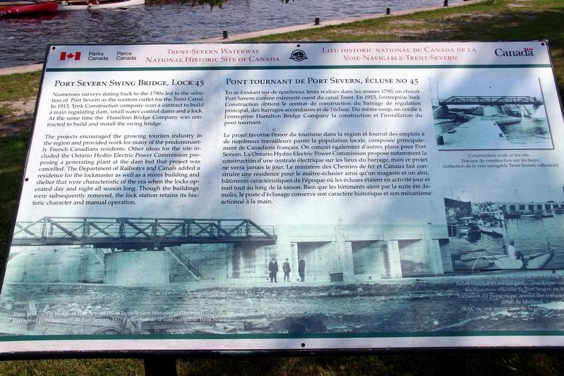
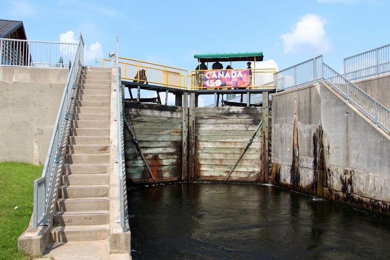
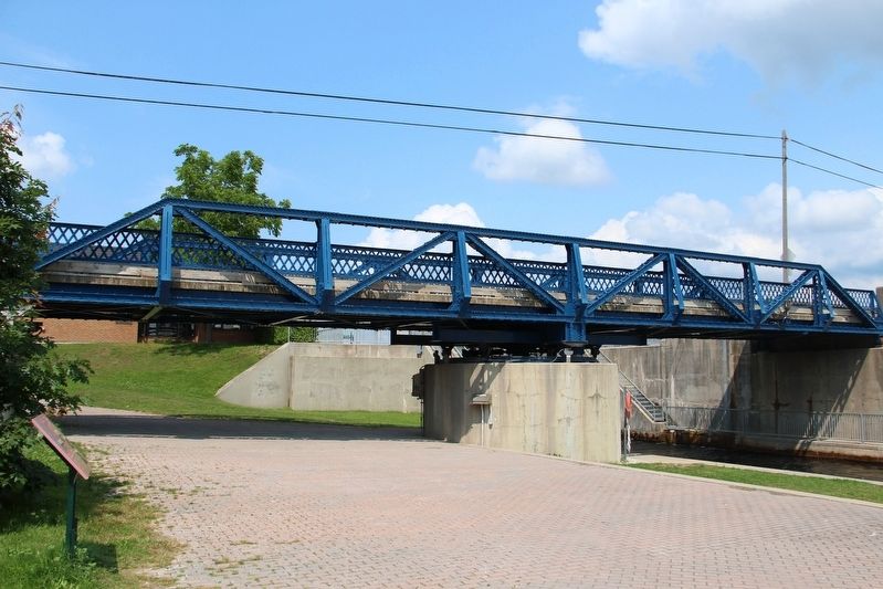
Numerous surveys dating back to the 1790s led to the selection of Port Severn as the western outlet for the Trent Canal. In 1913, York Construction company won a contract to build a main regulating dam, small water control dams and a lock. At the same time, the Hamilton Bridge Company was contracted to build and install the swing bridge.
The projects encouraged the growing tourism industry in the region and provided work for many of the predominantly French Canadians residents. Other ideas for the site included the Ontario Hydro Electric Power Commission proposing a generating plant at the dam but that project was cancelled. The Department of Railways and Canals added a residence for the lockmaster as well as a stores building and shelter that were characteristic of the era when the locks operated day and night all season long. Though the buildings were subsequently removed, the lock station retains its historic character and manual operation.
Captions (clockwise from top right)
• Construction work at the site (Trent Severn collection)
• Official opening of Port Severn in 1915 for the Maritime Retail Merchants' annual picnic (Jim Angus collection)
• Dam and Swing Bridge at Port Severn, 1915 (Trent Severn Waterway collection)
[Francais]
En se fondant sur de nombreaux levés réalisés dans les années 1790, on choisit Port Severn comme extrémité ouest du canal Trent. En 1913, l’entreprise York Construction obtient le contrat de construction du barrage de régulation principal, des barrages secondaires et de l’ecluse. Du même coup, on confie à l’entreprise Hamilton Bridge Company la construction et l’installation du pont tournant.
Le projet favorise l’essor du tourisme dans la région et fournit des emplois à de npmbreaux travailleurs parmi la population locale, composée principalement de Canadiens francais. On concoit également d’autres plans pour Port Severn. La Ontario Hydro Electric Power Commission propose notamment la construction d’une centrale électrique sur les lieux du barrage, mais ce projet ne verra jamais le jour. Le ministère des Chemins de fer et Canaux fait construire une résidence pour la maître-éclusier ainsi qu’un magasin et un abri, bâtiments caractéristiques de l’époque où les écluses étaient en activité jour et nuit tout au long de la saison. Bien que les bâtiments aient par la suite été démolis, le poste d’éclusage conserve son caractère historique et son mécanisme actionné à la main.
Légendes des photos (dans le sens des aiguilles d'une montre à partir du haut à droite)
• Travaux de construction sur les lieux (collection de la voie navigable Trent Severn)
• Inauguration
• Barrage en pont tournant de Port Severn, 1915 (collection de la voie navigable Trent Severn)
Erected by Parks Canada/Parcs Canada.
Topics. This historical marker is listed in these topic lists: Bridges & Viaducts • Man-Made Features • Waterways & Vessels. A significant historical year for this entry is 1913.
Location. 44° 48.211′ N, 79° 43.25′ W. Marker is in Port Severn, Ontario, in Simcoe County. Marker can be reached from Port Severn Road North, 1.2 kilometers east of Lone Pine Road, on the right when traveling east. Marker is along a brick walkway on the west end of the bridge. Touch for map. Marker is at or near this postal address: 181 Port Severn Rd N, Port Severn ON L0K 1S0, Canada. Touch for directions.
Other nearby markers. At least 2 other markers are within 10 kilometers of this marker, measured as the crow flies. Water Control Dams/Port Severn – The Secondary Lock (a few steps from this marker); Evolution of a Railway / Evolution d’un ber roulant (approx. 9.8 kilometers away).
Credits. This page was last revised on April 21, 2022. It was originally submitted on April 21, 2022, by Duane and Tracy Marsteller of Murfreesboro, Tennessee. This page has been viewed 90 times since then and 11 times this year. Photos: 1, 2, 3. submitted on April 21, 2022, by Duane and Tracy Marsteller of Murfreesboro, Tennessee.


