Welland in Niagara Region, Ontario — Central Canada (North America)
Main Street Bridge (Bridge 13)/Pont de la Rue Main (Pont 13)

cmh2315fl via Flickr (CC BY-NC 2.0), July 28, 2017
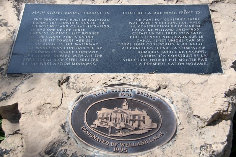
1. Main Street Bridge (Bridge 13)/Ont de la Rue Main (Pont 13) Marker
[Francais] Ce pont fut construit entre 1927-1930 en conjonction avec la construction du Quatriéme Canal de Welland (1913-1933). C’était un des trois plus gros ponts levant verticaux sur le canal. Il est unique car ses tours sont construites à un angle au parcours d’eau. La Compagnie Dominion Bridge de Lachine, Québec l’a construit et la structure entiere fut montée par la Première Nation Mohawk.
Topics. This historical marker is listed in these topic lists: Bridges & Viaducts • Native Americans • Waterways & Vessels. A significant historical year for this entry is 1930.
Location. 42° 59.491′ N, 79° 15.05′ W. Marker is in Welland, Ontario, in Niagara Region. Marker is at the intersection of King Street (Road 68) and East Main Street (Road 27), on the right when traveling south on King Street. Marker is set on a boulder in Canal Terrace park. Touch for map. Marker is in this post office area: Welland ON L3B L3B, Canada. Touch for directions.
Other nearby markers. At least 8 other markers are within 16 kilometers of this marker, measured as the crow flies. Welland County Court House (approx. 0.2 kilometers away); Battle of Cook's Mill (approx. 6.2 kilometers away); The Old Welland Canal (approx. 10 kilometers away); Humberstone Hall (approx. 10.1 kilometers away); The Welland Canal (approx. 11.7 kilometers away); DeCou's Stone House (approx. 12.9 kilometers away); To the Memory of the Pioneers (approx. 15.1 kilometers away); The Founding of Thorold (approx. 15.1 kilometers away). Touch for a list and map of all markers in Welland.

cmh2315fl via Flickr (CC BY-NC 2.0), July 28, 2017
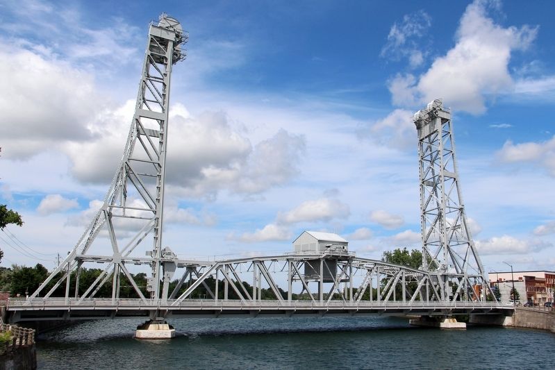
2. Main Street Bridge (Bridge 13)/Pont de la Rue Main (Pont 13)
Credits. This page was last revised on April 23, 2022. It was originally submitted on April 23, 2022, by Duane and Tracy Marsteller of Murfreesboro, Tennessee. This page has been viewed 77 times since then and 3 times this year. Photos: 1, 2. submitted on April 23, 2022, by Duane and Tracy Marsteller of Murfreesboro, Tennessee.
Editor’s want-list for this marker. Wide shot of marker and surrounding area in context. • Can you help?